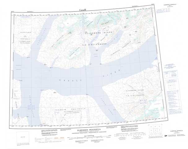
340B Elmerson Peninsula Topographic Maps
Maps for the Elmerson Peninsula map sheet 340B at 1:250,000 scale are available in 5 versions:
Topographic Map of Elmerson Peninsula
1:50,000 Scale Topos for Elmerson Peninsula 340B:
 |
 |
||
 |
 |
 |
340B Related Maps:
340B Elmerson Peninsula
340B02 No Title
340B03 Black Top Ridge
340B04 Skraeling Point
340B05 Iceberg Point
340B06 Mount Lockwood
340B02 No Title
340B03 Black Top Ridge
340B04 Skraeling Point
340B05 Iceberg Point
340B06 Mount Lockwood
