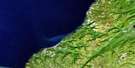
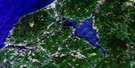
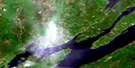
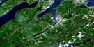
Margaree Satellite Image Map
Download Free Aerial Photo 011K06 at 1:50,000 scale
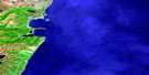
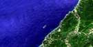
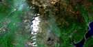
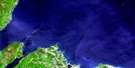
Margaree Satellite Imagery
To view this satellite map, mouse over the air photo on the right.
You can also download this satellite image map for free:
011K06 Margaree high-resolution satellite image map.
Maps for the Margaree aerial map sheet 011K06 at 1:50,000 scale are also available in these versions:
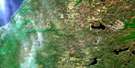
Margaree Surrounding Area Aerial Photo Maps
 |
 |
||
 |
 |
 |
|
 |
 |
 |
|
 |
 |
 |
 |
© Department of Natural Resources Canada. All rights reserved.
Margaree Gazetteer
The following places can be found on satellite image map 011K06 Margaree:
Margaree Satellite Image: Bays
Anse des ArsenaultAnse des Delaney
Anse des Doucet
Broad Cove
Dawsons Cove
Friars Head Boat Harbour
Gillis Cove
Golfe du Saint-Laurent
Gulf of St. Lawrence
MacDonalds Cove
MacNeils Cove
Margaree Harbour
Petite Église Cove
Plaster Rocks Cove
Simon Neils Cove
Whale Cove
Margaree Satellite Image: Beaches
Belle Côte BeachChimney Corner Beach
Donks Beach
Kennedys Shore
MacKinnons Beach
MacLellans Shore
MacLeods Beach
MacLeods Shore
MacPhersons Shore
MacRaes Beach
McLeod's Beach
Margaree Satellite Image: Capes
Cape GreyChimney Corner
Côte des Cadet
East Point
Gillis Point
Grey Point
MacKays Cape
Marsh Point
Mizies Point
Smiths Point
West Point
Whale Head
Margaree Satellite Image: Geographical areas
InvernessJuste au Corps
Margaree Satellite Image: Indian Reserves
Margaree 25Margaree Satellite Image: Islands
Cape Breton IslandÎle du Cap-Breton
Margaree Island (Sea Wolf Island)
Margaree Satellite Image: Lakes
Arsenaults PondBulger Pond
Cormier Lake
MacLeods Ponds
McNeils Pond
Pembroke Lake
Petit Lac
St. Rose Pond
Margaree Satellite Image: Mountains
Arsenaults HillBeatons Mountain
Donks Mountain
Donk's Mountain
Gillis Mountain
MacKinnons Mountain
McDougall Bluff
Mount Coady
Phillips Mountain
Phillips Mountain Lookoff
Round Mountain
Twelve O'Clock Mountain
Margaree Satellite Image: Major municipal/district area - major agglomerations
InvernessMargaree Satellite Image: Conservation areas
Réserve nationale de faune de l'Île Sea WolfSea Wolf Island National Wildlife Area
South West Margaree Provincial Park
Margaree Satellite Image: Rivers
Angus BrookAngus Brook
Arsenaults Brook
Basiles Brook
Beatons Brook
Big Brook
Blacksmiths Brook
Blanchards Brook
Bocan Brook
Cameron Brook
Captain Allan Brook
Captain Allans Brook
Charlie Donalds Brook
Charlie MacLeods Brook
Collins Brook
Collins Brook
Dans Brook
Deep Brook
East Branch Gallant River
Francis Coadys Brook
Gallant River
Gillis Brook
Gillis Brook
Grand Etang Brook
Grand Étang Brook
Gulch Brook
Jack Gillis Brook
Jackie MacDonalds Brook
Joe Elis Brook
John Donalds Lower Brook
Johnsons Brook
Lake O'Law Brook
MacEachern Brook
MacIsaacs Brook
MacKays Brook
MacKenzies Brook
MacKinnons Brook
MacLellans Brook
MacLellans Brook
MacLeods Brook
MacNeils Brook
Margaree River
Marsh Brook
Marsh Brook
Martin Camerons Brook
McLeod Brook
Mill Brook
Mill Valley Brook
Mink Brook
Mizies Brook
Munro Brook
Murdoch MacLeods Brook
Murphy Brook
Murphys Brook
Murphys Brook
Northeast Margaree River
Old Bridge Brook
Pine Brook
Ruisseau des Basile
Ruisseau Noir
Salt Brook
Schoolhouse Brook
Scotch Hill Brook
Shingle Brook
Smiths Brook
Southwest Margaree River
Tanners Brook
Timmins Brook
Tomkins Brook
Tompkins Brook
Tompkins Brook
William Donalds Brook
Margaree Satellite Image: River features
Barrack PoolBarracks Pool
Big McDaniel Pool
Brook Pool
Camerons Pool
Carrolls Pool
Collins Pool
Doyles Bridge Pool
Etheridge Pool
Garden Pool
Hut Pool
Little McDaniel Pool
Long Marsh Pool
Long Pool
MacDonnell Pool
Martin Camerons Pool
Noon Pool
Peter Gillis Pool
Peter MacFarlane Pool
Red Bank Pool
Seal Pool
Thornbush Pool
Tidal Pool
Wash Pool
Margaree Satellite Image: Shoals
Black RockDonks Reef
Plaster Rocks
The Monster
Margaree Satellite Image: Unincorporated areas
Belle CôteBig Brook
Broad Cove Chapel
Broad Cove Marsh
Brook School
Campbellton Road
Chimney Corner
Chisholm
Coady Road
Cranton Section
Dunvegan
Emerald
Fordview
Margaree
Margaree Brook
Margaree Centre
Margaree Forks
Margaree Harbour
Marsh Brook
McEachern Mills
McLean Cove
Murphy
North East Margaree
Rear Dunvegan
Scotch Hill
South West Margaree
St. Rose
Terre Noire
Victoria Road
Widow Lord
Margaree Satellite Image: Valleys
John Philiberts GulchLong Marsh Gulch
Margaree Satellite Image: Low vegetation
Coadys Swamp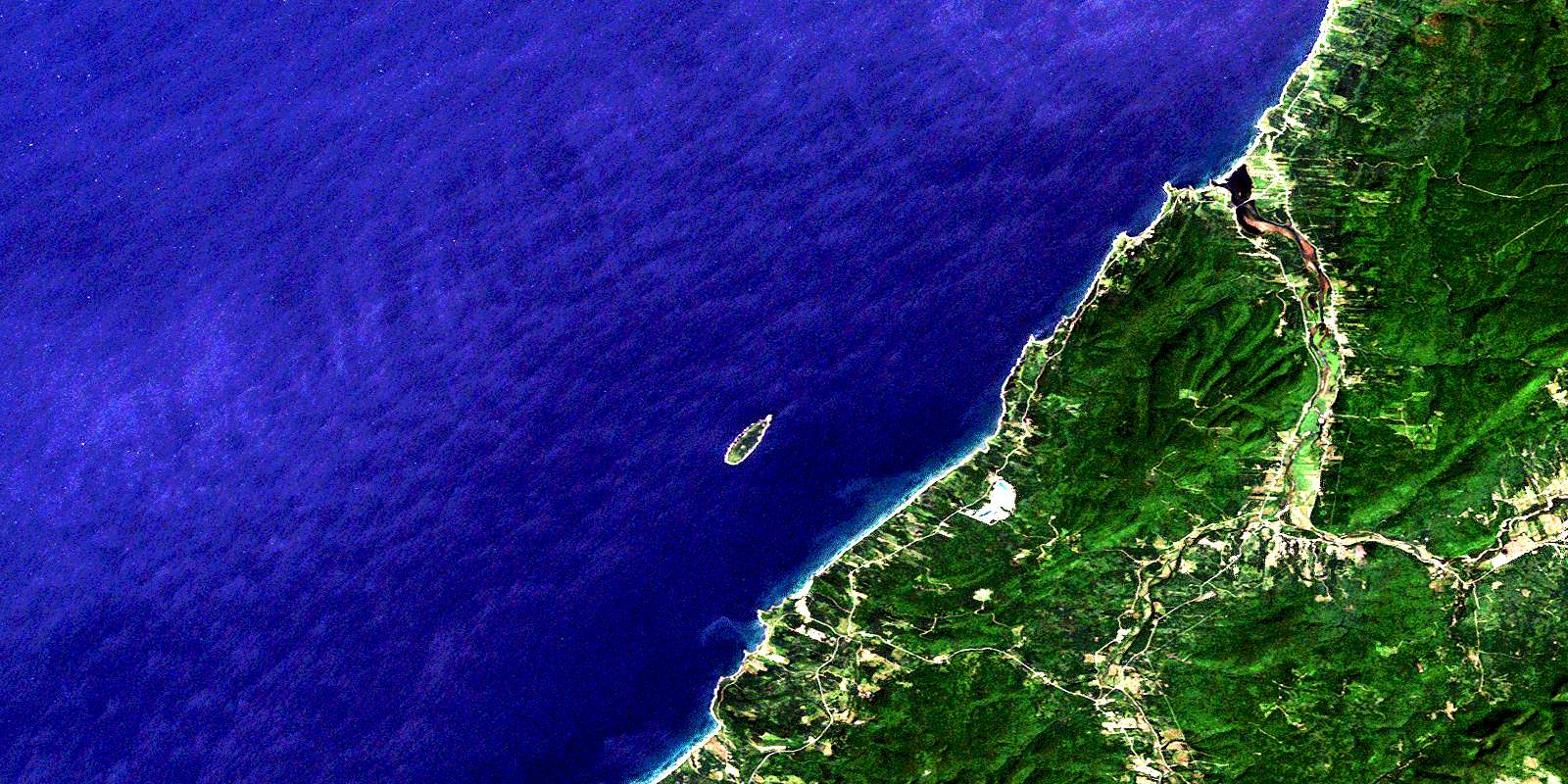
© Department of Natural Resources Canada. All rights reserved.
