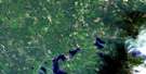
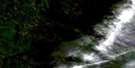
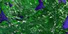
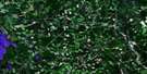
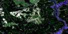
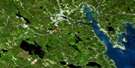
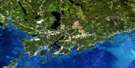
St Stephen Satellite Image Map
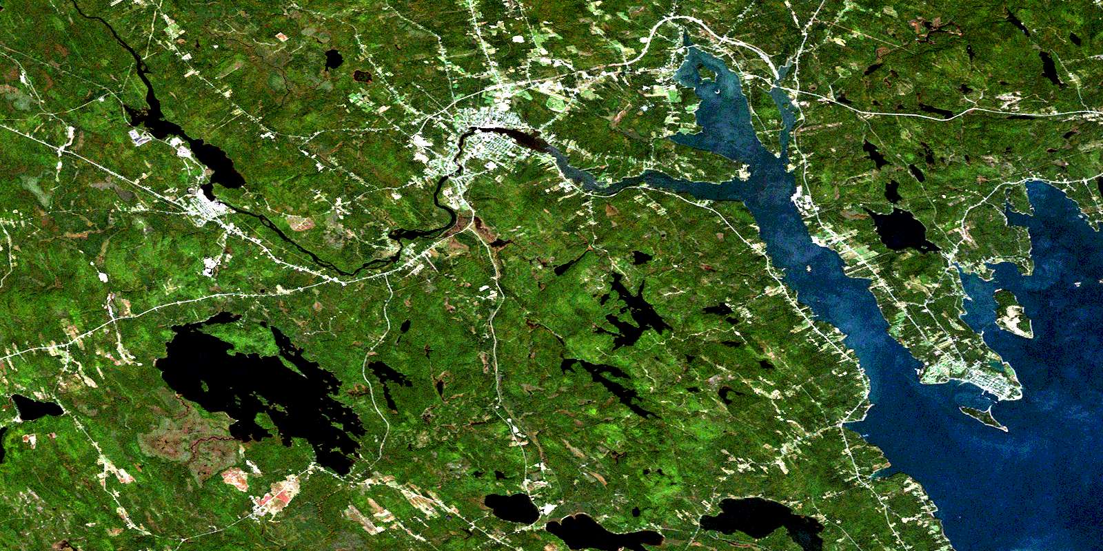
Download Free Aerial Photo 021G03 at 1:50,000 scale
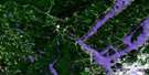
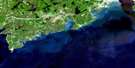
St Stephen Satellite Imagery
To view this satellite map, mouse over the air photo on the right.
You can also download this satellite image map for free:
021G03 St Stephen high-resolution satellite image map.
Maps for the St Stephen aerial map sheet 021G03 at 1:50,000 scale are also available in these versions:
St Stephen Surrounding Area Aerial Photo Maps
 |
 |
 |
 |
 |
 |
 |
 |
 |
 |
 |
|
 |
 |
 |
© Department of Natural Resources Canada. All rights reserved.
St Stephen Gazetteer
The following places can be found on satellite image map 021G03 St Stephen:
St Stephen Satellite Image: Bays
Big BayBirch Cove
Bocabec Cove
Brandy Cove
Chamcook Harbour
Hanson Cove
Johnson Cove
Katys Cove
Katy's Cove
Kitty Cove
Marshalls Cove
McCann Cove
Mill Cove
Oak Bay
Pagans Cove
Passamaquoddy Bay
Port St. Andrews
Pottery Cove
Sandy Cove
St. Andrews Harbour
Tufts Cove
St Stephen Satellite Image: Beaches
Long BarSt Stephen Satellite Image: Capes
Apple PointBerry Point
Campbell Point
Chamcook Point
Craig Point
Cranberry Point
Creighton Point
Haley Point
Hanson Point
Hills Point
Holey Point
Indian Point
Joes Point
Joe's Point
Kilmarnock Head
Long Point
Mark Point
North Point
Oak Point
Pagan Point
Pine Point
Plaisler Point
Raven Head
Ross Point
Sand Point
Sandy Point
Spruce Point
Todds Point
St Stephen Satellite Image: Channels
Chamcook ChannelThe Narrows
Western Channel
St Stephen Satellite Image: Falls
Salmon FallsSt Stephen Satellite Image: Geographical areas
CharlotteDufferin
Saint Andrews
Saint Croix
Saint David
Saint James
Saint Patrick
Saint Stephen
West Isles
St Stephen Satellite Image: Islands
Butler IslandsCookson Island
Crocker Island
Hardwood Island
Hospital Island
McVicar Island
Minister Island
Ministers Island
Mosquito Island
Navy (St. Andrews) Island
Navy Island
Odell Island
Rickets Island
Spoon Island
St. Andrews Island
St Stephen Satellite Image: Lakes
Bills LakeBocabec Lake
Bonaparte Lake
Canty Lake
Chamcook Lake
Chris Wren Lake
Cranberry Lake
Creasey Lake
Dennis Lake
Duck Lake
Eastman Lake
Gibson Lake
Goldsmiths Lake
Greenlaw Lake
Haddock Lake
Ingrams Lake
Johnson Lake
Kelly Lake
Kendricks Lake
Kerr Lake
Kerrs Lake
Limeburners Lake
Little Chamcook Lake
Long Lake
McCulloughs Pond
Morgan Lake
Mud Lake
Navigation Lake
North Lake
Potters Lake
Round Pond
Sam Orr Pond
Second Chamcook Lake
Snowshoe Lake
St. Patricks Lake
Stein Lake
Twin Lakes
Welch Lake
Wheaton Lake
Woodland Flowage
Woodland Lake
St Stephen Satellite Image: Mountains
Bald HillBlueberry Mountain
Buchanan Hill
Burnt Hill
Chamcook Mountain
Chickahominy Mountain
Clarks Mountain
Greenlaws Mountain
Grimmers Mountain
Haleys Hill
Hansons Hill
Hartford Mountain
Libbys Hill
Lily Hill
Russell Ridge
Sheas Hill
Shorts Mountain
Simpson Hill
St. Croix Mountain
Todds Mountain
Wileys Mountain
St Stephen Satellite Image: Conservation areas
Bureau de l'enregistrement du comté de CharlotteCharlotte County Court House
Charlotte County Gaol
Charlotte County Registry Office
Dunn McQuoid House
Gladstone Smith House
Hansen House
Lieu historique international de l'Île-Sainte-Croix
Lieu historique national du Canada du Blockhaus-de-St. Andrews
Maison de Gladstone Smith
Maison de Hansen
Maison de Pagan-O'Neil
Maison du shérif Andrews
Maison Dunn McQuoid
Minister's Island
Oak Bay Provincial Park
Pagan Point
Pagan-O'Neil House
Palais de justice du comté de Charlotte
Prison du comté de Charlotte
Saint Croix Island International Historic Site
Sheriff Andrews House
St. Andrews Blockhouse National Historic Site of Canada
St Stephen Satellite Image: Rapids
Bailey RipsSt Stephen Satellite Image: Rivers
Allen BrookAsh Brook
Berry Brook
Billy Weston Brook
Bush Brook
Campbell Brook
Campbell Brook
Campbells Brook
Chamcook Stream
Cottrell Brook
Dawsons Brook
Dennis Stream
Denny Stream
Doodle Brook
Gallop Stream
Goldsmiths Stream
Greenlaws Brook
Huckleberry Brook
James Brook
John Orr Brook
Little Trout Brook
Mahannas Stream
McCarley Brook
Meadow Brook
Meadow Brook
Mitchell Brook
Mohannas Creek
Mohannas Stream
Mohannes Stream
Pagans Mill Stream
Pottery Creek
Pout Brook
Smith Brook
Soap Brook
St. Croix River
Strachan Brook
Taggarts Brook
Waweig River
St Stephen Satellite Image: Shoals
Big RockBlack Rock
Cochrane Rocks
Navy Bar
Navy Bar
Navy Island Shoal
Niger Reef
Short Bar
Tongue Shoal
St Stephen Satellite Image: Towns
Saint AndrewsSt. Stephen
St Stephen Satellite Image: Unincorporated areas
Bar RoadBarter Settlement
Bartlett
Bartletts Mills
Bay Road
Bayside
Benson Corner
Blackland
Bocabec Cove
Burnt Hill
Chamcook
Chamcook Lake
Champlain
Crocker Hill
Dougherty
Edwards Corner
Five Corners
Four Corners
Gilmans Corner
Heathland
Kerrs Ridge
Lower Bayside
Lower Little Ridge
Maxwell
Maxwell Crossing
Mayfield
Milltown
Mohannes
Oak Bay
Oak Haven
Old Ridge
Pomeroy Landing
Simpson Corner
St. Andrews North
The Ledge
Union Mills
Upper Bayside
Upper Little Ridge
Upper Mills
Valley Road
Waweig
Wileys Corner
© Department of Natural Resources Canada. All rights reserved.
