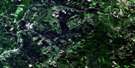
Perth-Andover Satellite Image Map
Download Free Aerial Photo 021J12 at 1:50,000 scale
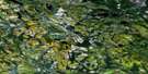
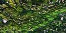
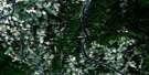
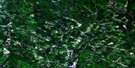
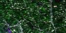
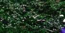
Perth-Andover Satellite Imagery
To view this satellite map, mouse over the air photo on the right.
You can also download this satellite image map for free:
021J12 Perth-Andover high-resolution satellite image map.
Maps for the Perth-Andover aerial map sheet 021J12 at 1:50,000 scale are also available in these versions:
Perth-Andover Surrounding Area Aerial Photo Maps
 |
 |
 |
 |
 |
 |
 |
 |
 |
 |
 |
 |
 |
 |
 |
 |
© Department of Natural Resources Canada. All rights reserved.
Perth-Andover Gazetteer
The following places can be found on satellite image map 021J12 Perth-Andover:
Perth-Andover Satellite Image: Falls
Craig FallsMonquart Falls
Perth-Andover Satellite Image: Geographical areas
AndoverPerth
Wicklow
Perth-Andover Satellite Image: Lakes
Bishop LakeBlind Lake
Lawrence Lakes
Moose Lake
Moose Mountain Lake
Mud Lake
Murphy Lake
Priest Lake
Reid Lake
Round Lake
Tomlinson Lake
Tweedie Lake
Perth-Andover Satellite Image: Mountains
Carrol HillLawson Hill
Moose Mountain
Porcupine Mountain
Sweeney Hill
Perth-Andover Satellite Image: Conservation areas
Muniac Provincial ParkPerth-Andover Satellite Image: Rivers
Big Flat BrookBishop Brook
Blind Gully Brook
Blowdown Brook
Bobie Brook
Brown Brook
Browning Brook
Bryson Brook
Bumfrow Brook
Caldwell Brook
Carr Brook
Carrol Brook
Cochrane Brook
Craig Brook
Cuffman Brook
DeMerchant Brook
Dougherty Brook
Dyer Branch
East Branch Monquart Stream
East Monquart River
Finey Brook
Finnemore Brook
Gallop Brook
Giberson Brook
Grahams Brook
Hardwood Creek
Hiscock Brook
Holmes Brook
Huds Brook
Hurley Brook
Inman Branch
Inman Brook
Inman Brook
Jawbone Brook
Kilpatrick Brook
Lake Brook
Lake Brook
Larlee Creek
Left Hand Branch Caldwell Brook
Left Hand Branch Larlee Creek
Lovelly Brook
Lovelly Brook
Lovely Brook
Lovely Brook
Lower Guisiguit Brook
Lower Guisiguit Brook
Lower North Shikatehawk River
McCrae Brook
McDonald Brook
McGinley Brook
McMullen Brook
Monquart River
Monquart River
Monquart Stream
Muniac River
Muniac Stream
Murphy Brook
North Branch Monquart Stream
North Monquart River
O'Brien Brook
Patterson Brook
Patterson Gully Brook
Phillips Brook
Pickett Brook
Plant Brook
Price Brook
Quaker Brook
Randall Brook
Right Hand Branch Caldwell Brook
Right Hand Branch Larlee Creek
Right Hand Branch Trout Brook
Right Hand Trout Brook
Ring Brook
River de Chute
Rivière Saint-Jean
Saint John River
Scott Brook
Silver Brook
Smith Brook
South Gully Brook
Sweeney Brook
Tibbits Brook
Tibbitts Brook
Trout Brook
Upper Guisiguit Brook
Wark Brook
Watt Brook
West Caldwell Brook
Young Brook
Young Brook
Perth-Andover Satellite Image: Shoals
Pickett RockPerth-Andover Satellite Image: Unincorporated areas
AndoverBairdsville
Beaconsfield
Beech Glen
Beechwood
Blue Hill
Bon Accord
Carlingford
Carlow
Clearview
Coronation
Demerchant Settlement
Dover Hill
Dover Hill
Giberson Settlement
Gladstone
Good Corner
Halls Corner
Hillandale
Holmesville
Inman
Johnville
Kilburn
Kilfoil
Killoween
Killowen
Kincardine
Kintore
Knoxford
Linville
Listerville
Lower Kintore
Lower Perth
Maplehurst
Mars Hill
Mineral
Monquart
Moose Mountain
Muniac
Murphy Corner
Piercemont
River de Chute
River de Chute Siding
Rosine
South Johnville
Summerfield
Sweeney Corner
Tarrtown
Tweedie
Upper Kent
Upper Kintore
Upper Knoxford
Upper Royalton
Upper Wicklow
Wicklow
Perth-Andover Satellite Image: Valleys
Inman GullyPerth-Andover Satellite Image: Villages
Andover-PerthBath
Perth
Perth-Andover

© Department of Natural Resources Canada. All rights reserved.
021J Related Maps:
021J Woodstock021J01 Minto
021J02 Burtts Corner
021J03 Millville
021J04 Woodstock
021J05 Florenceville
021J06 Coldstream
021J07 Napadogan
021J08 Boiestown
021J09 Doaktown
021J10 Hayesville
021J11 Juniper
021J12 Perth-Andover
021J13 Aroostook
021J14 Plaster Rock
021J15 Tuadook Lake
021J16 Mckendrick Lake
