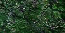
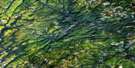
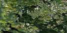
Big Bald Mountain Satellite Image Map
Download Free Aerial Photo 021O01 at 1:50,000 scale
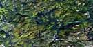
Big Bald Mountain Satellite Imagery
To view this satellite map, mouse over the air photo on the right.
You can also download this satellite image map for free:
021O01 Big Bald Mountain high-resolution satellite image map.
Maps for the Big Bald Mountain aerial map sheet 021O01 at 1:50,000 scale are also available in these versions:
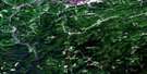
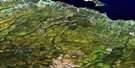
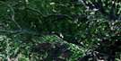
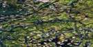
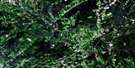
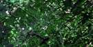
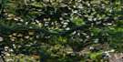
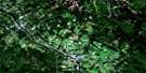
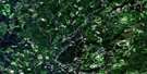
Big Bald Mountain Surrounding Area Aerial Photo Maps
 |
 |
 |
 |
 |
 |
 |
 |
 |
 |
 |
 |
 |
 |
 |
 |
© Department of Natural Resources Canada. All rights reserved.
Big Bald Mountain Gazetteer
The following places can be found on satellite image map 021O01 Big Bald Mountain:
Big Bald Mountain Satellite Image: Channels
The NarrowsBig Bald Mountain Satellite Image: Falls
Squirrel FallsBig Bald Mountain Satellite Image: Geographical areas
NortheskNorthumberland
Southesk
Big Bald Mountain Satellite Image: Lakes
Allan PondBayles Lake
Bear Lake
Beaver Lake
Bills Lake
Burnt Land Ponds
Christmas Pond
Clearwater Lake
Cuckoo Lake
Deer Lake
First Lake
Guagus Lake
Hubbards Pond
Jacks Lake
Kenny Lake
Moose Lake
Mullin Lake
Mullin Stream Lake
Muskrat Lake
Musquash Pond
Neds Lake
North Pole Lake
Peabody Lake
Riordan Lake
Second Lake
Slacks Lake
South Little River Lake
Spruce Lake
Squirrel Lake
Waubigut Lake
Big Bald Mountain Satellite Image: Mountains
Apskwa RidgeBig Bald Mountain
Birch Mountain
Caribou Mountain
Colonels Mountain
Historians Range
Maneater Mountain
Middle Mountain
Mount McElwee
Mount Robinson
Mount Webster
Toms Mountain
Big Bald Mountain Satellite Image: Rivers
Barracks BrookBear Lake Brook
Big Sevogle River
Bills Brook
Boobey Brook
Clarks Brook
Clearwater Lake Brook
Clearwater Stream
Freeze Brook
Gill Brook
Glory Hole Brook
Hubbard Brook
Johnson Brook
Kagoot Brook
Lake Brook
Little North Branch
Little North Branch Big Sevogle River
Little North Branch Sevogle River
Little North Sevogle River
Little North Sevogle River
Little River
Little Sheephouse Brook
Little South Branch Big Sevogle River
Little South Branch Sevogle River
Little South Sevogle River
Lower North Branch Little Southwest Miramichi River
Lower South Branch Nepisiguit River
Lower South Branch Nipisiguit River
Lower South Nepisiguit River
Moose Brook
Mountain Brook
Muhals Brook
Mullin Stream
North Branch Big Sevogle River
North Branch Mullin Stream
North Branch South Branch Big Sevogle River
North Branch South Sevogle River
North Mullin Stream
North Pole Brook
North Pole Stream
North Sevogle River
Northwest Miramichi River
Peabody Lake Brook
Peters Brook
Pringle Brook
Sandburn Brook
Sheephouse Brook
South Branch Big Sevogle River
South Branch Nepisiguit River
South Branch Nepisiguit River
South Branch Nipisiguit River
South Branch Northwest Miramichi River
South Nepisiguit River
South Sevogle River
Stony Brook
Tozer Brook
Travis Brook
Whitney Brook
Whitney Brook
Big Bald Mountain Satellite Image: River features
Mullin Stream DeadwaterScotts Crossing
Big Bald Mountain Satellite Image: Low vegetation
Holmes Meadow
© Department of Natural Resources Canada. All rights reserved.
021O Related Maps:
021O Campbellton021O01 Big Bald Mountain
021O02 Serpentine Lake
021O03 Riley Brook
021O04 Grand Falls
021O05 Grand River
021O06 Sisson Branch Reservoir
021O07 Nepisiguit Lakes
021O08 California Lake
021O09 Tetagouche Lakes
021O10 Upsalquitch Forks
021O11 Kedgwick
021O12 Gounamitz River
021O13 States Brook
021O14 Menneval
021O15 Atholville
021O16 Charlo
