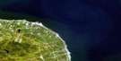
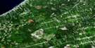
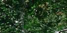
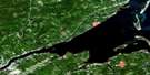
Wishart Point Satellite Image Map
Download Free Aerial Photo 021P07 at 1:50,000 scale
Wishart Point Satellite Imagery
To view this satellite map, mouse over the air photo on the right.
You can also download this satellite image map for free:
021P07 Wishart Point high-resolution satellite image map.
Maps for the Wishart Point aerial map sheet 021P07 at 1:50,000 scale are also available in these versions:
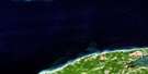
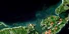
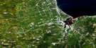
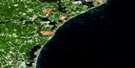
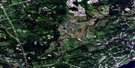
Wishart Point Surrounding Area Aerial Photo Maps
 |
 |
 |
|
 |
 |
 |
|
 |
 |
 |
|
 |
 |
 |
 |
© Department of Natural Resources Canada. All rights reserved.
Wishart Point Gazetteer
The following places can be found on satellite image map 021P07 Wishart Point:
Wishart Point Satellite Image: Bays
Anderson CoveAnse des Richard
Big Cove
Chamberlains Cove
French Cove
Golfe du Saint-Laurent
Golfe Saint-Laurent
Gulf of St. Lawrence
Miramichi Bay
Neguac Bay
Ruisseau à Agnée
Ruisseau à Brideau
Ruisseau à Euchère
Ruisseau à Georges
Ruisseau à Thibodeau
Ruisseau Sureau Blanc
Tabusintac Bay
Williams Cove
Wishart Point Satellite Image: Beaches
Neguac BeachTabusintac Beach
Tracadie Beach
Wishart Point Satellite Image: Capes
Barreau PointBass Point
Birch Point
Black Point
Burkes Point
Cap à Julien
Chamberlains Point
Church Point
Ferguson Point
Ferguson Point
Ferry Point
Foster Point
Jackos Point
Johns Point
McEacherns Point
McRaws Point
Palmer Point
Point au Lac
Point of Marsh
Pointe à Agnée
Pointe à Barreau
Pointe à Breau
Pointe à Canache
Pointe à François
Pointe à Gautreau
Pointe à l'Évêque
Pointe à Maurice
Pointe à Nazaire
Pointe à Roussell
Pointe à Sinai
Pointe à Tom
Pointe à William
Pointe au Belvidore
Pointe au Lac
Pointe au Terra Noir
Pointe de la Hêtrière
Pointe de l'Ile
Pointe des Richard
Ross Point
Swinging Point
Upper Point
Wishart Point
Wishart Point Satellite Image: Channels
Bass Fishing ChannelBig Tracadie River Gully
Ferguson Gully
Old Seal Gully
Old Tabusintac Gully
Tabusintac Gully
Tabusintac Gully
Tracadie South Gully
Wishart Point Satellite Image: Geographical areas
AlnwickGloucester
Northumberland
Saumarez
Wishart Point Satellite Image: Islands
Brant IslandCrab Island
Hay Island
Île au Cheval
McLeods Island
Whiskey Island
Wishart Point Satellite Image: Lakes
Grand LacGrand Lake
Neguac Lagoon
Somersons Pond
Tabusintac Lagoon
The Lake
Wishart Point Satellite Image: Conservation areas
Val Comeau Provincial ParkWishart Point Satellite Image: Rivers
Big Cove BrookBig Tracadie River
Burkes Brook
Fraser Brook
Leech River
Limekiln Brook
Lufburys Brook
Palmers Brook
Portage Creek
Portage River
Rivière à Comeau
Rivière du Portage
Robertson Brook
Ruisseau à Israël
Ruisseau à Nicolas
Ruisseau à Sylvain
Ruisseau des Nat
Ruisseau du Portage
Tabusintac River
Tracadie River
Trout Stream
Wishart Point Satellite Image: Shoals
Murray ShoalsWishart Point Satellite Image: Towns
Tracadie-SheilaWishart Point Satellite Image: Unincorporated areas
BayshoreBenoit
Brantville
Leech
Légère
Pont Lafrance
Pontgravé
Pont-Lafrance
Portage River
Rivière-du-Portage
Saint-Pons
Saumarez
Sheila
Sonier
St. Pons
St-Pons
Tracadie Beach
Upper Sheila
Val-Comeau
Wishart Point
Wishart Point Satellite Image: Low vegetation
Black LandsMacWilliams Marsh
Pré à Silvain
Pré à Sylvain
Red Marsh

© Department of Natural Resources Canada. All rights reserved.
