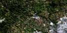
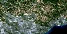
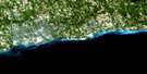
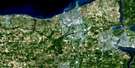
Markham Satellite Image Map
Download Free Aerial Photo 030M14 at 1:50,000 scale
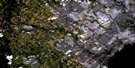
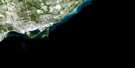
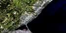
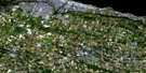
Markham Satellite Imagery
To view this satellite map, mouse over the air photo on the right.
You can also download this satellite image map for free:
030M14 Markham high-resolution satellite image map.
Maps for the Markham aerial map sheet 030M14 at 1:50,000 scale are also available in these versions:
Markham Surrounding Area Aerial Photo Maps
 |
 |
 |
 |
 |
 |
||
 |
|||
 |
 |
© Department of Natural Resources Canada. All rights reserved.
Markham Gazetteer
The following places can be found on satellite image map 030M14 Markham:
Markham Satellite Image: Bays
Frenchman BayFrenchman's Bay
Markham Satellite Image: Beaches
Pickering BeachMarkham Satellite Image: Capes
Moore PointSimcoe Point
Markham Satellite Image: City
PickeringToronto
Vaughan
Markham Satellite Image: Geographical areas
East WhitbyEast York
King
Markham
North York
Pickering
Scarborough
Uxbridge
Whitby
Whitchurch
York
York
Markham Satellite Image: Lakes
Bond LakeGlasgow Pond
Haynes Lake
Lac Ontario
Lake Ontario
Philips Lake
Preston Lake
Reesor Lake
Simeon Lake
St. George Lake
Thompson Lake
Toogood Pond
van Nostrand Lake
Whitevale Pond
Wilcox Lake
Markham Satellite Image: Mountains
Dicksons HillHeise Hill
The Pinnacles
Markham Satellite Image: Major municipal/district area - major agglomerations
DurhamMetropolitan Toronto
Ontario
Ontario
United Counties of Northumberland and Durham
York
Markham Satellite Image: Other municipal/district area - miscellaneous
KingMarkham
Markham
Pickering
Pickering
Uxbridge
Vaughan
Whitchurch
Whitchurch
Whitchurch
Markham Satellite Image: Rivers
Beaver CreekBerczy Creek
Brougham Creek
Bruce Creek
Deerlick Creek
Don River
Don River
Don River East Branch
Don River West Branch
Dufferin Creek
Duffin Creek
Duffins Creek
Duncan Woods Creek
East Humber River
Eckardt Creek
Ganatsekiagon Creek
German Mills Creek
Highland Creek
Highland Creek
Highland Creek
Holland River East Branch
Katabokokonk Creek
Little Don River
Little Rouge Creek
Lynde Creek
Major Creek
Michell Creek
Milne Creek
Morningside Creek
Mount Joy Creek
Newtonbrook Creek
Petticoat Creek
Pomona Creek
Reesor Creek
Rivière Rouge
Robinson Creek
Rouge River
Southwest Highland Creek
Spring Creek
Stouffville Creek
Tannery Creek
Taylor Creek
Urfé Creek
West Duffin Creek
West Duffins Creek
West Highland Creek
Westminster Creek
Wilket Creek
Willowgrove Creek
Wixon Creek
Markham Satellite Image: Towns
AjaxAurora
Aurora
Markham
Richmond Hill
Whitby
Whitchurch-Stouffville
Markham Satellite Image: Unincorporated areas
AgincourtAgincourt North
Almira
Altona
Amber
Armadale
Atha Road
Audley
Balsam
Bayview Village
Belford
Bendale
Bethesda
Beverley Acres
Birnhaven
Box Grove
Brock Road
Brougham
Browns Corners
Brown's Corners
Buttonville
Cachet
Carrville
Cashel
Cedar Grove
Centennial
Cherry
Cherrywood
Cherrywood Station
Claremont
Clarkes Hollow
Clarks Corners
Concord
Coronation Gardens
Deckers Hill
Dickson Hill
Dicksons Hill
Dilco
Dixie
Dixons Hill
Dollar
Doncaster
Dorset Park
Dunbarton
Elgin Mills
Elia
Ellesmere
Fairport
Fairport Beach
Fisherville
German Mills
Glasgow
Glen Grove
Glen Major Station
Gormley
Green River
Greenwood
Guildwood
Guildwood Village
Hagerman Corners
Hagerman's Corners
Haviland
Headford
Henry Farm
Highland Creek
Hillcrest Village
Jefferson
Kinsale
L'Amaroux
Langstaff
Lansing
Lemonville
Liverpool
Locust Hill
Malvern
Malvern West
Maple
Maryvale
Milliken
Milnesville
Mongolia
Mount Joy
Mount Zion
Muirheads Corners
Newton Brook
North Claremont
North York
Northmount
Oak Ridges
Oriole
O'Sullivan
Parkway East
Parkway West
Patterson
Pickering
Pickering Beach
Pickering Village
Port Union
Preston Lake
Quaker
Quantztown
Richvale
Ringwood
Riverside
Rosebank
Rosebank Station
Rouge
Rouge Hill
Rouge Park
Scarborough
Silver Hills
Simcoe Point
Squires Beach
Steeles
Steeles Corners
Stouffville
Sullivan
Tam O'Shanter
Temperanceville
Thornhill
Thornlea
Underwood
Unionville
Vandorf
Victoria Square
Vinegar Hill
West Ellesmere
West Hill
Wexford
White Rose
Whitevale
Wilcox Lake
Willowdale
Woburn
Yongehurst
York Height
York Mills
Markham Satellite Image: Valleys
Rouge Valley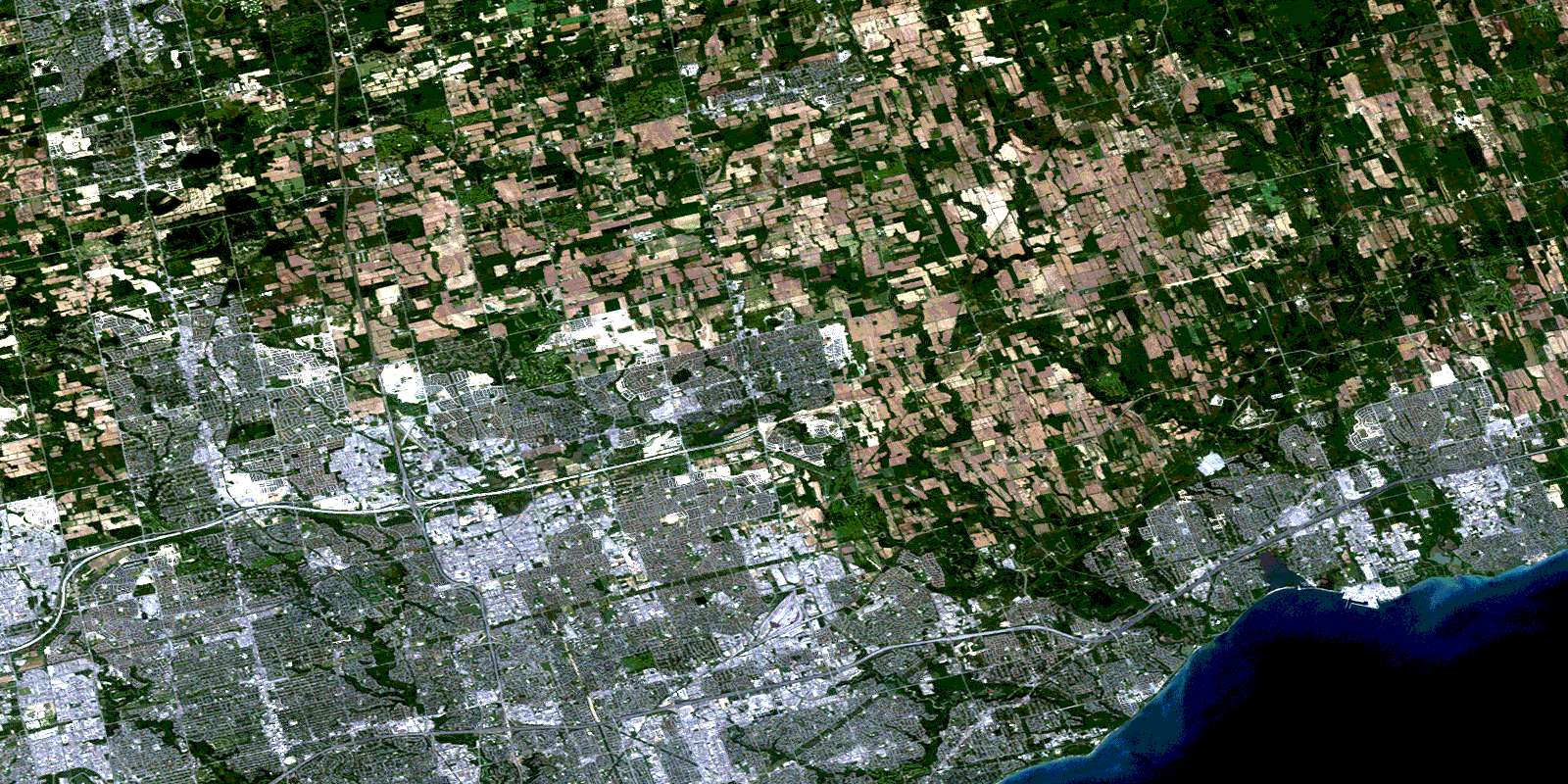
© Department of Natural Resources Canada. All rights reserved.
