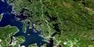
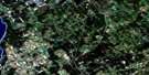
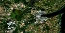
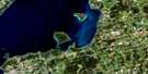
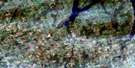
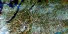
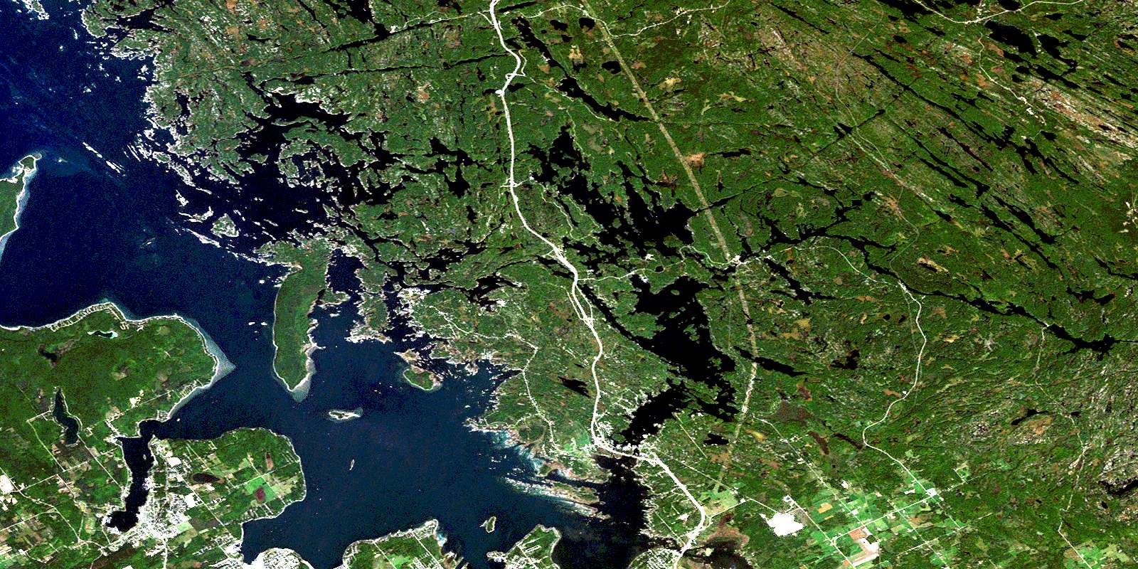
Penetanguishene Satellite Image Map
Download Free Aerial Photo 031D13 at 1:50,000 scale
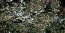
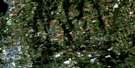
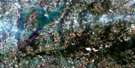
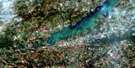
Penetanguishene Satellite Imagery
To view this satellite map, mouse over the air photo on the right.
You can also download this satellite image map for free:
031D13 Penetanguishene high-resolution satellite image map.
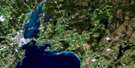
Maps for the Penetanguishene aerial map sheet 031D13 at 1:50,000 scale are also available in these versions:
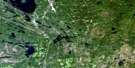
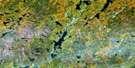
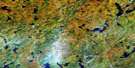
Penetanguishene Surrounding Area Aerial Photo Maps
 |
 |
 |
 |
 |
 |
 |
 |
 |
 |
 |
 |
 |
 |
 |
 |
© Department of Natural Resources Canada. All rights reserved.
Penetanguishene Gazetteer
The following places can be found on satellite image map 031D13 Penetanguishene:
Penetanguishene Satellite Image: Bays
Avery's BayAvery's Bay
Back Of The Moon Bay
Baie de Midland
Baie de Penetang
Baie des Esturgeons
Baie Georgienne
Bala Bay
Bass Bay
Beausoleil Bay
Black Bay
Brotherson's Bay
Brown Bay
Burrows Bay
Bushby Inlet
Cardinal Cove
Chimney Bay
Clifton Bay
Copp Bay
Coulter's Bay
Crooked Bay
Deadman's Bay
Echo Bay
Em's Bay
Four Seasons Bay
Frying Pan Bay
Ganyon Bay
Georgian Bay
Geri Bay
German Bay
Go Home Bay
Goblin Bay
Good Harbour
Hog Bay
Honey Harbour
Honeymoon Bay
Hungry Bay
Inner Bay
Kamenni Bay
Kettle's Bay
Lamb Bay
Leduc Bay
Lily Pad Bay
Little Go Home Bay
Long Bay
Longuissa Bay
Lost Bay
Macey Bay
Maceys Bay
Matchedash Bay
Midland Bay
Minors Bay
Moon Bay
Muskie Bay
North Bay
North Go Home Bay
Northwest Basin
O'Hara Bay
Ojibway Bay
Outer Bay
Outer Harbour
Papoose Bay
Parnassus Cove
Penetang Harbour
Pirates Cove
Pratt Bay
Redfox Bay
Regina Bay
Riddells Bay
Russian Bay
Sandpiper Bay
Sawlog Bay
Severn Sound
South Basin
South Bay
Stumpy Bay
Sturgeon Bay
Sugar Bay
Sunset Bay
Sweet Bay
Tiffin Basin
Tobies Bay
Torrance Bay
Treasure Bay
Turtle Bay
Vennings Bay
Wana Keta Bay
Weirs Bay
Whites Bay
Wood Bay
Penetanguishene Satellite Image: Beaches
Crescent BeachCrescentwood Beach
Crystal Beach
Penetanguishene Satellite Image: Capes
Adams PointAsylum Point
Ballantynes Point
Basswood Point
Beausoleil Point
Beman Point
Bergie Point
Blueberry Point
Bluff Point
Brown Head
Buena Vista Point
Bushby Point
Chapel Point
Cherry Point
Cogawa Point
Cognashene Point
Copp Point
Dalton Point
Davidson Point
Dog Point
Elephants Rump
Elimere Point
Finger Point
Flat Point
Flat Rock Point
Florence Point
George Point
Jones' Point
Leduc Point
Long Point
Long Point
Longuissa Point
Manitou Point
McLeod Point
Michaud Point
Midland Point
Minnehaha Point
Moore Point
O'Hara Point
One Eye Point
Peekaboo Point
Pickerel Point
Picnic Point
Pinery Point
Pleasant Point
Pleasant Point
Point Manchee
Portage Point
Raft Point
Red Cedar Point
Reynolds Point
Richardson Point
Samuel Point
Sawlog Point
Shehan Point
Shore Dinner Point
Sloane Point
Spero Point
Sturgeon Point
Sucker Creek Point
Sunrise Point
Tannery Point
Thumb Point
Thurallin Point
Tonch Point
Trudeau Point
Wabena Point
Waitabit Point
Watson Point
White Point
Windsor Island
Penetanguishene Satellite Image: Channels
Back ChannelBig Dog Channel
Deer Island Channel
Devils Elbow Channel
Freddy Channel
Gloucester Passage
Hangdog Channel
Inner Channel
Little Dog Channel
Lost Channel
Main Channel
Minnicog Channel
Monument Channel
Muskoka Landing Channel
Muskosh Channel
Musquash Channel
Potato Island Channel
Pretty Channel
Six Mile Channel
The Gap
The Gut
The Narrows
The Narrows
Tug Channel
Waubaushene Channel
Whalesback Channel
Penetanguishene Satellite Image: Cliffs
Bushby Point BluffPenetanguishene Satellite Image: Falls
Big ChuteHigh Falls
Little Chute
Long Falls
Three Rock Chute
White's Falls
Penetanguishene Satellite Image: Geographical areas
BaxterGibson
Matchedash
Muskoka
Orillia
Tay
Tiny
Wood
Penetanguishene Satellite Image: Indian Reserves
Gibson Indian Reserve 31Réserve indienne Gibson 31
Réserve indienne Wahta Mohawk Territory
Wahta Mohawk Territory
Penetanguishene Satellite Image: Islands
Aberdeen IslandAble Island
Ahatamanga Island
Aitken Island
Alexander Island
Ardilaun Island
Ardiluan Island
Arthur Island
Austin Island
Ava Island
Baddeley Island
Barron Island
Bather Island
Beausoleil Island
Beechwood Island
Bellelune Island
Bensley Island
Big Gem Island
Big Island
Big Ship Island
Biolog Island
Birchall Island
Black Squirrel Island
Blueberry Island
Bone Island
Brandy Creek Island
Brandy Island
Brandy's Island
Brébeuf Island
Broadview Island
Brousseau Island
Buckskin Island
Buller Island
Burke Island
Burnt Island
Burrows Island
Bushby Island
Calf Island
Campion Island
Canary Island
Carthew Island
Cecil Island
Centennial Island
Chads Island
Chelsea Island
Clare Island
Coney Island
Cook Island
Cow Island
Cowan Island
Crescent Island
Cupid Island
Cuzco Island
Darling Island
Deer Island
Deer Island
Delasco Island
Delf Island
Dinnick's Island
Dixie Island
Double Island
Duck Island
Eshpabekong Island
Firth Island
Fishermans Island
Foreman Islands
Francis Island
Garden Island
Gem Island
Giants Tomb Island
Gin Islands
Gin Rock Island
Givens Island
Glacis Island
Gordon Island
Gouette Island
Governor Island
Green Island
Green Island
Gwetchewan Island
Hangdog Island
Hawkins Island
Helena Island
Herb Island
Herdman Island
High Rock Island
Horne's Island
Horseshoe Island
Huckleberry Island
Île Travers
Jacks Rock
Janetawan Island
Juanita Island
Jubilee Island
Keating Island
Kelleher Island
Kenebec Island
Kennebeck Island
Kindersley Island
Kishkaoina Island
La Salle Island
Lambart Island
Lambert Island
Lauley Island
Liberty Island
Little Beausoleil Island
Little Gem Island
Llanberris Island
Lockerbie Island
Lockerby Island
Lone Star Island
Long Island
Long Point Island
Lookout Island
Lownie Island
Mackay Island
Magazine Island
Mallobuoy Island
Maltby Island
Marie Island
Marshal Island
Maud Island
Maxwell Island
McBurney Island
McDonell Island
McLeod Island
Mermaid Island
Methodist Island
Minnicognashene Island
Mitawanga Island
Morris Island
Murray Island
Neptune Island
Newton Islands
Nicholson Island
One Tree Island
Payette Island
Picnic Island
Pig Island
Pilkington Island
Pole Island
Porcupine Island
Portage Island
Potato Island
Powwow Island
Present Island
Prism Island
Pudding Island
Quarry Island
Ripley Island
Ritchie Island
Roberts Island
Rockcliffe Island
Rose Island
Royal Island
Ruth Island
Salisbury Island
Sasaga Island
Sawdust Island
Sawdust Islands
Sawmill Island
Shields Island
Ship Island
Smith's Island
Smooth Island
Snake Island
Splitrock Island
Starr's Island
Stocking's Island
Stony Island
Sugar Island
Suydan Island
Sweatman Island
Tabasakwa Island
Talbot Islands
The Reef
The Whaleback
Thibodeau Island
Thompson's Island
Tomahawk Island
Townsend Island
Treasure Island
Treasure Island
Tucker Island
Uncle Henry Island
Union Jack Island
Vanomi Island
Vencal Island
Wabeck Island
Walpole Island
Waubanoka Island
Wawa Island
Wawonaissa Island
Webber Island
Whalesback Islands
Whisky Island
Wigwam Island
Wigwam Island
Wildgoose Island
Yellowhead Island
Yenadizze Island
Zachary Island
Zachary Islands
Zumrud Island
Penetanguishene Satellite Image: Lakes
A-frame LakeBarron's Lake
Bastedo Lake
Baxter Lake
Bear Lake
Bear Lake
Bearshead Lake
Big Otter Lake
Black Lake
Black Lake
Blue Lagoon
Boleau Lake
Boot Lake
Boot Lake
Brophy Lake
Brotherson's Lake
Buck Lake
Buckshoof Lake
Buckskin Lake
Buckskin Lake
Buckskin Lakes
Burrows Lake
Burwash Lake
Cain Lake
Cana Lake
Clear Lake
Cognashene Lake
Coldwater Lake
Comb's Lake
Coombs Lake
Cranberry Lake
Cranberry Lake
Dark Lake
Dumbell Lake
East Brophy Lake
Echo Lake
Fairy Lake
Farlain Lake
Gibson Lake
Gignac Lake
Gloucester Pool
Go Home Lake
Goblin Lake
Gullwing Lake
Hardy Lake
Hart Lake
Hart Lake
Highland Pond
Horseshoe Lake
Indian Pond
Island Lake
Kettle's Lake
L Lake
Lac Huron
Lafarce Lake
Lake Huron
Lake St. Patrick
Lalonde Lake
Little Lake
Little Otter Lake
Lone Lake
Long Lake
Long Lake
Loudon Lake
Lower Boleau Lake
MacLean Lake
Matchedash Lake
McCrae Lake
McDonald Lake
Mosquito Lake
Mountain Lake
Narrow Lake
Neilson Lake
Neipage Lake
Niepage Lake
Nine Mile Lake
Otter Lake
Pence Lake
Penetang Lake
Pine Lake
Rabbit Lake
Rat Lake
Resound Lake
Sahanatien Lake
Second Lake
Shaw Lake
Shaw Lake
Six Mile Lake
Spence Lake
St. Andrews Lake
Stuart Lake
Swan Lake
Tank Lake
Tar Lake
Tea Lake
Torrance Lake
Turtle Lake
Turtle Lake
Upper Boleau Lake
Webster Lake
Woodland Lake
Penetanguishene Satellite Image: Marine navigation features
Lost Channel LandingPenetanguishene Satellite Image: Mountains
Lafontaine HillPenetanguishene Satellite Image: Major municipal/district area - major agglomerations
MuskokaSimcoe
Penetanguishene Satellite Image: Other municipal/district area - miscellaneous
FreemanGeorgian Bay
Matchedash
Muskoka Lakes
Orillia
Severn
Tay
Tay
Tay
Tiny
Penetanguishene Satellite Image: Conservation areas
Awenda Provincial ParkCognashene Lake Conservation Reserve
Cognashene Point Conservation Reserve
Georgian Bay Islands National Park of Canada
Gibson River Conservation Reserve
Gibson River Provincial Nature Reserve
Gibson River Provincial Park
Hardy Lake Provincial Park
Lieu historique national du Canada de la Voie-Navigable-Trent--Severn
McCrae Lake Conservation Reserve
McCrae Lake Wilderness Area
Moreau's Bay Conservation Reserve
Parc national du Canada des Îles-de-la-Baie-Georgienne
Severn River Conservation Reserve
Six Mile Lake Provincial Park
Torrance Barrens Conservation Reserve
Trent--Severn Waterway National Historic Site of Canada
Waubaushene Beaches Provincial Nature Reserve
Penetanguishene Satellite Image: Rapids
Basswood RunDeer Island Run
Dinnertime Rapids
Double Decker
Flat Rapids
Flat Rapids
Ragged Rapids
Swift Rapids
Penetanguishene Satellite Image: Rivers
Big CreekBlack River
Brandy Creek
Cherry Creek
Copeland Creek
Gibson River
Hungry Creek
Little Creek
Matchedash River
Muskoka River
Musquash River
North River
Picotte's Creek
Severn River
Shaw Creek
Sucker Creek
Tea Creek
Penetanguishene Satellite Image: River features
Portage BendThe Elbow
Penetanguishene Satellite Image: Road features
Turtle Lake PortagePenetanguishene Satellite Image: Shoals
Alfred BankAlice Rock
Bakewell Rock
Bare Rock
Barnard Bank
Beechwood Rock
Beman Rock
Bolster Bank
Boucher Rock
Bruce Shoal
Burke Rock
Campana Shoal
Candlemas Shoal
Chapelle Rock
Connors Rock
Conns Shoal
Donald Rock
Donald Rocks
DuBeau Shoal
Echo Rock
Felix Rock
Flat Rock
Flat Rock Bank
Fraser Bank
Gin Rocks
Gore Rock
Gull Rock
Hallen Rock
Hewis Rocks
Hill Bank
Hopkins Bank
Hotchkiss Rock
Indian Belle Rock
Ingram Rock
Jeffery Reef
Joe's Rock
Jubilee Rock
Judd Bank
Langmuir Rock
Mary Rocks
Mather Rock
McCabe Rock
Middle Ground Shoal
Middle Shelf
Midland Bay Shoal
Minos Bank
Mohawk Rock
Monkhouse Bank
Moreau Rock
Moss Rock
Myrtie Bank
Northeast Shelf
Oriole Rock
Osprey Bank
Otonabee Shoal
Owen Shoal
Penetang Rock
Picnic Rock
Pudding Rock
Quarry Island Bank
Red Rock
Rickord Rocks
Roe Rock
Ross Shoal
Skylark Rock
Split Rock
Superior Shoal
Sweet Shoal
The Whalesback
Tug Channel Rock
Turning Rock
Turning Rock
Turtle Rock
Valentine Rocks
Wabeck Rock
Wales Rock
Warwick Rocks
Washtub Rock
Woore Rocks
Penetanguishene Satellite Image: Towns
GravenhurstMidland
Penetanguishene
Penetanguishene Satellite Image: Unincorporated areas
Bayview ParkBig Chute
Buckskin
Burnside
Cedar Nook
Clearwater Beach
Cognashene
Connell
Coutnac Beach
Crescentwood Beach
Crooked Bay
Darling
Elimere Point
Farlain Lake
Fentons Landing
Forest Harbour
Franceville
Go Home
Grandview Beach
Highland Point
Honey Harbour
Hydro Glen
Kettle's Beach
Lawson
Lovering
Macey Bay
Maceys Bay
Marygrove
Massier Bay
Midland Point
Mordolphin
Muskoka Mills
Northwest Basin
Ogden's Beach
Paradise Point
Peekaboo Point
Penetang
Petaguishene Beach
Port McNicoll
Port Severn
Portage Park
Potters Landing
Robin's Point
Sahanatien
Sahanatien
Sawlog Bay
Severn Falls
Severn Park
South Bay
Southwood
Sturgeon Beach
Sunnyside
Sunset Beach
Swift Rapids
Toanche
Torrance
Triple Bay Park
Victoria Harbour
Wahta
Waubaushene
Wolverine Beach
Wood Landing
Woodward
Penetanguishene Satellite Image: Low vegetation
Argues MarshBallground Marsh
Bedford's Marsh
Big Gully
Borrows Marsh
Bowers Marsh
Hoaglands Marsh
Lower Hawks Marsh
Mosquito Lake Marsh
Poleline Marsh
Red Marsh
Sinkhole Marsh
Swift Marsh
Taylor's Marsh
Thompson Marsh
Upper Hawks Marsh
Weirs Marsh
© Department of Natural Resources Canada. All rights reserved.
