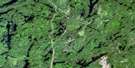
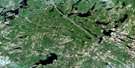
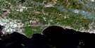
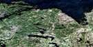
Nipissing Satellite Image Map
Download Free Aerial Photo 031L04 at 1:50,000 scale
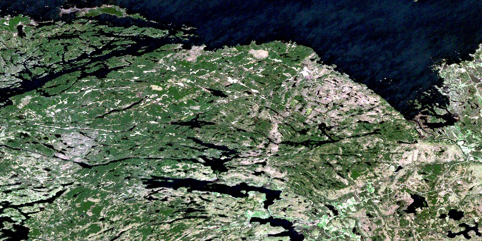
Nipissing Satellite Imagery
To view this satellite map, mouse over the air photo on the right.
You can also download this satellite image map for free:
031L04 Nipissing high-resolution satellite image map.
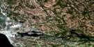
Maps for the Nipissing aerial map sheet 031L04 at 1:50,000 scale are also available in these versions:
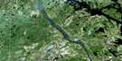
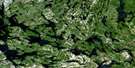
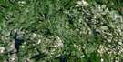
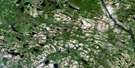
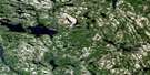
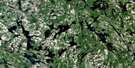
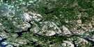
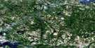
Nipissing Surrounding Area Aerial Photo Maps
 |
 |
 |
 |
 |
 |
 |
 |
 |
 |
 |
 |
 |
 |
 |
 |
© Department of Natural Resources Canada. All rights reserved.
Nipissing Gazetteer
The following places can be found on satellite image map 031L04 Nipissing:
Nipissing Satellite Image: Bays
Atkin BayBobs Bay
Campbell Bay
Campbell's Bay
Crosspoint Bay
Crowbar Bay
Deep Bay
Durrell Bay
Durrell's Bay
Fish Bay
Frank Bay
Frank's Bay
Greening's Bay
Hardy Bay
Hinchberger Bay
Hunters Bay
Hunters Bay
Kervin's Bay
Long Wing
Marsh Bay
Meadow Bay
Muskie Bay
Sand Bay
Sandy Bay
Satchells Bay
Satchels Bay
Simms Bay
Simpson's Bay
South Bay
Stinking Bay
Sunlit Bay
Sunlit Cove
Sunset Cove
Twilight Bay
Waltonian Bay
Whitney Bay
Wigwam Bay
Nipissing Satellite Image: Capes
Angel's PointArthurs Point
Campbell Point
Campbell's Point
Cross Point
Durrell Point
Fishermans Point
Frank Point
Frank's Point
Gibraltar Point
Johnston Point
Lake Point
Pickerel Point
Stormy Point
Wabiscaunk Point
Wigwam Point
Windy Point
Nipissing Satellite Image: Channels
Brock's ChannelCanoe Pass
Canoe Passage
Nipissing Satellite Image: City
Nipissing OuestNipissing Satellite Image: Falls
Chapman ChuteChapman's Chute
Nipissing Satellite Image: Geographical areas
BertramGurd
Hardy
Nipissing
Nipissing
Parry Sound
Patterson
Pringle
Nipissing Satellite Image: Indian Reserves
Dokis Indian Reserve 9Réserve indienne Dokis 9
Nipissing Satellite Image: Islands
#162Allison Island
Atcheson Island
Beacon Island
Bennett Island
Bingham Island
Blueberry Island
Blueberry Island
Boston Island
Bracken Island
Bragdon Island
Brills Island
Brownell Island
Browns Island
Burnt Island
Burnt Island
Cameron Island
Cleland Island
Comfort Island
Commanda Island
Dads Rest Island
Deelong Island
Doolittle Island
Droughton Island
Drunken Island
Dry Island
Duncan's Island
Elliot Island
Eureka Island
Fawn Island
Ferguson Island
Fishermans Island
Forestry Island
Fraser Island
Giesler Island
Green Island
Green Island
Greening Island
Greening's Island
Gull Islands
Hammond Islands
Hardy Island
Hendrie Island
Home Island
Homewood Island
Horseshoe Island
Hunt Island
Hunters Bay Island
Idlewylde Island
Îles Manitou
Jennings Island
Jessop Island
Jessup Island
Kawartha Island
Kennedy Island
Little Sandy Island
Loftus Island
Lonely Island
Lorne Island
Lucas Island
Manitou Islands
Marshall Island
Maw's Island
Merritt Island
Metapedia Island
Miller's Island
Minosin Island
Nivcent Island
Norris Island
North Jessup Island
Partridge Island
Perkins Island
Pine Island
Pine Knot Island
Porter Island
Rankin Island
Red Pine Island
Richardson Island
Robertson Island
Russell Island
Sandy Island
Schnaufer Island
Somerville Island
Spanner Island
Stark Island
Sumner Island
Sylvia May Island
Target Island
Three Pine Island
Three Sisters Islands
Torrance Island
Trescher Island
Twin Islands
Waldemar Island
Wanaki Island
Wigwam Island
Wilderslee Island
Wilson Island
Wright Island
Nipissing Satellite Image: Lakes
Baldy LakeBarton Lake
Bass Lake
Beatty Lake
Beaudry Lake
Beaver Lake
Bob's Lake
Brimson Lake
Broadwell Lake
Brownell Lake
Brown's Lake
Bruce Lake
Burnt Lake
Clear Lake
Commanda Lake
Crooked Lake
Dishaw Lake
Doland Lake
Duck Lake
Duncan Lake
First Lake
Fright Lake
Gerber Lake
Hazel Lake
Hicks Lake
Ibbitson Lake
Jinx Lake
Kidd Lake
Kilty Lake
La France Pond
Lac Nipissing
Lake Nipissing
Lennon Lake
Limbo Lost Lake
Little Clear Lake
Little Perch Lake
Little Rainy Lake
Long Lake
Lower Wiggins Lake
MacDonald Lake
Mayhew Lake
McQuaby Lake
McVeety Lake
Memesagamesing Lake
Migisi Lake
Mud Lake
Obashking Lake
Patterson Lake
Paul Lake
Perch Lake
Phantom Lake
Portage Lake
Porter Lake
Porter Lake
Rainy Lake
Rainy Lakes
Reserve Lake
Restoule Lake
Robin Lake
Ruth Lake
Sand Lake
Sandys Lake
Sandy's Lake
Satchells Lake
Satchels Lake
Scare Lake
Scud Lake
Second Lake
Secord Lake
Shoal Lake
Sloman Lake
Smallpox Lake
Spruce Lake
Stinking Lake
Stony Lake
Stormy Lake
Swalwell Lake
Tamarack Lake
Third Lake
Upper Wiggins Lake
Watt Lake
Wiggins Lake
Wolfe Lake
Woodcock Lake
Nipissing Satellite Image: Other municipal/district area - miscellaneous
CaldwellField
Nipissing
Springer
Nipissing Satellite Image: Conservation areas
Fish Bay Conservation ReserveFrench River Provincial Park
Manitou Islands Provincial Nature Reserve
Restoule Provincial Park
South Bay Provincial Park
West Sandy Island Provincial Nature Reserve
Nipissing Satellite Image: Rapids
Grawbarger's RapidsMacArthur's Rapids
Restoul Rapids
Restoule Rapids
Nipissing Satellite Image: Rivers
Bear CreekBeatty Creek
Beatty Creek
Beaudry Creek
Beaudry Creek
Burnt Lake Creek
Commanda Creek
Duncan Creek
Fraser Creek
French River
Hardy Creek
McQuaby Creek
Meadow Creek
Muskie Creek
Paul Creek
Portage Creek
Rainy Creek
Redpine Creek
Reserve Creek
Reserve Creek
Reserve Creek
Restoule River
Rivière des Français
Sand Creek
Satchels Creek
Shoal Creek
South River
Steels Creek
Steels Creek
Steel's Creek
Wades Creek
Wade's Creek
Wiggins Creek
Wolfe Creek
Woodcock Creek
Nipissing Satellite Image: Shoals
Gull RockGull Rock
Keystone Rock
Rusty Rock
Sugar Loaf Rock
Nipissing Satellite Image: Towns
West NipissingNipissing Satellite Image: Unincorporated areas
AlsaceCarr
Chapmans Landing
Chapman's Landing
Hotham
Keystone Camps
Nipissing
Nipissing Beach
Restoule
Wades Landing
Wade's Landing
© Department of Natural Resources Canada. All rights reserved.
031L Related Maps:
031L North Bay031L01 Brent
031L02 Kiosk
031L03 Powassan
031L04 Nipissing
031L05 Sturgeon Falls
031L06 North Bay
031L07 Mattawa
031L08 Riviere Maganasipi
031L09 Lac Bleu
031L10 Lac Beauchene
031L11 Temiscaming
031L12 Marten Lake
031L13 Ingall Lake
031L14 Ottertail Creek
031L15 Lac Grindstone
031L16 Lac Sairs
