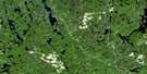
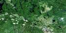
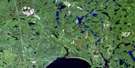
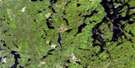
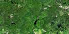
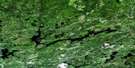
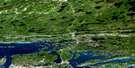
Milnet Satellite Image Map
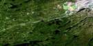
Download Free Aerial Photo 041I15 at 1:50,000 scale
Milnet Satellite Imagery
To view this satellite map, mouse over the air photo on the right.
You can also download this satellite image map for free:
041I15 Milnet high-resolution satellite image map.
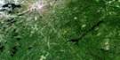
Maps for the Milnet aerial map sheet 041I15 at 1:50,000 scale are also available in these versions:
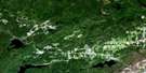
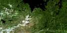
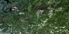
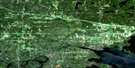
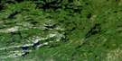
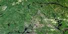
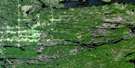
Milnet Surrounding Area Aerial Photo Maps
 |
 |
 |
 |
 |
 |
 |
 |
 |
 |
 |
 |
 |
 |
 |
 |
© Department of Natural Resources Canada. All rights reserved.
Milnet Gazetteer
The following places can be found on satellite image map 041I15 Milnet:
Milnet Satellite Image: Bays
Jack's BayMcCarthy Bay
McConnell Bay
Musko Bay
North Arm
Portage Bay
Southeast Bay
Southwest Bay
Telfer Bay
Warford's Bay
Milnet Satellite Image: Capes
Bonhomme PointBragg's Point
Eagle Point
McVittie Point
Peloquins Point
Milnet Satellite Image: Channels
Crystal NarrowsMilnet Satellite Image: City
Grand SudburyGreater Sudbury
Milnet Satellite Image: Geographical areas
AylmerBeresford
Clary
Creelman
DeMorest
Fraleck
Grigg
Hutton
Kelly
Mackelcan
Maclennan
McCarthy
McConnell
Norman
Parkin
Rathbun
Sheppard
Stobie
Sudbury
Telfer
Wisner
Milnet Satellite Image: Indian Reserves
Réserve indienne Wahnapitei 11Wahnapitae 11
Wahnapitei Indian Reserve 11
Milnet Satellite Image: Islands
A IslandCaribou Island
Gavin Island
Goalscap Island
Milnet Satellite Image: Lakes
Adelaide LakeAlma Lake
Alphretta Lake
Anelia Lake
Bad Lake
Bannagan Lake
Barron Lake
Bass Lake
Bass Lake
Bass Lake
Beaver Lake
Beavertooth Lake
Beresford Lake
Bernard Lake
Bessie Lake
Big Valley Lake
Blackthorn Lake
Blackwater Lake
Bluff Lake
Boland's Lake
Bonesteel Lake
Bonhomme Lake
Bonhomme Lake
Bottom Lake
Bowland Lake
Bragg Lake
Bronson Lake
Bull Lake
Bushy Lake
Button Lake
Cache Lake
Camp Nine Lake
Camp One Lake
Camp Seven Lake
Camp Three Lake
Camp Two Lake
Carlo Lake
Caswell Lake
Cathro Lake
Chiniguchi Lake
Chuggin Lake
Colin Scott Lake
Connelly Lake
Davis Lake
Dead Lake
Dean Lake
Deer Lake
Den Lake
Dewdney Lake
Dobbie Lake
Donald Lake
Doon Lake
Dougherty Lake
Dreamy Lake
Eaglenest Lake
East Bass Lake
Edna Lake
Evelyn Lake
Farm Lake
Fire Lake
Fisher Lake
Flesher Lake
Fraleck Lake
Framan Lake
Franks Lake
Fraser Lake
Futh Lake
Gibson Lake
Gipsy Lake
Goat Lake
Gold Lake
Grassy Lake
Grave Lake
Halleck Lake
Hammend Lake
Hicks Lake
High Dump Lake
Houston Lake
Hutton Lake
Irish Lake
Irving Lake
Jess Lake
John Lake
Jones Lake
Josephine Lake
Karl Lake
Keith Lake
Kettyle Lake
Kosmerly Lake
Kukagami Lake
Lac Wanapitei
Laundry Lake
Laura Lake
Lawlor Lake
Lingo Lake
Little Bonhomme Lake
Little Italy Lake
Little Lynx Lake
Little Otter Lake
Little Valley Lake
Loney Lake
Loon Lake
Lower Mowat Lake
Lynn Lake
Malbeuf Lake
Marion Lake
Marjorie Lake
Mark Lake
Matagamasi Lake
McFie Lake
McGown Lake
Minnow Lake
Mountaintop Lake
Mowat Lake
Mud Lake
Norman Lake
Otter Lake
Overhead Lake
Owen Lake
Paradise Lake
Parkin Lake
Pedro Lake
Pelo Lake
Perch Lake
Peterson Lake
Pine Lake
Post Lake
Pothole Lake
Poulton Lake
Rat Lake
Rathbun Lake
Rathwell Lake
Rawson Lake
Redpine Lake
Ross Lake
Sam Martin Lake
Sandy Lake
Sawhorse Lake
Sawmill Lake
Selwyn Lake
Shed Lake
Shedden Lake
Silvester Lake
Skynner Lake
Squirrel Lake
Stake Lake
Sunfish Lake
Telephone Lake
Telfer Lake
The Sluiceway
Theresa Lake
Thomas Lake
Three Sisters Lakes
Tower Lake
Twin Lakes
Twin Lakes
Upper Gipsy Lake
Upper Mowat Lake
Upper Thomas Lake
Wallin Lake
Wanapitei Lake
Wessel Lake
White Rock Lake
Wisner Lake
Wolf Lake
Milnet Satellite Image: Mountains
The ElephantMilnet Satellite Image: Major municipal/district area - major agglomerations
SudburyMilnet Satellite Image: Other municipal/district area - miscellaneous
BlezardCapreol
Capreol and Hanmer
Garson
Hanmer
Neelon and Garson
Milnet Satellite Image: Conservation areas
Chiniguchi Waterway Provincial ParkSturgeon River Provincial Park
Wanapitei Provincial Park
Milnet Satellite Image: Rivers
Balsam CreekBig Valley Creek
Blackash Creek
Bonhomme Creek
Chiniguchi River
East Wanapitei River
Frog Creek
Grassy Creek
Halleck Creek
Hutton Creek
Josephine Creek
Laura Creek
Mountain Creek
Mowat Creek
Parkin Creek
Parkin Creek
Post Creek
Rivière Vermillion
Rivière Wanapitei
Roberts River
Sam Martin Creek
Stobie Creek
Sturgeon River
Vermilion River
Wanapitei River
Whistle Creek
Wisner Creek
Milnet Satellite Image: Road features
Donald Lake PortageToenail Portage
Milnet Satellite Image: Unincorporated areas
CapreolMilnet
Valley East

© Department of Natural Resources Canada. All rights reserved.
