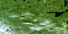
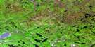
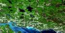
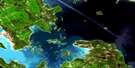
Whiskey Lake Satellite Image Map
Download Free Aerial Photo 041J08 at 1:50,000 scale
Whiskey Lake Satellite Imagery
To view this satellite map, mouse over the air photo on the right.
You can also download this satellite image map for free:
041J08 Whiskey Lake high-resolution satellite image map.
Maps for the Whiskey Lake aerial map sheet 041J08 at 1:50,000 scale are also available in these versions:
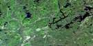
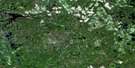
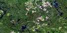
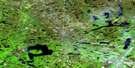
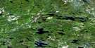
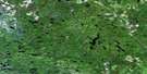
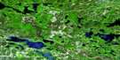
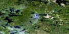
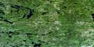
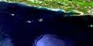
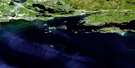
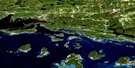
Whiskey Lake Surrounding Area Aerial Photo Maps
 |
 |
 |
 |
 |
 |
 |
 |
 |
 |
 |
 |
 |
 |
 |
 |
© Department of Natural Resources Canada. All rights reserved.
Whiskey Lake Gazetteer
The following places can be found on satellite image map 041J08 Whiskey Lake:
Whiskey Lake Satellite Image: Bays
Arm of the BearBellmore Bay
Dollar Bay
Haight Bay
MacDermott Bay
Whiskey Lake Satellite Image: Capes
Ale PointAnticline Point
Beer Point
Brandy Point
Cider Point
Cognac Point
Diabase Point
Gin Point
Paddy Point
Pine Point
Rum Point
Sandy Point
Shelter Point
Whiskey Lake Satellite Image: City
Elliot LakeWhiskey Lake Satellite Image: Falls
Cameron FallsMeareau Falls
Whiskey Lake Satellite Image: Geographical areas
118119
123
124
129
130
131
137
138
143
144
Algoma
Boon
Buckles
Cadeau
Deagle
Gaiashk
Gerow
Gough
Joubin
Lehman
Lewis
Lockeyer
Mandamin
May
Proctor
Salter
Shedden
Shibananing
Sudbury
Tennyson
Victoria
Weeks
Whiskey Lake Satellite Image: Islands
Barrow IslandCampbell Island
Whiskey Lake Satellite Image: Lakes
Alto LakeBarrow Lake
Batty Lake
Bean Lake
Bear Lake
Beishlag Lake
Bellows Lake
Big Trout Lake
Birch Lake
Black Lake
Bock Lake
Bonamico Lake
Bouchard Lake
Bull Lake
Burnett Lake
Camera Lake
Canoe Lake
Caribou Lake
Clayton Lake
Closs Lake
Complin Lake
Conley Lake
Conway Lake
Corner Lake
Deresti Lake
Dinny Lake
Dyelle Lake
East Bull Lake
Folson Lake
Forestell Lake
Fryer Lake
Gabel Lake
Gaetano Lake
Geldart Lake
Goulding Lake
Gourd Lake
Grimard Lake
Hackford Lake
Haight Lake
Hanna Lake
Hone Lake
Horseshoe Lake
Hough Lake
Kecil Lake
Kindle Lake
Kitts Lake
Kriwoy Lake
Laitila Lake
Lang Lake
Larocque Lake
Little Bull Lake
Little Folson Lake
Little Serpent Lake
Little Trout Lake
Lizotte Lake
Lochness Lake
Louttit Lake
Macdermott Lake
MacDermott Lake
May Lake
May Lake
McCarthy Lake
McCool Lake
McGivney Lake
McKiggan Lake
McMinn Lake
Millen Lake
Moreland Lake
Moyle Lake
Mutcheguis Lake
Nazar Lake
Neumann Lake
Nook Lake
Novick Lake
Ortona Lake
Ouellette Lake
Paddy Lake
Parisien Lake
Pawson Lake
Pecors Lake
Pilon Lake
Quirke Lake
Rangers Lake
Renault Lake
Rioux Lake
Roney Lake
Salmay Lake
Savage Lake
Shaule Lake
Shawanda Lake
Shedden Lake
Shoe Lake
Smail Lake
Snapshot Lake
Sorley Lake
Speck Lake
St. Jules Lake
Stalker Lake
Stong Lake
Streich Lake
Tarsan Lake
Teasdale Lake
Tee Lake
Tees Lake
Tilt Lake
Tiplady Lake
Toria Lake
Trap Lake
Tweedle Lake
Vance Lake
Vanhorn Lake
Walton Lake
Weasel Lake
West Lake
Whiskey Lake
Whitefish Lake
Whitson Lake
Wickstrom Lake
Wiggly Lake
Wigmore Lake
Wing Lake
Whiskey Lake Satellite Image: Mountains
Sutherland HillWhiskey Lake Satellite Image: Other municipal/district area - miscellaneous
HallamSables-Spanish Rivers
Salter, May and Harrow
Shedden
The North Shore
The Spanish River
Victoria
Whiskey Lake Satellite Image: Conservation areas
Flat Creek Old Pine Conservation ReserveGlenn N. Crombie Conservation Reserve
River Aux Sables Provincial Park
Whiskey Lake Satellite Image: Rivers
Batty CreekBuff Creek
Cameron Creek
Cutler Creek
Flat Creek
Fleck Creek
Heffler Creek
Little Serpent River
Low Creek
Paddy Creek
River aux Sables
Serpent River
West River aux Sables
Whiskey Lake Satellite Image: Unincorporated areas
The Back Settlement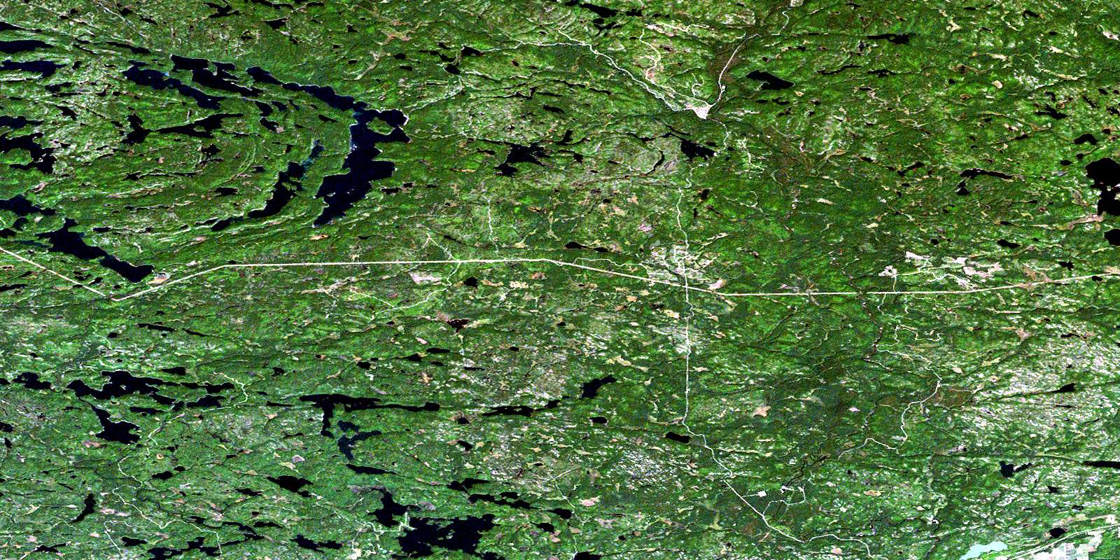
© Department of Natural Resources Canada. All rights reserved.
041J Related Maps:
041J Blind River041J01 Spanish
041J02 Algoma
041J03 Dean Lake
041J04 St Joseph Island
041J05 Bruce Mines
041J06 Iron Bridge
041J07 Elliot Lake
041J08 Whiskey Lake
041J09 Madawanson Lake
041J10 Rawhide Lake
041J11 Wakomata Lake
041J12 Echo Lake
041J13 Ranger Lake
041J14 Rocky Island Lake
041J15 Kindiogami Lake
041J16 Mozhabong Lake
