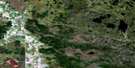
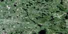
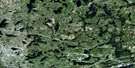
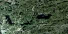
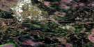
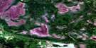
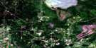
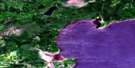
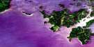
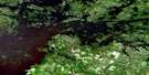
Falcon Island Satellite Image Map
Download Free Aerial Photo 052E07 at 1:50,000 scale
Falcon Island Satellite Imagery
To view this satellite map, mouse over the air photo on the right.
You can also download this satellite image map for free:
052E07 Falcon Island high-resolution satellite image map.
Maps for the Falcon Island aerial map sheet 052E07 at 1:50,000 scale are also available in these versions:
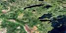
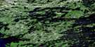
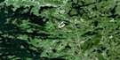
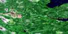
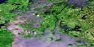
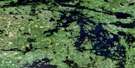
Falcon Island Surrounding Area Aerial Photo Maps
 |
 |
 |
 |
 |
 |
 |
 |
 |
 |
 |
 |
 |
 |
 |
 |
© Department of Natural Resources Canada. All rights reserved.
Falcon Island Gazetteer
The following places can be found on satellite image map 052E07 Falcon Island:
Falcon Island Satellite Image: Bays
Astron BayBeaver Inlet
Bishop Bay
Boggy Bay
Deepwater Bay
Grassy Bay
Gull Bay
Little Traverse Bay
Loon Bay
Monument Bay
Northwest Angle Inlet
Outer Bay
Poachers Bay
Portage Bay
Redwater Bay
Rice Bay
Sabaskosing Bay
Sandy Bay
Spruce Portage Bay
The Little Traverse
Turtle Bay
Falcon Island Satellite Image: Capes
Aulneau PeninsulaBishop Point
Bunting's Point
Mica Point
Picture Rock Point
Sand Point
School House Point
Separation Point
Starting Point
Toadstool Point
Falcon Island Satellite Image: Channels
Deadbroke ChannelDevils Elbow
Devil's Elbow
French Portage Narrows
Johnston Passage
Naongashing Channel
Sturgeon Channel
Sunset Channel
The Tug Channel
Tranquil Channel
Treaty Narrows
Whaler Channel
Falcon Island Satellite Image: Indian Reserves
Agency 30Agency Indian Reserve 30
Lake of the Woods 31C
Lake of the Woods 31G
Lake of the Woods 34
Lake of the Woods 37
Lake of the Woods 37B
Lake of the Woods Indian Reserve 31B
Lake of the Woods Indian Reserve 31C
Lake of the Woods Indian Reserve 31G
Lake of the Woods Indian Reserve 34
Lake of the Woods Indian Reserve 37
Lake of the Woods Indian Reserve 37B
Naongashing Indian Reserve 31A
Naongashing Indian Reserve 35A
Northwest Angle Indian Reserve 33B
Réserve indienne Agency 30
Réserve indienne Lake of the Woods 31B
Réserve indienne Lake of the Woods 31C
Réserve indienne Lake of the Woods 31G
Réserve indienne Lake of the Woods 34
Réserve indienne Lake of the Woods 37
Réserve indienne Lake of the Woods 37B
Réserve indienne Naongashing 31A
Réserve indienne Naongashing 35A
Réserve indienne Northwest Angle 33B
Falcon Island Satellite Image: Islands
Arrow Head IslandBay Island
Betty Island
Birch Island
Bishop Point Island
Blaze Island
Bluff Island
Boucha Island
Bukete Island
Burnt Island
Burnt Rock Island
Calendar Island
Centre Island
Cliff Island
Clipper Island
Cochrane Island
Coste Island
Cyclone Island
Dagger Island
Deadbroke Island
Dog Island
Drift Island
Eagle Island
East Long Island
Egg Island
Egg Island
Enchanted Island
Falcon Island
Firebag Island
Fish Island
Folster Island
Gardner Island
High Island
Horse Island
Ike Island
Jessie Island
Kennedy Island
La Vérendrye Island
Lily Island
Little Eagle Island
Little Island
Little Smokey Island
Long Island
Low Island
Lynx Island
Massacre Island
McPherson Island
Mist Island
North Island
Onion Island
Passage Island
Pine Island
Poplar Island
Powder Island
Red Fox Island
Redrock Island
Rock Island
Rough Island
Royal Island
Sandy Bar Island
Skeet Island
Skiff Island
Spruce Island
Squaw Island
Thomas Island
Toadstool Island
Tranquil Island
Twin Island
Twin Islands
Willow Island
Windfall Island
Windigo Islands
Falcon Island Satellite Image: Lakes
Arrow LakeBuck Lake
Deacon Lake
Don Lake
Dumbbell Lake
Dumbell Lake
Inland Lake
Lac des Bois
Lake of the Bays
Lake of the Woods
Mason Lake
Mason Lake
Maud Lake
O'Dell Lake
Pin Lake
Reid Lake
Reid Lake
Shoal Lake
Tex Lake
Westly Lake
Falcon Island Satellite Image: Other municipal/district area - miscellaneous
Lake of the WoodsMcCrosson and Tovell
Morson
Falcon Island Satellite Image: Conservation areas
Massacre Island Wilderness AreaFalcon Island Satellite Image: Rivers
Don CreekO'Dell Creek
Falcon Island Satellite Image: Shoals
Flag Island ReefGrandy Reef
Gull Reef
Gull Rock
Jean-Baptiste Rocks
Monkey Rocks Reef
Paquin Reef
Pinnacle Rock
Powassin Rock
Voyageur Rocks
Falcon Island Satellite Image: Unincorporated areas
French PortageNaongashing

© Department of Natural Resources Canada. All rights reserved.
052E Related Maps:
052E Kenora052E01 Morson
052E02 Big Island
052E03 Buffalo Bay
052E04 Sprague
052E05 Whitemouth River
052E06 Berry Point
052E07 Falcon Island
052E08 Sioux Narrows
052E09 Longbow Lake
052E10 Clearwater Bay
052E11 Falcon Lake
052E12 Mcmunn
052E13 Whitemouth
052E14 Caddy Lake
052E15 Keewatin
052E16 Kenora
