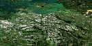
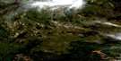
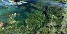
Duval Lake Satellite Image Map
Download Free Aerial Photo 063N04 at 1:50,000 scale
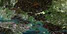
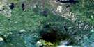
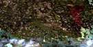
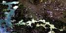
Duval Lake Satellite Imagery
To view this satellite map, mouse over the air photo on the right.
You can also download this satellite image map for free:
063N04 Duval Lake high-resolution satellite image map.
Maps for the Duval Lake aerial map sheet 063N04 at 1:50,000 scale are also available in these versions:
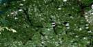
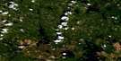
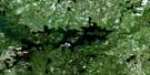
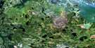
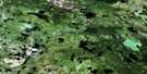
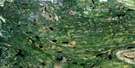
Duval Lake Surrounding Area Aerial Photo Maps
 |
 |
 |
 |
 |
 |
 |
 |
 |
 |
 |
 |
 |
 |
 |
 |
© Department of Natural Resources Canada. All rights reserved.
Duval Lake Gazetteer
The following places can be found on satellite image map 063N04 Duval Lake:
Duval Lake Satellite Image: Bays
Barrett BayJens Bay
Duval Lake Satellite Image: Capes
Matheson PeninsulaDuval Lake Satellite Image: Islands
Buckingham IslandErnie Leech Island
Freemans Island
Jens Island
Moose Island
Zuks Island
Duval Lake Satellite Image: Lakes
Albulet LakeBeaudry Lake
Cacholotte Lake
Caledon Lake
Duval Lake
Eccles Lake
Forester Lake
French Lake
Gilford Black Lake
Gummerson Lake
Hay Lake
Holopina Lake
Hume Lake
Kipahigan Lake
Kipahigan Lake
Kississing Lake
Mansask Lake
Mansask Lake
Mari Lake
McCormick Lake
Moroz Lake
Newman Lake
Philfoster Lake
Saskman Lake
Saskman Lake
Shapland Lake
Steeds Lake
Surbey Lake
Wizard Lake
Woloski Lake
Duval Lake Satellite Image: Mountains
Bell HillMcDonald Hill
Duval Lake Satellite Image: Rivers
Kississing RiverLittle Mikes Creek

© Department of Natural Resources Canada. All rights reserved.
063N Related Maps:
063N Kississing Lake063N01 Nightingale Lake
063N02 Batty Lake
063N03 Sherridon
063N04 Duval Lake
063N05 Kipahigan Lake
063N06 Lamont Lake
063N07 Takipy Lake
063N08 Burntwood Lake
063N09 Pahayo Lake
063N10 Flatrock Lake
063N11 Pukatawagan
063N12 Sisipuk Lake
063N13 Britton Lake
063N14 Llama Lake
063N15 Madsen Bay
063N16 Highrock Lake
