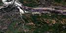
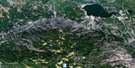
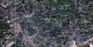
Bunting Bay Satellite Image Map
Download Free Aerial Photo 074D09 at 1:50,000 scale
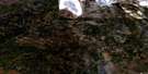
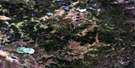
Bunting Bay Satellite Imagery
To view this satellite map, mouse over the air photo on the right.
You can also download this satellite image map for free:
074D09 Bunting Bay high-resolution satellite image map.
Maps for the Bunting Bay aerial map sheet 074D09 at 1:50,000 scale are also available in these versions:
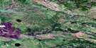
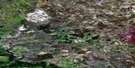
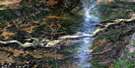
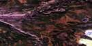
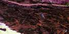
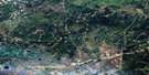
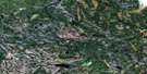
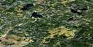
Bunting Bay Surrounding Area Aerial Photo Maps
 |
 |
 |
 |
 |
 |
 |
 |
 |
 |
 |
 |
 |
 |
 |
 |
© Department of Natural Resources Canada. All rights reserved.
Bunting Bay Gazetteer
The following places can be found on satellite image map 074D09 Bunting Bay:
Bunting Bay Satellite Image: Bays
Bunting BayBunting Bay Satellite Image: Capes
Little Rocky PointMain Point
Bunting Bay Satellite Image: Falls
Whitemud FallsBunting Bay Satellite Image: Islands
Flowerpot IslandIrma Island
Kenee Island
Bunting Bay Satellite Image: Lakes
Gordon LakeBunting Bay Satellite Image: Major municipal/district area - major agglomerations
Wood BuffaloBunting Bay Satellite Image: Rapids
Cascade RapidsBunting Bay Satellite Image: Rivers
Clearwater RiverClearwater River
D.D.'s Creek
Edwin Creek
Edwin Creek
Gipsy Creek
High Hill River
Poacher's Creek
Rattlepan Creek
Romeo's Creek
Soda Creek
Bunting Bay Satellite Image: Road features
Cascade Portage
© Department of Natural Resources Canada. All rights reserved.
074D Related Maps:
074D Fort Mcmurray074D01 Watchusk Lake
074D02 Quigley
074D03 No Title
074D04 Horse River
074D05 No Title
074D06 Gregoire Lake
074D07 Cheecham
074D08 Gipsy Lake
074D09 Bunting Bay
074D10 Hollies Creek
074D11 Fort Mcmurray
074D12 Cascade Rapids
074D13 Ruth Lake
074D14 Wood Creek
074D15 No Title
074D16 High Hill River
