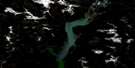
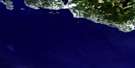
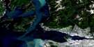
New Westminster Satellite Image Map
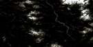
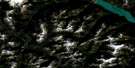
Download Free Aerial Photo 092G02 at 1:50,000 scale
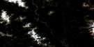
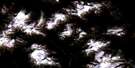
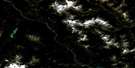
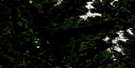
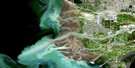
New Westminster Satellite Imagery
To view this satellite map, mouse over the air photo on the right.
You can also download this satellite image map for free:
092G02 New Westminster high-resolution satellite image map.
Maps for the New Westminster aerial map sheet 092G02 at 1:50,000 scale are also available in these versions:
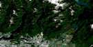
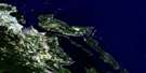
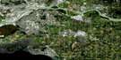
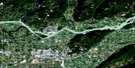
New Westminster Surrounding Area Aerial Photo Maps
 |
 |
 |
 |
 |
 |
 |
 |
 |
 |
 |
 |
 |
 |
 |
 |
© Department of Natural Resources Canada. All rights reserved.
New Westminster Gazetteer
The following places can be found on satellite image map 092G02 New Westminster:
New Westminster Satellite Image: Bays
Boundary BayMud Bay
North Arm
North Arm Fraser River
North Arm of Fraser River
Semiahmoo Bay
Semiamu Bay
New Westminster Satellite Image: Beaches
Sapperton BarNew Westminster Satellite Image: Capes
Blackie SpitEndsleigh Point
Helmcken Point
Kwomais Point
Mann Point
Purfleet Point
Robert Point
Sebastian Point
Shoal Point
Tavistock Point
New Westminster Satellite Image: Channels
Annacis ChannelAnnieville Channel
Bedford Channel
Parsons Channel
Sapperton Channel
New Westminster Satellite Image: City
LangleyNew Westminster
Pitt Meadows
Port Coquitlam
Surrey
White Rock
New Westminster Satellite Image: District municipality
DeltaLangley
Maple Ridge
New Westminster Satellite Image: Geographical areas
New Westminster Land DistrictNew Westminster Satellite Image: Hydraulic construction
Annieville DykeNew Westminster Satellite Image: Indian Reserves
Barnston Island Indian Reserve 3Coquitlam Indian Reserve 1
Coquitlam Indian Reserve 2
Graveyard Indian Reserve 5
Katzie Indian Reserve 1
Katzie Indian Reserve 2
Langley Indian Reserve 5
McMillan Island Indian Reserve 6
Réserve indienne Barnston Island 3
Réserve indienne Coquitlam 1
Réserve indienne Coquitlam 2
Réserve indienne Graveyard 5
Réserve indienne Katzie 1
Réserve indienne Katzie 2
Réserve indienne Langley 5
Réserve indienne McMillan Island 6
Réserve indienne Semiahmoo
Semiahmoo Indian Reserve
New Westminster Satellite Image: Islands
Annacis IslandBarnston Island
Brae Island
Don Island
Douglas Island
Essondale Islet
Lion Island
Lulu Island
McMillan Island
Patrick Island
Poplar Island
Tree Island
New Westminster Satellite Image: Lakes
Burnaby LakeCook Slough
Cranberry Slough
Deer Lake
Gundersen Slough
Katzie Slough
Latimer Pond
Tulley Slough
New Westminster Satellite Image: Military areas
Canadian Forces Station AldergroveStation des Forces canadiennes Aldergrove
New Westminster Satellite Image: Mountains
Connaught HillGrant Hill
Mary Hill
New Westminster Satellite Image: Major municipal/district area - major agglomerations
Central Fraser Valley Regional DistrictDewdney-Alouette Regional District
New Westminster Satellite Image: Conservation areas
Fort Langley National Historic Site of CanadaGolden Ears Park
Lieu historique national du Canada du Fort-Langley
Peace Arch Park
New Westminster Satellite Image: Provinces
British ColumbiaColombie-Britannique
New Westminster Satellite Image: Rivers
Alouette RiverAnderson Creek
Austin Creek
Baker Creek
Barker Creek
Bertrand Creek
Best Creek
Booth Creek
Brunette River
Campbell Creek
Campbell River
Cave Creek
Chantrell Creek
Coghlan Creek
Como Creek
Coquitlam River
Cougar Canyon Creek
Damsite Creek
Elgin Creek
Elgin Creek
Fergus Creek
Fleuve Fraser
Fraser River
Hyland Creek
Kanaka Creek
Langley Creek
Latimer Creek
Lay Creek
Macdonald Brook
MacDonald Creek
Mackereth Creek
Mahood Creek
McInnis Creek
McKenny Creek
Muckle Creek
Munday Creek
Murray Creek
Nelson Creek
Newlands Brook
Nicomekl River
North Alouette River
Old Sawmill Creek
Palmateer Creek
Pitt River
Pleasantdale Creek
Quibble Creek
Salmon River
Sam Hill Creek
Serpentine River
Spencer Creek
Still Creek
Stoney Creek
Tyre Creek
West Creek
Willock Brook
Yorkson Creek
New Westminster Satellite Image: River features
Bishops ReachChatham Reach
City Reach
Derby Reach
Queens Reach
Russel Reach
New Westminster Satellite Image: Shoals
City BankNew Westminster Satellite Image: Unincorporated areas
AlbionAnnacis
Anniedale
Annieville
Austin Heights
Barnston Island
Bridgeview
Brookswood
Brownsville
Brunette Creek
Buckingham Heights
Burke Road
Burnaby
Byrne Road
Cariboo
Cariboo Road
Cloverdale
Coghlan
Colebrook
Connaught Heights
Craigs
Crescent
Crescent
Crescent Beach
Dartmoor
Douglas
East Burnaby
Eastburn
Edmonds
Elgin
Elsona
Endot
Essondale
Ewen Junction
Fern Ridge
Fleetwood
Forest Knolls
Fort Langley
Fraser Arm
Fraser Heights
Fraser Mills
Fraser River Junction
Fraser Surrey
Glenbrooke North
Grandview
Guildford
Gyproc
Hammond
Haney
Hazelmere
Hopington
Hydro
Inverholm
Johnson Heights
Jubilee
Kelvin
Kennedy
Kings
Liverpool
Livingstone
Maillardville
Mary Hill
Mayfair
McGregor
McPherson Avenue
Meridian
Metrotown
Middlegate
Milner
Mud Bay
Murrayville
Newton
Newton Station
North Delta
North Surrey
North Surrey (Whalley Comm.-Aggl.)
Ocean Park
Panorama Ridge
Pitt Meadows
Pitt River
Port Hammond
Port Haney
Port Kells
Port Mann
Pratt
Queens Park
Queensborough
Rawlison
Royal Oak
Sapperton
Shops
South Burnaby
South Surrey
South Westminster
Sperling
Sperling Station
Sprott
Strawberry Hill
Sullivan
Sunbury
Sunnyside
Sunshine Hills
Surrey
Surrey Centre
Thornton Yard
Townsend
Trapp Road
Tynehead
Walnut Grove
Webster Corners
Websters Corners
West End
Westlang
Westminster
Whalley
Yennadon
New Westminster Satellite Image: Low vegetation
Burns Bog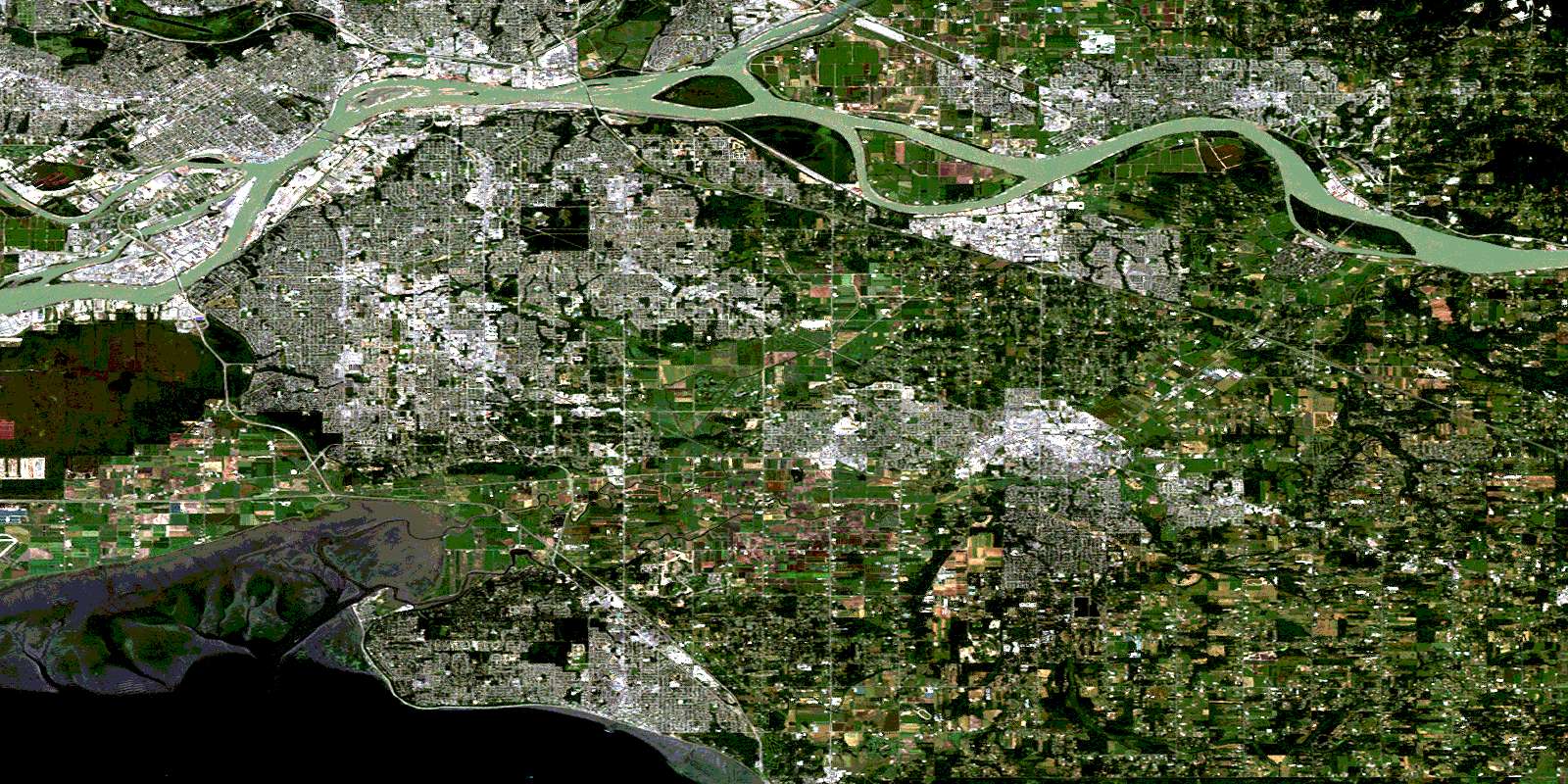
© Department of Natural Resources Canada. All rights reserved.
092G Related Maps:
092G Vancouver092G01 Mission
092G02 New Westminster
092G03 Lulu Island
092G04 Nanaimo
092G05 Sechelt
092G06 North Vancouver
092G07 Port Coquitlam
092G08 Stave Lake
092G09 Stave River
092G10 Pitt River
092G11 Squamish
092G12 Sechelt Inlet
092G13 Jervis Inlet
092G14 Cheakamus River
092G15 Mamquam Mountain
092G16 Glacier Lake
