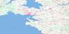
Charlottetown Topo Map Online
Download Free Topo Map Sheet 011L03 at 1:50,000 scale
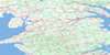
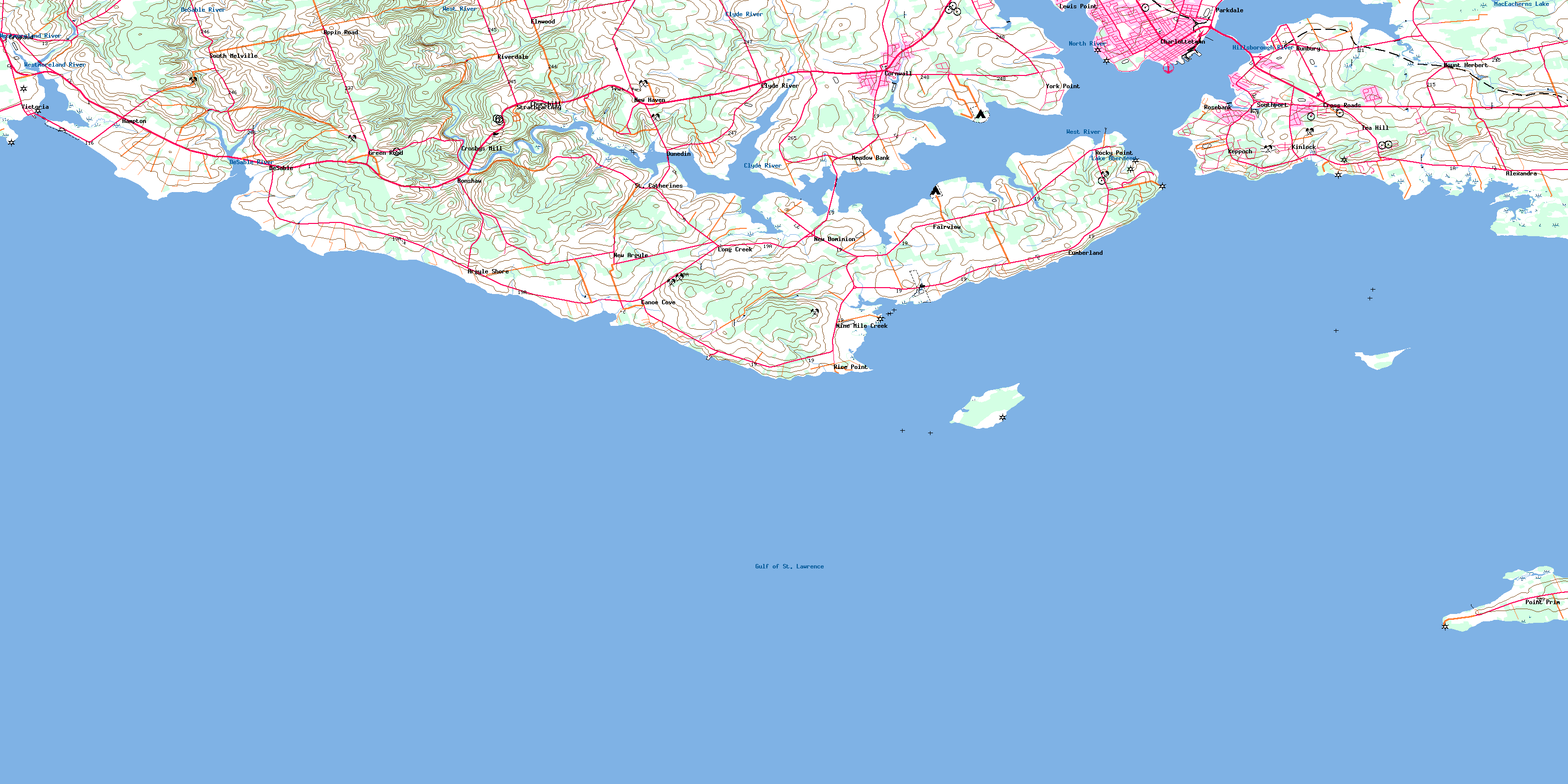
011L03 Charlottetown Topo Map
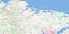
To view this map, mouse over the map preview on the right.
You can also download this topo map for free:
011L03 Charlottetown high-resolution topo map image.
Maps for the Charlottetown topo map sheet 011L03 at 1:50,000 scale are also available in these versions:
Charlottetown Surrounding Area Topo Maps
 |
|||
 |
 |
 |
 |
 |
 |
 |
 |
© Department of Natural Resources Canada. All rights reserved.
Charlottetown Gazetteer
The following places can be found on topographic map sheet 011L03 Charlottetown:
Charlottetown Topo Map: Bays
Alexandra BayAllen Cove
Bacon Cove
Bass Cove
Bellevue Cove
Black Creek
Canceaux Cove
Canoe Cove
Charlottetown Harbour
Codys Creek
Crapaud Road
Feehans Creek
Ferguson Creek
French Creek
Golfe du Saint-Laurent
Goose Creek
Gulf of St. Lawrence
Hillsborough Bay
Holland Cove
Hydes Cove
Indian Cove
Jardines Bay
Kelly Cove
Kellys Cove
MacEacherns Creek
MacEwens Creek
Pownal Bay
Pownall Bay
Squaw Bay
St. Peter Road
St. Peters Road
Stewart Cove
Stuart Creek
Victoria Harbour
Warren Cove
Webster Creek
Webster Creek
Wilsons Creek
Woods Bay
Charlottetown Topo Map: Beaches
Brighton ShoreKeppoch Beach
Langley Beach
St. Peters Island Bar
Charlottetown Topo Map: Capes
Alchorn PointAlexandra Point
Bacon Point
Battery Point
Beacon Point
Bellevue Point
Black Point
Blockhouse Point
Brocklesby Head
Burhoes Point
Cameron Island
Cameron Point
Canceaux Point
Canceaux Spit
Crosby Point
Crown Point
Crown Point
Dickiesons Point
Dickieson's Point
Drakes Point
Duchess Point
Duffys Point
Ferguson Point
Ferry Point
George Point
Haszard Point
Hyde Point
Hydes Point
Jardines Point
Kelly Point
Kellys Point
Kensington Point
Lewis Point
Lobster Point
MacIvors Point
MacNeills Point
May Point
McMullan Point
McMullen Point
North Point
Old Battery Point
Parks Point
Point Prim
Pownal Peninsula
Prim Point
Primrose Point
Rice Point
Rocky Point
Rosebank Point
Sand Point
Seatrout Point
Squaw Point
St. Peter Spit
St. Peters Spit
Wilsons Point
Woods Point
Wrights Point
York Point
Yorke Point
Charlottetown Topo Map: Channels
Détroit de NorthumberlandNorthumberland Strait
Charlottetown Topo Map: City
CharlottetownCharlottetown Topo Map: Cliffs
Paul BluffPauls Bluff
Charlottetown Topo Map: Geographical areas
CharlottetownLot 29
Lot 30
Lot 31
Lot 32
Lot 48
Lot 49
Lot 57
Lot 58
Lot 65
Prince
Queens
Charlottetown Topo Map: Indian Reserves
Rocky Point 3Charlottetown Topo Map: Islands
Governor IslandGovernors Island
Judson Island
Prince Edward Island
St. Peter Island
St. Peters Island
Websters Island
Charlottetown Topo Map: Lakes
Crosbys PondDickiesons Pond
Hatchery Pond
Holms Pond
Hydes Pond
Ings Pond
Lake Aberdeen
MacDonalds Pond
MacEacherns Lake
Mermaid Pond
Stewarts Pond
Charlottetown Topo Map: Military areas
Alexandra Point RangeChamp de tir Alexandra Point
Charlottetown Topo Map: Mountains
Jones HillTea Hill
Tea Hill
Charlottetown Topo Map: Conservation areas
Argyle Provincial ParkArgyle Shore Provincial Park
Bonshaw Provincial Park
Lieu historique national du Canada de Port-la-Joye--Fort-Amherst
Lieu historique national du Canada Province House
Port-la-Joye--Fort Amherst National Historic Site of Canada
Province House National Historic Site of Canada
Strathgartney Provincial Park
Tea Hill Provincial Park
Victoria Provincial Park
Charlottetown Topo Map: Provinces
Île-du-Prince-ÉdouardPrince Edward Island
Charlottetown Topo Map: Rivers
Bovyer CreekBrocklesby River
Brocklesby River
Burhoes Creek
Burkes Creek
Clyde River
De Sable River
DeSable River
East (Hillsborough) River
East Branch Westmoreland River
Eliot River
Ellens Creek
Franklyn Creek
Fullerton Creek
Fullertons Creek
Greens Brook
Hampton Creek
Hillsborough River
Howard Creek
Howards Creek
Howells Brook
Hyde Creek
Ingenuity Creek
Long Creek
Mabey Creek
MacFaydens Creek
MacLaughlins Creek
MacLeods Creek
McEwens Creek
McKenzie Creek
McKies Creek
McPhee Creek
Mill Creek
Mill Creek
Nine Mile Creek
North (Yorke) River
North Creek
North River
West (Eliot) River
West River
Westmoreland River
Westmoreland River
Westmorland River
Westmorland River
Yorke River
Charlottetown Topo Map: Shoals
Alexandra ShoalAstyanax Rock
Fitzroy Rock
Governor Shoals
Governors Shoals
Huntley Rock
Inman Reef
Inman Rock
Middle Ground
Prim Reefs
Spithead
Squaw Shoal
St. Peter Shoals
St. Peters Shoals
Trout Rock
Charlottetown Topo Map: Towns
CornwallStratford
Charlottetown Topo Map: Unincorporated areas
AlexandraAppin Road
Argyle Shore
Bonshaw
Brighton
Bunbury
Canoe Cove
Churchill
Churchill
Clyde River
Crosby Mills
Crosbys Mill
Cross Roads
Crossroads
Cumberland
De Sable
DeSable
Dunedin
Elmwood
Englewood
Fairview
Green Road
Hampton
Hillsborough
Kenloch
Keppoch
Keppoch Beach
Kinloch
Kinlock
Langley
LewisPoint
Long Creek
Meadow Bank
Mount Herbert
New Argyle
New Dominion
New Haven
Newhaven
Nine Mile Creek
Ninemile Creek
Parkdale
Point Prim
Rice Point
Riverdale
Rocky Point
Rosebank
South Melville
Southport
St. Catherines
Strathgartney
Tea Hill
York Point
Charlottetown Topo Map: Low vegetation
Fullertons MarshCharlottetown Topo Map: Villages
AftonAlexandra
Alexandra
Belfast
Bonshaw
Clyde River
Crapaud
Cross Roads
Hazelbrook
Kingston
Meadow Bank
New Haven-Riverdale
North River
Southport
Victoria
West River
West Royalty
Winsloe
© Department of Natural Resources Canada. All rights reserved.
