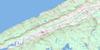
Chester Topo Map Online
Download Free Topo Map Sheet 021A09 at 1:50,000 scale
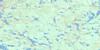
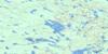
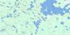
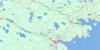
021A09 Chester Topo Map
To view this map, mouse over the map preview on the right.
You can also download this topo map for free:
021A09 Chester high-resolution topo map image.
Maps for the Chester topo map sheet 021A09 at 1:50,000 scale are also available in these versions:
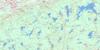
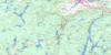
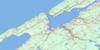
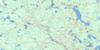
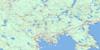
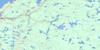
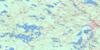
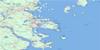
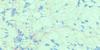
Chester Surrounding Area Topo Maps
 |
 |
 |
 |
 |
 |
 |
 |
 |
 |
 |
 |
 |
 |
 |
 |
© Department of Natural Resources Canada. All rights reserved.
Chester Gazetteer
The following places can be found on topographic map sheet 021A09 Chester:
Chester Topo Map: Bays
Adams CoveAspotogan Harbour
Back Cove
Back Harbour
Backmans Cove
Bear Cove
Borgels Big Cove
Borgels Little Cove
Butter Cove
Chandlers Cove
Chester Basin
Chester Harbour
Chestermans Cove
Coleman Cove
Coleman Harbour
Colemans Cove
Colemans Harbour
Corbins Cove
Crane Cove
Dam Bay
Dauphinees Cove
Deep Cove
Domineys Cove
Duncan Cove
Dunn Cove
East River Bay
Fox Cove
Frail Cove
Front Harbour
Gaetz Cove
Garret Cove
Gates Cove
Goose Creek
Graves Cove
Halfmoon Cove
Hauling Cove
Hubbards Cove
Kip Hill Cove
Lily Cove
Long Bay
Mahone Bay
Marriott Cove
Marriotts Cove
Marriott's Cove
Mill Cove
Mill Cove
Mountain Cove
Mud Cove
Northwest Cove
Pond Hole
Porter Cove
Rafuses Cove
River Basin
Rous Cove
Sand Bay
Sandy Cove
Sandy Cove
Sandy Cove
Schnare Cove
Schnares Cove
Scotch Cove
Sellars Cove
Sellars Cove
Sheerdam Cove
Shoal Cove
Shoal Cove
Smelt Brook Cove
Smiths Cove
Southwest Cove
Squid Cove
Squid Cove
St. Margaret Bay
St. Margarets Bay
St. Margaret's Bay
Stevens Cove
The Puddle
The Seine Berth
Tilley Cove
Tilleys Cove
Timber Lake Basin
Tottens Cove
Zincks Cove
Zwickers Cove
Chester Topo Map: Beaches
Algerine ShoreBackhouse Shore
Bayswater Beach
Cherrys Beach
Cooks Beach
Dauphinees Beach
Fox Point Beach
Gates Beach
Meisners Beach
Queensland Beach
Schwartz Shore
Chester Topo Map: Capes
Aspotogan PeninsulaBackmans Head
Birch Point
Birchy Head
Borgel Point
Borgels Point
Clay Island Spit
Covey Head
Coveys Point
Crandall Point
Dauphinee Head
Dauphinee Point
Dauphinees Head
Dicks Point
East River Point
Eisner Point
Farquhars Point
Fox Point
Fredas Point
Frog Island Head
Grandall Point
Green Point
Green Point
Hawker Point
Hubleys Point
Hume Point
Hunts Point
Hutt Point
Indian Point
Isaacs Point
Kurser Spit
Lobster Point
Long Reef Point
Long Spit
Meisner Point
Moland Point
Nauss Point
Otter Point
Owls Head
Owls Head
Owl's Head
Peninsula Point
Point Hill
Red Bank
Rocky Point
Rous Point
Schnare Point
Sheldrake Point
Simons Point
Smiths Point
Snake Spit
Southeast Point
Southwest Point
Spruce Point
Spruce Point
Squaw Point
The Peninsula
Tilley Point
Tilleys Point
White Point
Zincks Head
Zink Head
Zwickers Point
Chester Topo Map: Channels
The CanalThe Canal
The Narrows
The Narrows
Chester Topo Map: Cliffs
Sawlers BankThe Bluff
Chester Topo Map: Falls
Burned Potato FallsHemlock Falls
Mosher Falls
Myra Falls
Salmon Falls
Skerry Falls
Chester Topo Map: Geographical areas
HalifaxLunenburg
Chester Topo Map: Indian Reserves
Gold River 21Chester Topo Map: Islands
Aalder IslandAce Hill Island
Adams Island
Apple Island
Arties Island
Big Fish Island
Big Gooseberry Island
Big Island
Big Island
Birch Island
Black Island
Borgels Island
Bowens Island
Clay Island
Coffey Island
Crowbar Island
Dauphinees Island
First Island
Flemming Island
Frog Island
Gooseberry Island
Gravel Island
Graves Island
Green Island
Hemlock Island
Horse Island
Hume Island
Jimmys Island
Keizer Island
Little Fish Island
Little Gooseberry Island
Little Island
Lynch Island
Mark Island
Marra Island
Marrs Island
Marvin Island
Marvins Island
Meisner Island
Meisners Island
Moose Island
Mountain Island
Oak Island
Partridge Island
Quaker Island
Round Island
Saddle Island
Saddle Islands
Sam Island
Sams Island
Seacomb Island
Seacomus Island
Seccombe Island
Seccombes Island
Second Island
Shaw Island
Snake Island
Squid Island
Swinehemers Island
The Peninsula
Woody Island
Chester Topo Map: Lakes
Adams LakeAnderson Lake
Awalt Lake
Backman Lake
Bad Lake
Bag Lake
Bayswater Pond
Beaverdam Ponds
Beech Hill Lake
Bezanson Lake
Big Loaf Hill Lake
Big Whitford Lake
Birch Lake
Blandford Cranberry Lake
Bog Lakes
Borgels Pond
Bowen Lake
Bowens Lake
Brigley Lake
Callender Lake
Camp Lake
Card Lake
Caribou Lake
Caribou Lake
Centre Lake
Chain Lakes
Clarke Lake
Connaught Lake
Coolan Lake
Coolen Lake
Corkum Lake
Cranberry Lake
Cress Lake
Cress Lake
Croft Lake
Darling Lake
Dauphinee Lake
Dauphinees Lake
Dauphinees Mill Lake
Deep Lake
Deep Mountain Lake
Dorey Lake
Drain Lake
Duck Lake
Duck Pond
Duck Pond
East Bog Lake
Farm Lake
Feather Pond
First Bog Lake
Floyd Lake
Fox Point Lake
Goat Lake
Goose Lake
Halfway Lake
Halfway River Lake
Hardings Mill Pond
Hardwood Lake
Hay Marsh Lakes
Henneberry Lake
Hennigar Lake
Hennigar Mill Pond
Henry Lake
Hirtles Pond
Holden Lake
Hollahan Lake
Holloway Lake
Hoop Pole Lake
Horseshoe Lake
Houghton Lake
Howell Lake
Hubley Little Lake
Hubley Mill Lake
Hubleys Lake
Huckleberry Lake
Hutt Lake
Hyson Lake
Joe Bill Pond
Joggins Pond
Kip Hill Lake
Labrador Lake
Lake Darling
Lake Lawson
Larder Lake
Leaf Lake
Lenihan Lake
Lily Pond
Little Bog Lake
Little Kip Hill Lake
Little Lake
Little Loaf Hill Lake
Little Mushamush Lake
Little Vaughans Lake
Little Whitford Lake
Lonesome Lake
Long Lake
Long Lake
Long Lake
Long Lake
Long Lake
Loon Lake
Lost Lake
Lower Vinegar Lake
Maple Lake
Marsh Lake
Martin River Lake
Meadow Lake
Mill Cove Big Lake
Mill Cove Cranberry Lake
Mill Cove Lake
Mill Cove Lake
Mill Cove Second Lake
Mill Lake
Millet Lake
Mountain Lake
Mud Lake
Muddy Lake
Mushamush Lake
Muskrat Lake
Muskrat Lake
Nevertell Lake
Newton Lake
Newton Lake
Newton Lake
Nine Mile Lake
Ninemile Lake
Noonan Lake
North Bog Lake
Northwest Cove Lake
Officers Camp Lake
Otter Lake
Otter Ponds
Panuke Lake
Peters Pond
Pigeon Lake
Pisgah Lake
Pitch Pine Lake
Pogwa Lake
Ponhook Lake
Porcupine Lake
Puddle Lake
Quacks Lake
Queensland Lake
Rocky Lake
Rocky Lake
Rocky Lake
Rocky Lake
Rollaway Lake
Round Lake
Round Lake
Sabody Pond
Sawler Lake
Sawlor Lake
Schwartz Lake
Second Bog Lake
Second Lake
Seffern Lake
Shankels Pond
Shankle Lake
Shankle Lake
Shea Lake
Shoal Cove Lake
Shoal Mountain Lake
Shoe Lake
Show Lake
Simms Lake
Skinner Lake
Snyder Pond
Southwest Cove Lake
Spectacle Lake
Spectacle Lake
Spondo Lake
Square Lake
St. Croix Lake
Stanford Lake
Stanford Lake
Steeves Lake
The Basin
The Mill Pond
Timber Lake
Upper Vinegar Lake
Vaughan Lake
Vaughans Lake
Veinot Lake
Vinegar Lake
Vinegar Lake
Walker Lake
Warrens Lake
Webster Lake
Weir Swamp Lake
Western Lake
Westhaver Lake
Whistler Lake
Whitford Lake
Whitney Lake
Whynachts Little Lake
Yellow Marsh Lake
Chester Topo Map: Mountains
Aspotogan MountainBeech Hill
Burnt Blanket Hill
Card Lake Hill
Deep Cove Mountain
Haddon Hill
Indian Hill
Kings Hill
Labrador Castle
Loaf Hill
Macks Hill
Marshalls Hill
Mathias Hill
Mountain Hill
Owls Head Hill
Porcupine Hill
Seacomb Hill
Skipper Hill
Slough River Pinnacle
The Pinnacle
Wake Up Hill
Chester Topo Map: Major municipal/district area - major agglomerations
ChesterHalifax
Lunenburg
Chester Topo Map: Conservation areas
Bayswater Beach Provincial ParkBlandford Game Sanctuary
Card Lake Provincial Park
Cleveland Beach Provincial Park
East River Provincial Park
Graves Island Provincial Park
Queensland Beach Provincial Park
Simms Settlement Provincial Park
Chester Topo Map: Rapids
Big EddyIndian Run
Little Eddy
Chester Topo Map: Rivers
Backman RunBarry Brook
Barrys Brook
Bear Brook
Beaverdam Brook
Beech Hill Brook
Bench Brook
Big North Brook
Black Marsh Brook
Bowens Brook
Branch Lake Brook
Brigley Brook
Burnt Bridge Brook
Burntwoods Brook
Canaan River
Clarke Brook
Cobbler Brook
De Monts Brook
Duncan Brook
East Middle River
East River
East River Chester
Fox Point Lake Run
Gold River
Gully Brook
Halfway Brook
Halfway River
Hay Marsh Brook
Henneberry Brook
Hoop Pole Brook
Hubbards River
Hubbards River
Joe Bill Brook
Larder River
Laybolt Brook
Line Brook
Little East River
Little East River Chester
Lower Twin Brook
Marsh Brook
Martin River
Martins River
Melvin Meadow Brook
Middle River
Mill Brook
Mill Brook
Mill Brook
Mill Dam Brook
Newton Brook
North Brook
Number Six Brook
Otter Brook
Pennal Brook
Quacks Brook
Red Brook
Rocky Brook
Roland Brook
Ross Meadow Brook
Sarty Brook
Shea Brook
Shupe Brook
Skinner Brook
Slough River
Smelt Brook
Southwest Brook
Southwest River
Spondo Brook
Stillwater Brook
Swinimer River
The Gut
The Half Mile Brook
The Mile Brook
Tilleys Cove Brook
Timber Lake Brook
Toad River
Trout Brook
Upper Twin Brook
Vaughan River
Vaughans River
Whitney River
Youngs Brook
Chester Topo Map: River features
Anns HoleBarrys Stillwaters
Beech Hill Stillwater
Big Cumberland Pool
Borgels Island Stillwater
Conway Stillwater
Coolan Deadwater
Devils Elbow
First Stillwater
Generals Pool
Gullivers Hole
Kill Devil Pool
Little Cumberland Pool
Long Lake Stillwaters
Lower Stillwater
Meadow Pool
Mine Dam Pool
Oak Pool
Pine Trout Hole
Plymouth Stump Stillwater
Quacks Lake Stillwaters
Salmon Hole
Sand Pool
Second Stillwater
Skerry Stillwaters
Spring Brook Stillwater
The Grant Stillwater
The Little Salmon Hole
The Long Stillwater
The S Flat
The Stillwaters
Third Stillwater
Upper Stillwater
Westhaver Deadwater
Zwickers Stillwaters
Chester Topo Map: Shoals
Big Fish ShoalBig Island Shoal
Big Ledge
Birch Shoal
Black Rock
Chester Rock
Cooper Shoal
Copper Shop Shoal
Cye Ledge
Dry Ledge
Dry Rock
Eastern Lobster Claw
Freemans Rock
Frog Island Shoal
Gold Ledge
Gravel Ledge
Graves Reef
Graves Shoal
Green Point Shoal
Hume Shoal
Little Ledge
Long Reef
Lynch Shoal
Mark Island Bar
Marvin Island Ledge
Meisner Shoal
Meisners Shoal
Middle River Ledge
Middle Rock
Morashs Ledges
Mountain Shoals
North Shoal
Northeast Coachman
Prescott Rock
Redden Rock
Sandy Cove Rock
Sheep Ledge
Slaughenwhite Ledge
Slaunwhites Ledge
South Gooseberry Shoal
Spectacle Shoal
Warnes Ledge
Warnes Shoal
Warrens Ledge
Warrens Shoal
Western Lobster Claw
Chester Topo Map: Unincorporated areas
AspotoganBeech Hill
Birchy Head
Borgels Point
Canaan
Chester Acres
Chester Basin
Chester Grant
Chester Islands
Commons
Duncan
East Chester
East River
East River Point
Forties
Forties Settlement
Fox Point
Glengarry
Gold River
Haddon Hall
Haddon Hill
Hubbards
Leville
Lower Grant Road
Marriott Cove
Marriotts Cove
Marriott's Cove
Martins Point
Marvins Island
Middle River
Mill Cove
Moland
New Ross
Northwest Cove
Queensland
Robinsons Corner
Robinson's Corner
Robinson's Corners
Seffernsville
Shaw Island
Sherwood
Simms Settlement
Southwest Cove
Squid Cove
The Lodge
Upper Blandford
Western Shore
Windsor Road
Woodstock
Chester Topo Map: Low vegetation
Caribou BogCaribou Marsh
Counties Marsh
Duncan Bog
Johnnys Meadow
Keizer Meadows
Lordlys Meadow
Lower Bog
Marriotts Meadows
Millers Marsh
Morashs Meadow
Rileys Marsh
Skinner Meadows
Swinimer Meadow
Weir Swamp
Yellow Marsh
Chester Topo Map: Villages
Chester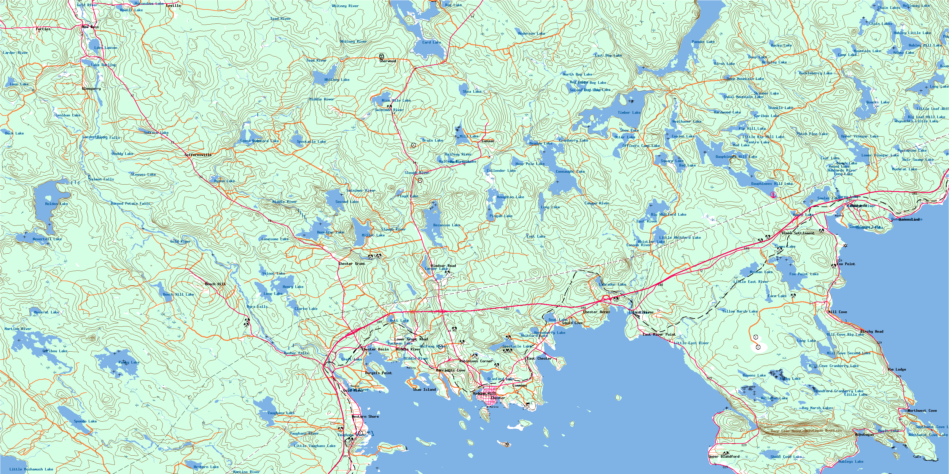
© Department of Natural Resources Canada. All rights reserved.
021A Related Maps:
021A Annapolis Royal021A01 Lahave Islands
021A02 Liverpool
021A03 Lake Rossignol
021A04 Wentworth Lake
021A05 Weymouth
021A06 Kejimkujik Lake
021A07 Bridgewater
021A08 Lunenburg
021A09 Chester
021A10 New Germany
021A11 Milford
021A12 Digby
021A13 Granville Ferry
021A14 Bridgetown
021A15 Gaspereau Lake
021A16 Windsor
