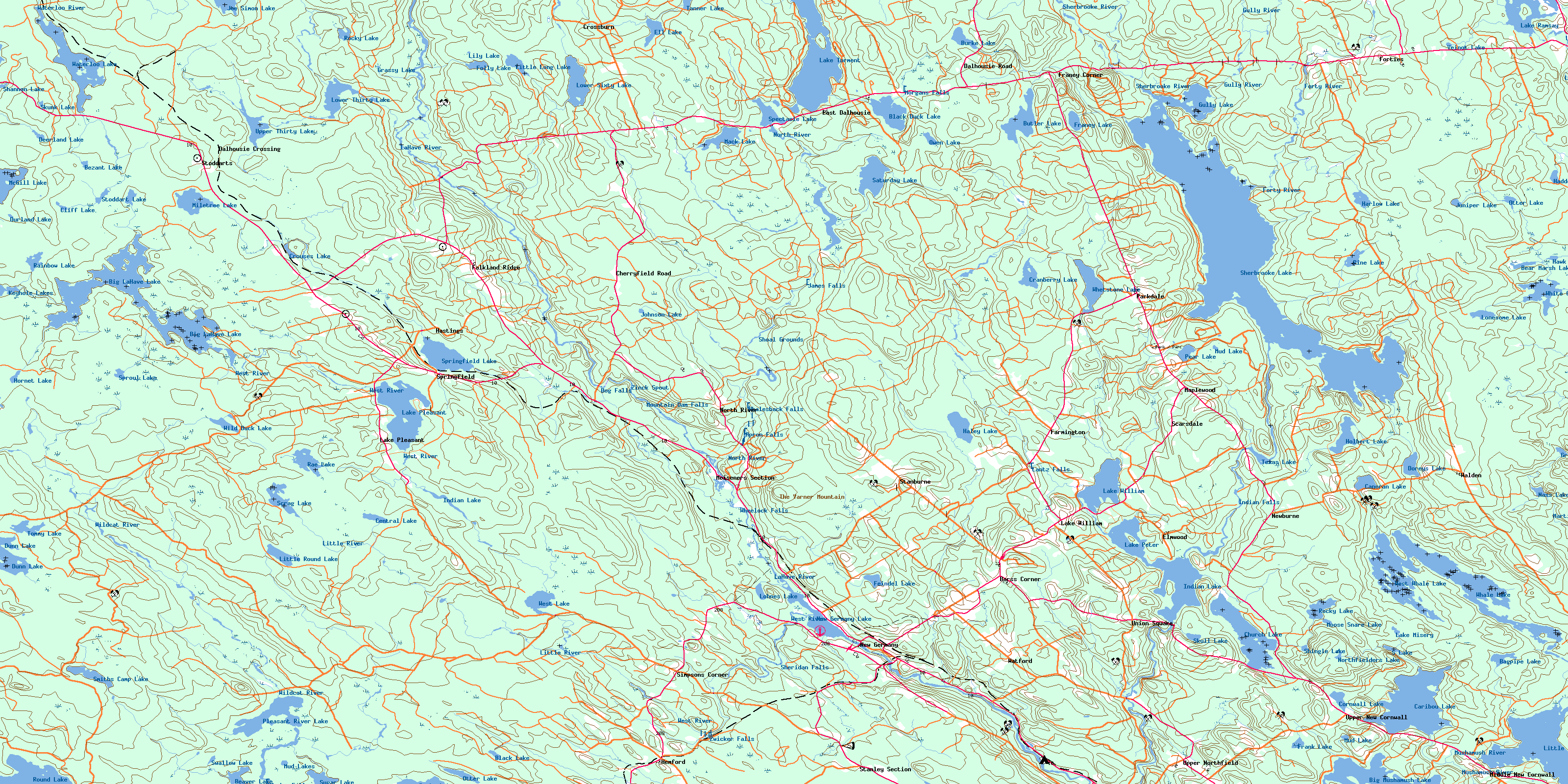
New Germany Topo Map Online
Download Free Topo Map Sheet 021A10 at 1:50,000 scale
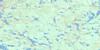
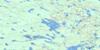
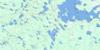
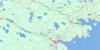
021A10 New Germany Topo Map
To view this map, mouse over the map preview on the right.
You can also download this topo map for free:
021A10 New Germany high-resolution topo map image.
Maps for the New Germany topo map sheet 021A10 at 1:50,000 scale are also available in these versions:
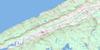
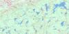
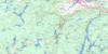
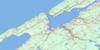
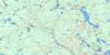
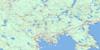
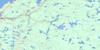
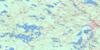
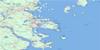
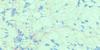
New Germany Surrounding Area Topo Maps
 |
 |
 |
 |
 |
 |
 |
 |
 |
 |
 |
 |
 |
 |
 |
 |
© Department of Natural Resources Canada. All rights reserved.
New Germany Gazetteer
The following places can be found on topographic map sheet 021A10 New Germany:
New Germany Topo Map: Bays
Allies CoveBoat Cove
Browns Cove
Bull Cove
Deep Cove
Grimms Cove
Kill Dog Cove
Milbury Cove
Peter Veinot Cove
Russells Cove
Sand Cove
Saulnier Cove
Sherbrooke Cove
Silver Cove
Stoddart Cove
Trout Cove
New Germany Topo Map: Capes
Cushing PointEisnors Point
Fox Point
Owls Head
Russells Point
The Peninsula
Turners Point
Wentzells Point
New Germany Topo Map: Channels
The NarrowsThe Narrows
The Narrows
New Germany Topo Map: Cliffs
West CliffNew Germany Topo Map: Falls
Apron FallsDog Falls
Glodes Falls
Indian Falls
James Falls
Lantz Falls
Morgans Falls
Mountain Dam Falls
Sheridan Falls
Whalesback Falls
Wheelock Falls
Zwicker Falls
New Germany Topo Map: Geographical areas
AnnapolisKings
Lunenburg
Queens
New Germany Topo Map: Islands
Flat IslandLevys Island
Loon Island
Partridge Island
Penaul Island
Silver Island
Silvers Island
Wentzells Island
New Germany Topo Map: Lakes
Ashland LakeBagpipe Lake
Bear Lake
Bear Marsh Lake
Beaver Lake
Bezant Lake
Big La Have Lake
Big LaHave Lake
Big Lahave Lake
Big Mushamush Lake
Black Duck Lake
Black Lake
Burke Lake
Butler Lake
Canoran Lake
Caribou Lake
Central Lake
Church Lake
Cliff Lake
Cornwall Lake
Cranberry Lake
Crouses Lake
Deerland Lake
Doreys Lake
Duck Lake
Dunn Lake
Durland Lake
Ell Lake
Feindel Lake
First Pond
Folly Lake
Franey Lake
Frank Lake
Grandmother Head Lake
Grant Lake
Grassy Lake
Gully Lake
Haddock Lake
Haley Lake
Harlow Lake
Hawk Lake
Holbert Lake
Hornet Lake
Indian Lake
Indian Lake
Indian Pond
Joe Simon Lake
Johnson Lake
Juniper Lake
Keyhole Lake
Keyhole Lakes
Lake Harlow
Lake Misery
Lake Peter
Lake Pleasant
Lake Ramsay
Lake Torment
Lake William
Lily Lake
Lily Lake
Little Lake
Little Long Lake
Little Mushamush Lake
Little Round Lake
Lohnes Lake
Lonesome Lake
Lower Sixty Lake
Lower Thirty Lake
Mack Lake
McGill Lake
Miletree Lake
Misery Lake
Moose Snare Lake
Morris Old Mill Pond
Mud Lake
Mud Lake
Mud Lakes
Mushamush Lake
Nass Lake
New Germany Lake
Northfielders Lake
Otter Lake
Otter Lake
Otter Lake
Owen Lake
Pear Lake
Pine Lake
Pleasant River Lake
Rae Lake
Rainbow Lake
Rocky Lake
Rocky Lake
Rocky Lake
Rocky Pond
Round Lake
S Lake
Saturday Lake
Scrag Lake
Second Pond
Shannon Lake
Sherbrooke Lake
Shingle Lake
Simon Lake
Skull Lake
Skunk Lake
Smith Camp Lake
Smiths Camp Lake
Spectacle Lake
Springfield Lake
Sproul Lake
Stoddart Lake
Sugar Lake
Swallow Lake
Tanner Lake
Tener Lake
Texas Lake
Third Pond
Tommy Lake
Twin Lakes
Twin Lakes
Upper Thirty Lake
Veinot Lake
Waterloo Lake
West Lake
West Lake
West Whale Lake
Whale Lake
Whetstone Lake
White Gull Lake
Wild Duck Lake
Wildcat Lake
New Germany Topo Map: Mountains
Charles HillDorey Hill
Franey Hill
Keddys Hill
Little Bluff
Reeves Hill
Sherbrooke River Hill
The Bluff
The Varner Mountain
Walker Hill
New Germany Topo Map: Major municipal/district area - major agglomerations
AnnapolisChester
Kings
Lunenburg
Queens
New Germany Topo Map: Rapids
Black RattleBlack Run
Demones Eddy
Moosehorn Eddy
Shoal Grounds
Whynachts Eddy
Zinck Spout
New Germany Topo Map: Rivers
Beaver BrookBezant Lake Brook
Big North Brook
Birch Brook
Biscuit Brook
Black Brook
Black Duck Lake Brook
Bob and Joan Brook
Bog Brook
Butler Lake Brook
Camp Four Lake Brook
Cape Marsh Brook
Caribou Brook
Church Lake Brook
Crooked Brook
Crossburn Brook
Crotch Brook
Dawson Brook
Demones Brook
Dexter Brook
Ell Lake Brook
Falkenham Run
Forties River
Forty River
Franey Brook
Franey Brook
Franey Lake Brook
Franey Run
Gully Brook
Gully River
Harlow Brook
Hemlock Run
Hirtle Brook
Hornet Brook
Indian Brook
Johnson Brook
Johnson Brook
Jonah Brook
Kelley Brook
Keyhole Brook
King Brook
La Have River
LaHave River
Lahave River
Lake Misery Brook
Lake Run
Larder River
Little North Brook
Little River
MacKay Brook
MacKays Brook
Manning Brook
Martin River
Martins River
Mason Brook
Mason Meadow Brook
McClearns Brook
McClearn's Brook
McClintock Brook
McLearns Brook
Mud Lake Brook
Mushamush River
Nelson Brook
North Branch Lahave River
North Branch LaHave River
North Brook
North La Have River
North Lahave River
North River
Ohio River
Ozie Meadow Brook
Papermill Brook
Patten Brook
Peter Veinot Brook
Pine Brook
Pine Lake Brook
Pleasant River
Princess Brook
Robar Brook
Roop Brook
Ross Brook
Ross Brook
Ross Meadow Brook
Sand Brook
Sarty Brook
Saturday Lake Brook
Scattering Brook
Shannon River
Sherbrooke River
Sheridan Brook
Shingle Brook
Shinglemill Brook
Sixty Brook
Smith Brook
Solomon Brook
Sucker Brook
Sucker Brook
Sucker Brook
Tea Brook
Tea Brook
The Gully
Thirty Brook
Twenty Brook
Varner Brook
Waterloo River
Watermans Meadow Brook
West River
Wildcat Brook
Wildcat River
William Ross Brook
Zwicker Brook
New Germany Topo Map: River features
Allen Meadows StillwaterBlue Ledge Pool
Chute Stillwater
Clifford Moore Stillwater
Devils Elbow
Devils Elbow
Devils Hook
Easter Stillwater
Eel Weir Hole
Enoch Stillwater
Fancys Pool
Feeners Pool
Feindels Bridge Pool
Fishpot Hole
Gerry Stillwater
Harper Stillwater
Hartland Stillwater
Hick Smith Stillwater
Hogans Dump
Indian Falls Pool
Joudreys Bridge Pool
Long Pool
Lower Stillwater
MacKays Bridge Pool
Mill Pond
Peter Veinot Stillwater
Peters Stillwater
Peter's Stillwater
Pleasant River Stillwaters
Sanfords Intervale Pool
Slippery Ledge Pool
Texas Lake Pool
Upper Stillwater
New Germany Topo Map: Shoals
Apron RockCounty Line Reef
New Germany Topo Map: Unincorporated areas
Barss CornerBarss Corners
Barss' Corners
Caledonia Junction
Cherryfield
Cherryfield Road
Church Lake
Crossburn
Dale
Dalhousie
Dalhousie Crossing
Dalhousie East
Dalhousie Road
East Dalhousie
Elmwood
Falkland Ridge
Farmington
Forties
Forties Settlement
Franey Corner
Hastings
Hemford
Lake Pleasant
Lake William
Lantz
Maplewood
Meiseners
Meisener's
Meiseners Section
Middle New Cornwall
Morton Corner
Mortons Corner
Morton's Corner
New Cornwall
New Germany
Newburn
Newburne
North River
Parkdale
Privett
Ridge Road
Sartys
Sarty's
Scarborough
Scarsdale
Scarsdale
Simpson Corner
Simpsons Corner
Springfield
Stanburn
Stanburne
Stanley Section
Stoddarts
Union Square
Upper New Cornwall
Upper Northfield
Walden
Watford
New Germany Topo Map: Low vegetation
Allen MeadowsBear Marsh
Bob and Joan Meadow
Caribou Bog
Cranberry Bog
Harlow Meadow
Holland Bog
Lantz Meadows
Leadbetters Meadow
Mason Meadow
Nevertell Meadows
Peter Veinot Bog
Robar Bog
Stoddart East Meadows
Stoddart West Meadows
Thousand Acre Bog
Vacant Land Meadows
Veinot Bog
Watermans Meadows
Wrights Meadow
© Department of Natural Resources Canada. All rights reserved.
021A Related Maps:
021A Annapolis Royal021A01 Lahave Islands
021A02 Liverpool
021A03 Lake Rossignol
021A04 Wentworth Lake
021A05 Weymouth
021A06 Kejimkujik Lake
021A07 Bridgewater
021A08 Lunenburg
021A09 Chester
021A10 New Germany
021A11 Milford
021A12 Digby
021A13 Granville Ferry
021A14 Bridgetown
021A15 Gaspereau Lake
021A16 Windsor
