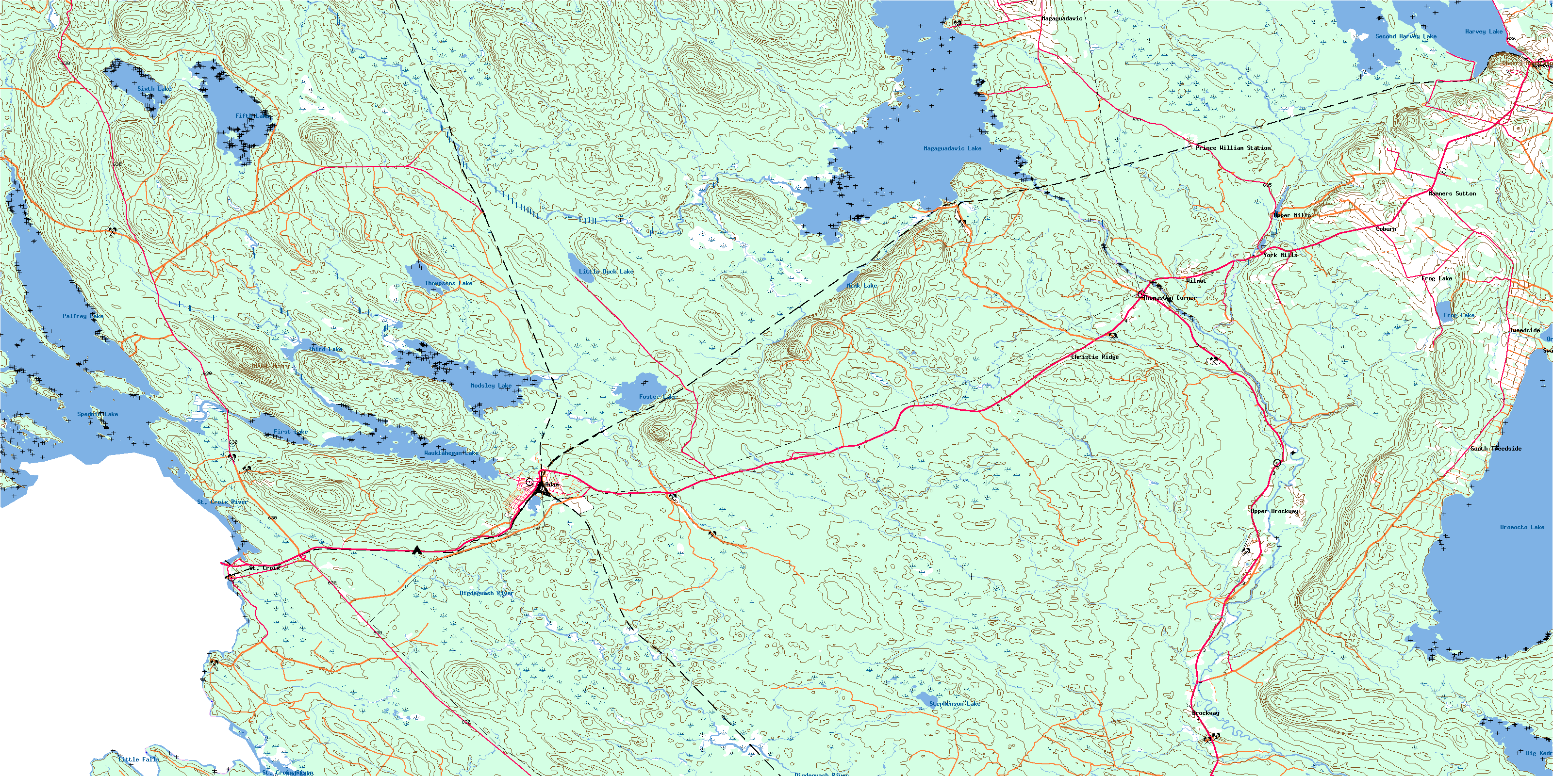
Mcadam Topo Map Online
Download Free Topo Map Sheet 021G11 at 1:50,000 scale
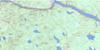
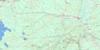
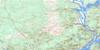
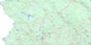
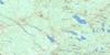
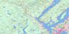
021G11 Mcadam Topo Map
To view this map, mouse over the map preview on the right.
You can also download this topo map for free:
021G11 Mcadam high-resolution topo map image.
Maps for the Mcadam topo map sheet 021G11 at 1:50,000 scale are also available in these versions:
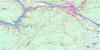
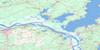
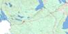
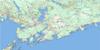
Mcadam Surrounding Area Topo Maps
 |
 |
 |
 |
 |
 |
 |
 |
 |
 |
 |
|
 |
 |
 |
© Department of Natural Resources Canada. All rights reserved.
Mcadam Gazetteer
The following places can be found on topographic map sheet 021G11 Mcadam:
Mcadam Topo Map: Bays
Anderson CoveArmstrong Cove
Bedford Cove
Deep Cove
Diggity Cove
English Cove
Harvey Cove
Herberts Cove
James Cove
Magaguadavic Cove
Myshrall Cove
Rum Cove
Scoodic Cove
Shields Cove
Silas Cove
South Cove
Tuttle Cove
Mcadam Topo Map: Capes
Bedford PointBirch Point
Farm Point
Green Point
Hills Head
Lower Palfrey Neck
Money Point
Pine Point
Upper Palfrey Neck
Windy Point
Mcadam Topo Map: Channels
Diggity GapHarvey Lake Thoroughfare
Indian Channel
Modsley Lake Thoroughfare
Palfrey Thoroughfare
Shooters Gap
The Narrows
Mcadam Topo Map: Falls
Little FallsMcadam Topo Map: Geographical areas
CanterburyCharlotte
Dumbarton
Dumfries
Manners Sutton
McAdam
New Maryland
North Lake
Prince William
Saint James
York
Mcadam Topo Map: Islands
Bells IslandBen Beachs Island
Big Island
Big Island
Birch Island
Bodkin Island
Butterfly Island
Camp Jersey Island
Cedar Islands
Cummings Island
Estys Island
Indian Island
Jackknife Islands
Lindsay Island
Little Indian Island
Long Island
Long Island
Luffs Island
MacKenzies Island
Nova Scotia Island
O'Malleys Island
Pine Island
Scovils Island
Ship Island
Spruce Island
Star Island
Todds Island
Varney Island
Varny Island
Whites Island
Williams Island
Wingdam Island
Works Island
Mcadam Topo Map: Lakes
Big Kedron LakeCranberry (Harvey) Lake
Duck Lake
Duck Pond
Fifth Lake
First Lake
Foster Lake
Frog Lake
Grieve Lake
Harvey Lake
Kedron Lake
Little Cranberry Lake
Little Duck Lake
Magaguadavic Lake
McAdam Lake
McAdam Pond
Mink Lake
Modsley Lake
Mud Lake
Oromocto Lake
Palfrey Lake
Pleasant Lake
Pleasant Pond
Second Harvey Lake
Sixth Lake
Spednic Lake
Spednik Lake
Stephenson Lake
Third Lake
Thompsons Lake
Tomilson Lake
Wauklahegan Lake
Mcadam Topo Map: Mountains
Big HillCherry Mountain
Cranberry Ridge
Howland Hill
Mount Henry
Mount Prospect
Prospect Ridge
Shaving Ridge
The Horseback
Vails Ridge
Mcadam Topo Map: Conservation areas
Diggity SiteLieu Diggity
Spednic Lake Provincial Park
Mcadam Topo Map: Rapids
Elbow RipsHalls Rips
Joe Georges Rips
Mile Rips
Picnic Ground Rips
Pork Rips
Tunnel Rips
Winding Stairs Rips
Wingdam Rips
Mcadam Topo Map: Rivers
Back Branch Lower Trout BrookBear Brook
Bear Brook
Big La Coote Stream
Black Hollow Brook
Brook Styx
Campbell Brook
Canoose River
Canoose Stream
Casey Brook
Colter Brook
Cranberry Brook
Cranberry Brook Run Round
Cranberry Brook Runround
Davis Brook
Dead Brook
Dead Brook
Deadwater Brook
Deadwater Brook
Deadwater Brook
Digdeguash River
Diggity Stream
Duck Brook
Duck Brook
Gills Brook
Jocks Brook
Joslin Brook
Little Bear Brook
Little Digdeguash River
Little Digdeguash River
Little McAdam Brook
Little SuckerBrook
Lower Trout Brook
Lyon Stream
Lyons Stream
Magaguadavic River
McAdam Brook
McFarland Brook
Mink Brook
N.E. Magaguadavic River
New Brook
North Branch Duck Brook
North Brook
Northeast Branch Magaguadavic River
Oakley Brook
Oliver Brook
Palfrey Brook
Palfrey Stream
Pats Brook
Pleasant Brook
Pratt Brook
Pratts Brook
Sears Brook
Serpentine Brook
Sixth Lake Brook
Solomons Brook
South Branch Cranberry Brook
South Brook
South Cranberry Brook
South End Brook
St. Croix River
Stone Brook
Sucker Brook
Sugar Brook
Swans Brook
Thomas Brook
Toby Guzzle
Trout Brook
Tuttle Brook
Upper Trout Brook
West Duck Brook
White Beaver Brook
Woods Brook
Mcadam Topo Map: River features
First DeadwaterFourth Deadwater
Long Sluice Deadwater
Second Deadwater
The Bogan
Third Deadwater
Mcadam Topo Map: Unincorporated areas
BrockwayBurpee
Christie Ridge
Coburn
Cottrell
Frog Lake
Gass
Harvey Settlement
Harvey Station
Little Settlement
Magaguadavic
Magaguadavic
Magaguadavic Siding
Manners Sutton
Newcomb
Prince William Station
South Tweedside
St. Croix
Sugar Brook
Swans Shore
Thomaston Corner
Tweedside
Upper Brockway
Upper Magaguadavic
Upper Mills
Wilmot
York Mills
Mcadam Topo Map: Low vegetation
Brockway MeadowsBrook Styx Heath
Diffin Heath
Lee Dam Meadows
Porters Meadows
Stephenson Heath
Trout Brook Heath
Mcadam Topo Map: Villages
HarveyMcAdam
© Department of Natural Resources Canada. All rights reserved.
