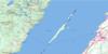
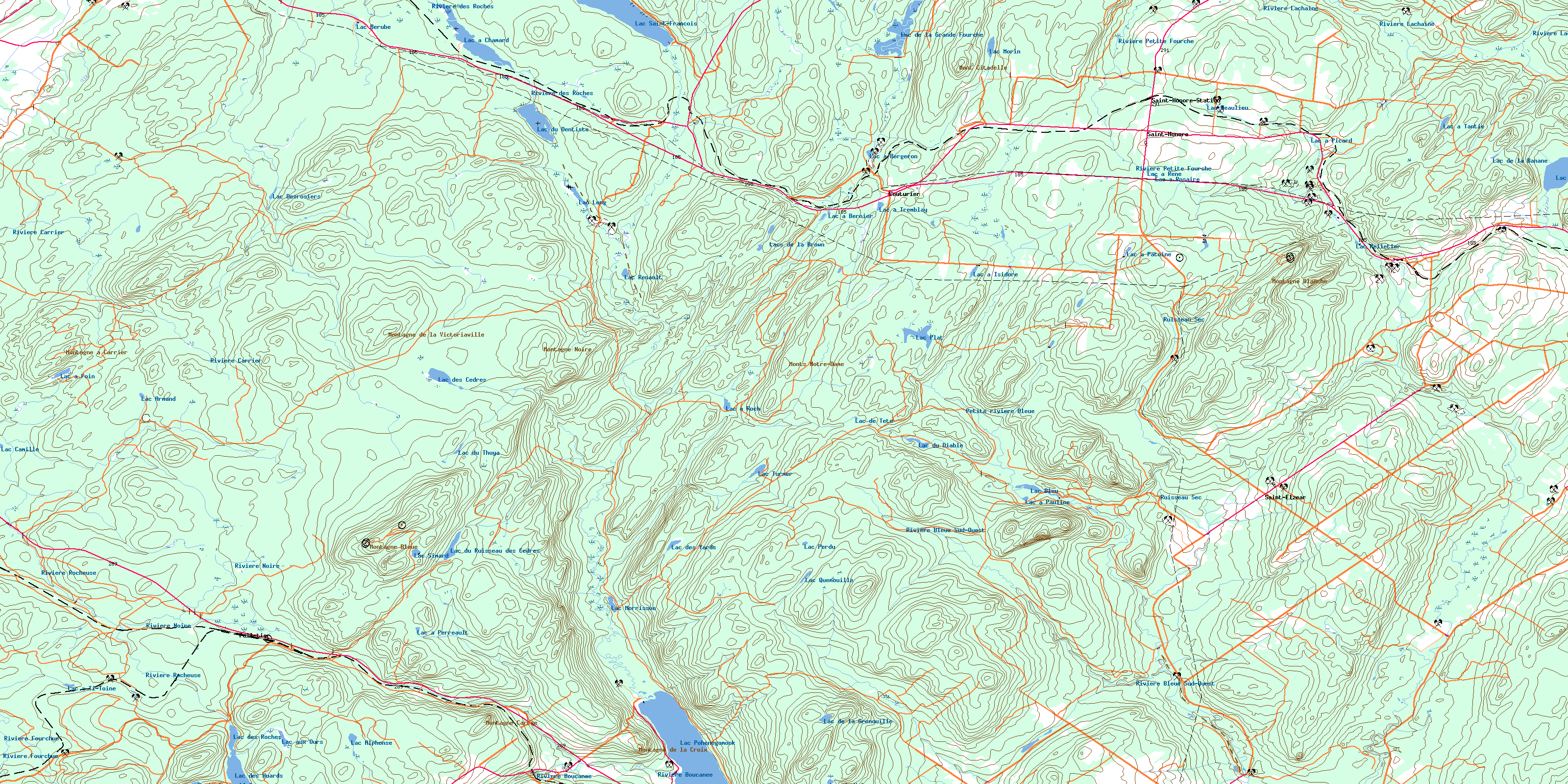
Saint-Honore Topo Map Online
Download Free Topo Map Sheet 021N11 at 1:50,000 scale
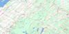
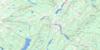
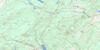
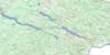
021N11 Saint-Honore Topo Map
To view this map, mouse over the map preview on the right.
You can also download this topo map for free:
021N11 Saint-Honore high-resolution topo map image.
Maps for the Saint-Honore topo map sheet 021N11 at 1:50,000 scale are also available in these versions:
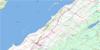
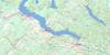
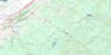
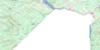
Saint-Honore Surrounding Area Topo Maps
 |
 |
 |
 |
 |
 |
 |
 |
 |
 |
 |
 |
 |
 |
 |
© Department of Natural Resources Canada. All rights reserved.
Saint-Honore Gazetteer
The following places can be found on topographic map sheet 021N11 Saint-Honore:
Saint-Honore Topo Map: Bays
Anse à BrochuSaint-Honore Topo Map: Beaches
La Petite PlagePlage des Rosiers
Saint-Honore Topo Map: Capes
Pointe à BrochuSaint-Honore Topo Map: City
PohénégamookSaint-Honore Topo Map: Geographical areas
ArmandBungay
Cabano
Chabot
Demers
Division d'enregistrement de Témiscouata
Estcourt
Marie-Médiatrice
Parke
Pohénégamook
Saint-Elzéar
Saint-Honoré
Whitworth
Saint-Honore Topo Map: Indian Reserves
Réserve indienne Whitworth 21Whitworth Indian Reserve 21
Saint-Honore Topo Map: Lakes
Étang du Ruisseau NoirLac à Bergeron
Lac à Bernier
Lac à Chamard
Lac à Foin
Lac à Isidore
Lac à Patoine
Lac à Pauline
Lac à Perreault
Lac à Picard
Lac à René
Lac à Roch
Lac à Rosaire
Lac à Tantie
Lac à Ti-Toine
Lac à Ti-Will
Lac à Tremblay
Lac Alphonse
Lac Armand
Lac Asselin
Lac aux Ours
Lac Beaulieu
Lac Bérubé
Lac Bleu
Lac Camille
Lac Cedar Brook
Lac de la Banane
Lac de la Grande Fourche
Lac de la Grenouille
Lac de Tête
Lac des Cèdres
Lac des Huards
Lac des Roches
Lac des Roches Nord
Lac des Roches Sud
Lac des Yards
Lac Desrosiers
Lac du Dentiste
Lac du Diable
Lac du Ruisseau des Cèdres
Lac du Thuya
Lac du Volcan
Lac la Goutte
Lac Long
Lac Morin
Lac Morrisson
Lac Pelletier
Lac Perdu
Lac Plat
Lac Pohénégamook
Lac Quenouille
Lac Renault
Lac Saint-François
Lac Savane
Lac Simard
Lac Turner
Lacs de la Brown
Le Pas d'Eau
Petit lac à l'Ours
Petit lac Asselin
Saint-Honore Topo Map: Miscellaneous
Halte de ParkeSaint-Honore Topo Map: Mountains
Butte du Bonhomme-BlanchetteMont Bleu
Mont Bouc
Mont Citadelle
Mont Deux Mille
Montagne à Carrier
Montagne Blanche
Montagne Bleue
Montagne Carrée
Montagne de la Croix
Montagne de la Victoriaville
Montagne Noire
Monts Notre-Dame
Saint-Honore Topo Map: Major municipal/district area - major agglomerations
KamouraskaTémiscouata
Saint-Honore Topo Map: Other municipal/district area - miscellaneous
Circonscription électorale de Kamouraska-TémiscouataPicard
Saint-Honore Topo Map: Rivers
Branche CôtéCours d'eau Beaulieu
Cours d'eau Després
Cours d'eau Dubé
Cours d'eau Pelletier
Cours d'eau Rodrigue
Le Grand Ruisseau
Petite rivière Bleue
Petite rivière du Loup
Petite rivière Savane
Rivière Bleue
Rivière Bleue Nord-Ouest
Rivière Bleue Sud-Ouest
Rivière Boucanée
Rivière Carrier
Rivière des Prairies
Rivière des Roches
Rivière du Grand Tracel
Rivière Fourchue
Rivière Lachaine
Rivière Noire
Rivière Petite Fourche
Rivière Rocheuse
Rivière Saint-François
Rivière Saint-Hubert
Rivière Toupiké
Rivière Verte
Ruisseau à Castonguay
Ruisseau Armstrong
Ruisseau Clair
Ruisseau des Cascades
Ruisseau des Cèdres
Ruisseau des Matane
Ruisseau des Saules
Ruisseau Noir
Ruisseau Providence
Ruisseau Sec
Ruisseau Turner
Saint-Honore Topo Map: Road features
Pont CasséPont de Broche
Pont de la Beurrerie
Pont de la Rivière-Boucanée
Pont des Cèdres
Pont du Dixième-Rang
Pont Malenfant
Pont Morrisson
Saint-Honore Topo Map: Unincorporated areas
CouturierPelletier
Pelletier-Station
Saint-Elzéar-de-Témiscouata
Saint-Honoré-de-Témiscouata
Saint-Honoré-Station
Vauban
Saint-Honore Topo Map: Valleys
Coulée des GlaçonsSaint-Honore Topo Map: Low vegetation
Le SabotMarais Bertrand-Deschênes
Saint-Honore Topo Map: Villages
Rivière-BleueSaint-Antonin
Saint-Athanase
Saint-Éleuthère
Saint-Elzéar
Saint-Elzéar-de-Témiscouata
Saint-Eusèbe
Saint-Honoré
Saint-Honoré-de-Témiscouata
Saint-Hubert
Saint-Hubert-de-Rivière-du-Loup
Saint-Joseph-de-la-Rivière-Bleue
Saint-Louis-du-Ha! Ha!
Saint-Pierre-de-Lamy
Saint-Pierre-d'Estcourt
Sully
© Department of Natural Resources Canada. All rights reserved.
021N Related Maps:
021N Edmundston021N02E Connors
021N02W Connors
021N03E Little Black River
021N03W Little Black River
021N04 Ste-Perpetue-De-Islet
021N05 Saint-Pacome
021N06 Estcourt
021N07 Lac-Baker
021N08 Edmundston
021N09 Grandmaison
021N10 Cabano
021N11 Saint-Honore
021N12 Saint-Pascal
021N13 Riviere-Du-Loup
021N14 Saint-Modeste
021N15 Squatec
021N16 Wild Goose Lake
