Gananoque Topo Map Online
Download Free Topo Map Sheet 031C08 at 1:50,000 scale
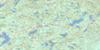
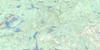
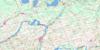
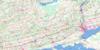
031C08 Gananoque Topo Map
To view this map, mouse over the map preview on the right.
You can also download this topo map for free:
031C08 Gananoque high-resolution topo map image.
Maps for the Gananoque topo map sheet 031C08 at 1:50,000 scale are also available in these versions:
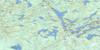
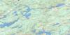
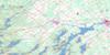
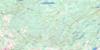
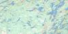
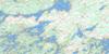
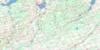
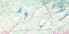
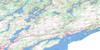
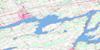
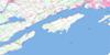
Gananoque Surrounding Area Topo Maps
 |
 |
 |
 |
 |
 |
 |
 |
 |
 |
 |
 |
 |
 |
 |
 |
© Department of Natural Resources Canada. All rights reserved.
Gananoque Gazetteer
The following places can be found on topographic map sheet 031C08 Gananoque:
Gananoque Topo Map: Bays
Barrs BayBattersea Bay
Broads Bay
Cassidys Bay
Chipmans Bay
Court of the Duke
Cunningham Bay
Esther March Bay
Gavins Bay
Gibraltar Bay
Grassy Bay
Halfmoon Bay
Halsteads Bay
Harper Bay
Hay Bay
Holstead Bay
Ivy Bay
Joe Welsh Bay
Johnson Bay
Lakes Bay
Landon Bay
Landons Bay
Long Bay
Lost Bay
Milburn Bay
Millers Bay
Mud Bay
Perch Cove
Quinns Bay
Round Lake Bay
Rush Bay
Sand Bay
Seeleys Bay
Slacks Bay
Sleeths Bay
Smith Bay
South Bay
Southern Water
Staffords Bay
Thompsons Bay
Waterlily Bay
Gananoque Topo Map: Capes
Barker PointBarkers Point
Beacon Point
Bishops Point
Brass Point
Broad Head
Butternut Point
Byrne Point
Cairns Point
Casey Point
Cassidy Point
Cassidys Point
Cedar Grove Point
Champagne Point
Charon Point
Cooks Point
Cordwood Point
Cross Point
Edwards Point
Esther Head
Fair Point
Firmans Point
Garrett Point
Gillespies Point
Gilmour Point
Gordon Point
Grass Creek Point
Greers Point
Harriet Point
Haskins Point
Horseblock Point
Hughes Point
Johnsons Point
Lindsay Point
Lone Fisherman Point
Mainshore Point
Milton Point
Nigger Head
Pine Point
Sampsons Point
Sheriff Point
Shipman Point
Shipmans Point
Spit Head
Squaw Point
Sturdivants Point
Sturtivan Point
The Round Tail
Thompsons Point
Trident Point
White Birch Point
Yardarm Point
Gananoque Topo Map: Channels
Bateau ChannelGananoque Narrows
Lovers Lane
Murphy Narrows
Murphys Narrows
Needle's Eye
The Crank
Wanderers Channel
Gananoque Topo Map: City
KingstonGananoque Topo Map: Cliffs
Duke's ProfileGananoque Topo Map: Falls
Beaver Rock RapidsGananoque Topo Map: Geographical areas
EscottFront of Leeds and Lansdowne
Front of Leeds and Lansdowne
Frontenac
Howe Island
Kingston
Lansdowne
Leeds
Leeds
Loughborough
Peterborough
Pittsburgh
Rear of Leeds and Lansdowne
Rear of Leeds and Lansdowne
South Crosby
Storrington
Storrington
Storrington
Wolfe Island
Gananoque Topo Map: Islands
Abercrombie IslandApohaqui Island
Ash Island
Astounder Island
Aubrey Island
Aubrey Island
Axeman Island
Barge Island
Basket Island
Bass Islands
Bass Rock
Baumgardt Island
Bearberry Island
Beaupre Island
Beaurivage Island
Belabourer Island
Bell Island
Bells Island
Bettsey Island
Big Island
Big Island
Big Island
Big White Calf Island
Bingham Island
Binnacle Island
Birch Island
Birchholme Island
Black Ant Island
Blackberry Island
Blackduck Island
Bloodletter Island
Bluff Island
Bond Island
Bostwick Island
Bouchier Island
Brock Island
Brother Islands
Buck Island
Burnt Island
Burnt Island
Butts Island
Cable Island
Cairns Island
Camelot Island
Campbell Island
Campbell Island
Caseys Island
Champagne Island
Charity Island
Cherry Island
Cob Island
Codfish Island
Collier Island
Coon Island
Corn Island
Crown Island
Cunliffe Island
Curtis Island
Dark Island
Davis Island
Deathdealer Island
Dinghy Island
Dobbs Island
Doe Island
Dominion Island
Downie Island
Duff Islands
Dumfounder Island
Eaglescrag Island
Endymion Island
Flying Mallard Islands
Forsyth Island
Fort Wallace Island
Francis Island
Garden Island
Garrett Island
Gig Island
Goat Island
Goat Island
Goose Island
Gordon Island
Green Island
Grices Island
Griffiths Island
Grog Island
Gull Island
Hale Island
Hambly Island
Hardwood Island
Hay Island
Hemlock Island
Hemlock Island
Hewitt Island
Hickey Island
Hickory Island
Hickory Island
Highpine Island
Hog Island
Hope Island
Horseshoe Island
Howe Island
Huckleberry Island
Hudson Island
Hurricane Island
Idlewyld Island
Idylwyld Island
Indiana Island
Island 5
Island 6
Island 86
Isle of Man
Isle of View
Ivy Island
Jackstraw Island
Jones Island
Juniper Island
Kalaria Island
Kid Island
Kitsymenie Island
Knapp Island
Lancaster Island
Lavignette Island
Leek Island
Leeward Island
Lemon Island
Lindsay Island
Little Huckleberry Island
Little Island
Little White Calf Island
Littlejohn Island
Long Island
Loon Island
Lorne Island
Lyndoch Island
Lynedoch Island
McDonald Island
Melville Island
Mermaid Island
Middle Brother Island
Middle Huckleberry Island
Mink Island
Minota Island
Moneysunk Island
Moses Island
Mountneys Island
Mudlunta Island
Mulcaster Island
Murrays Island
Myers Island
Netley Island
Niagara Island
Ninette Island
North Brother Island
O'Conor Island
Ogden Island
Ormiston Island
Otis Island
Otty Island
Owen Island
Pail Island
Papoose Island
Pencil Island
Perch Island
Pete Crow Island
Pike Island
Pine Island
Pine Island
Pitchpine Island
Pitchpine Island
Plumb Island
Point Island
Polaris Island
Popham Island
Porcupine Island
Potato Island
Prince Regent Island
Princess Charlotte Island
Princess Island
Psyche Island
Pumpkin Island
Ramsden Island
Redhorse Island
Rich Island
Rockland Island
Rowley Island
Sagistawika Island
Sampson Island
Scorpion Island
Seven Pines Island
Sheep Island
Sherbrooke Islands
Sir William Island
Sister Islands
Sisters Island
Sisters Islands
Snake Island
Snake Island
South Brother Island
Spilsbury Island
Squaw Island
St. Lawrence Island
Stave Island
Stonethrow Island
Sugar Island
Sundown Island
Sunset Island
Tea Island
The Admiralty Islands
The Five Sisters
The Lake Fleet Islands
The Navy Islands
The Punts
Thousand Islands
Three Sisters Islands
Thwartway Island
Tidds Island
Tiny Island
Towers Island
Track Island
Treasure Island
Tremont Park Island
Trident Island
Troughton Island
Turtle Island
Van Volkenburgh Island
Vanluvens Island
Walkers Island
Wallace Island
Watch Island
Wedlock Island
West Jackstraw Island
West Sister Island
Weston Island
White Calf Islands
Whitefish Island
Windward Island
Wolcott Island
Wyoming Island
Ynyscrag Island
Yorke Island
Gananoque Topo Map: Lakes
Bear LakeBrewer Lake
Buck Lake
Cedar Lake
Charleston Lake
Collins Lake
Colonel By Lake
Cranberry Lake
Crane Nest Lake
Cranesnest Lake
Dog Lake
Elbow Lake
Fishing Lake
Fodey Lake
Freeman Lake
Gananoque Lake
Goldfish Lake
Grippen Lake
Guerley Lake
Horseshoe Lake
Howard Lake
Inverary Lake
Killenbeck Lake
Killingbeck Lake
Lac Ontario
Lacey Lake
Lake Ontario
Leland Lake
Leo Lake
Lime Lake
Little Cranberry Lake
Little Franklin Lake
Little Mud Lake
Long Lake
Loughborough Lake
Lower Awada Lake
Mud Lake
Pond Hole Lake
Pot Lake
Round Lake
South Lake
Spectacle Lake
Traverse Lake
Upper Awada Lake
Upper Rock Lake
Whitefish Lake
Gananoque Topo Map: Military areas
Base des Forces canadiennes KingstonCanadian Forces Base Kingston
Gananoque Topo Map: Mountains
Abbey Dawn HillBig Hill
Blue Mountain
Curtis Mountain
Fishers Hill
Fitzsimmons Mountain
Lime Hill
Little Blue Mountain
Long Mountain
Morelands Hill
Sand Hill
Tuttles Hill
Gananoque Topo Map: Major municipal/district area - major agglomerations
FrontenacPeterborough
United Counties of Leeds and Grenville
Gananoque Topo Map: Other municipal/district area - miscellaneous
Bastard and South BurgessBedford
Front of Escott
Front of Leeds and Lansdowne
Frontenac Islands
Howe Island
Kingston
Leeds and the Thousand Islands
Loughborough
North Crosby
Pittsburgh
Portland
Rear of Leeds and Lansdowne
Rideau Lakes
South Crosby
South Elmsley
South Frontenac
Storrington
Wolfe Island
Gananoque Topo Map: Conservation areas
Canal RideauCharleston Lake Provincial Park
Lieu historique national du Canada du Canal-Rideau
Parc national du Canada des Îles-du-Saint-Laurent
Rideau Canal National Historic Site of Canada
Rideau Canal World Heritage Site
St. Lawrence Islands National Park of Canada
Gananoque Topo Map: Provinces
OntarioGananoque Topo Map: Rivers
Abbey Dawn CreekBear Creek
Bear Creek
Beaver Meadow Creek
Black Creek
Brady Creek
Brown's Creek
Bullet Creek
Butternut Creek
Cataraqui River
Cataraqui River (Rideau Canal)
Cockrill Creek
Collins Creek
Firmans Creek
Fleuve Saint-Laurent
Gananoque River
Gander Creek
Gander Creek
Grass Creek
Grays Creek
Grays Creek
Gray's Creek
Grippen Creek
Hartnett Creek
Knights Creek
Leakey's Creek
Legg Creek
Legge Creek
Legge Creek
Legges Creek
Little Cataraqui Creek
Lloyds Creek
Milburn Creek
Moores Creek
Mosquito Creek
Mud Creek
River Styx
Seburns Creek
South Lake Creek
St. Lawrence River
Steventown Creek
Stocking Hill Creek
Sucker Brook
Sucker Brook
Sucker Creek
Willys Brook
Wiltse Creek
Gananoque Topo Map: River features
Fiddlers ElbowLong Reach
Outlet Reach
Gananoque Topo Map: Shoals
Anchor ShoalBrowns Shoal
Cassidy Shoal
Duckling Rock
Forty Acre Shoal
Gull Rock
Jackstraw Shoal
McKay Shoal
Redhorse Rock
Redhorse Shoal
Sir William Shoal
Spectacles Rocks
Spectacles Shoal
Steeple Shoal
The Cranberries
Tin Cap Shoal
Gananoque Topo Map: Towns
GananoqueGananoque Topo Map: Unincorporated areas
AtkinsonBallentyne Crossing
Battersea
Berryton
Brewer Lake
Brewers Mills
Burnt Hills
Campbell Maxwell Front
Cedar Lake
Cheeseborough
Codes Corner
Cushendall
D'Arcy
Dillondale
Dulcemaine
Dulcenmaine
Eastview
Eastview Park
Ebenezer
Eden Grove
Ellisville
Emery
Fairfax
Fairmount
Findley
Fingerboard
Gananoque Junction
Glenburnie
Gray's Beach
Greenfield
Halsteads Bay
Hemlock Downs
Holstead Bay
Howe Island
Ida Hill
Inverary
Ivy Lea
Joyceville
Keelerville
Kilbirnie
King Pitt
Kingston
Kingston Mills
Kingston Station
Lansdowne
Legge
Leland
Maclean Park
Maple Grove
Maple Hill
Maple Lawn
Marble Rock
Milburn
Missouri
Mount Chesney
Outlet
Perth Road
Pine Grove
Pine Hill
PittsFerry
Rapid Valley
Raymonds Corners
Rideau
Rideau Heights
Sand Bay
Sand Bay Corner
Sand Hill
Seeleys Bay
South Lake
Springfield
Sunbury
Sunny Plains
Taylor
Tuttles Hill
Warburton
Washburn
Whitmount
Willetsholme
Willowbank
Wilstead
Woodburn
Gananoque Topo Map: Valleys
The GoreGananoque Topo Map: Low vegetation
Madoma Marsh
© Department of Natural Resources Canada. All rights reserved.
