Kemptville Topo Map Online
Download Free Topo Map Sheet 031G04 at 1:50,000 scale
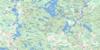
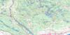
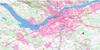
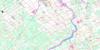
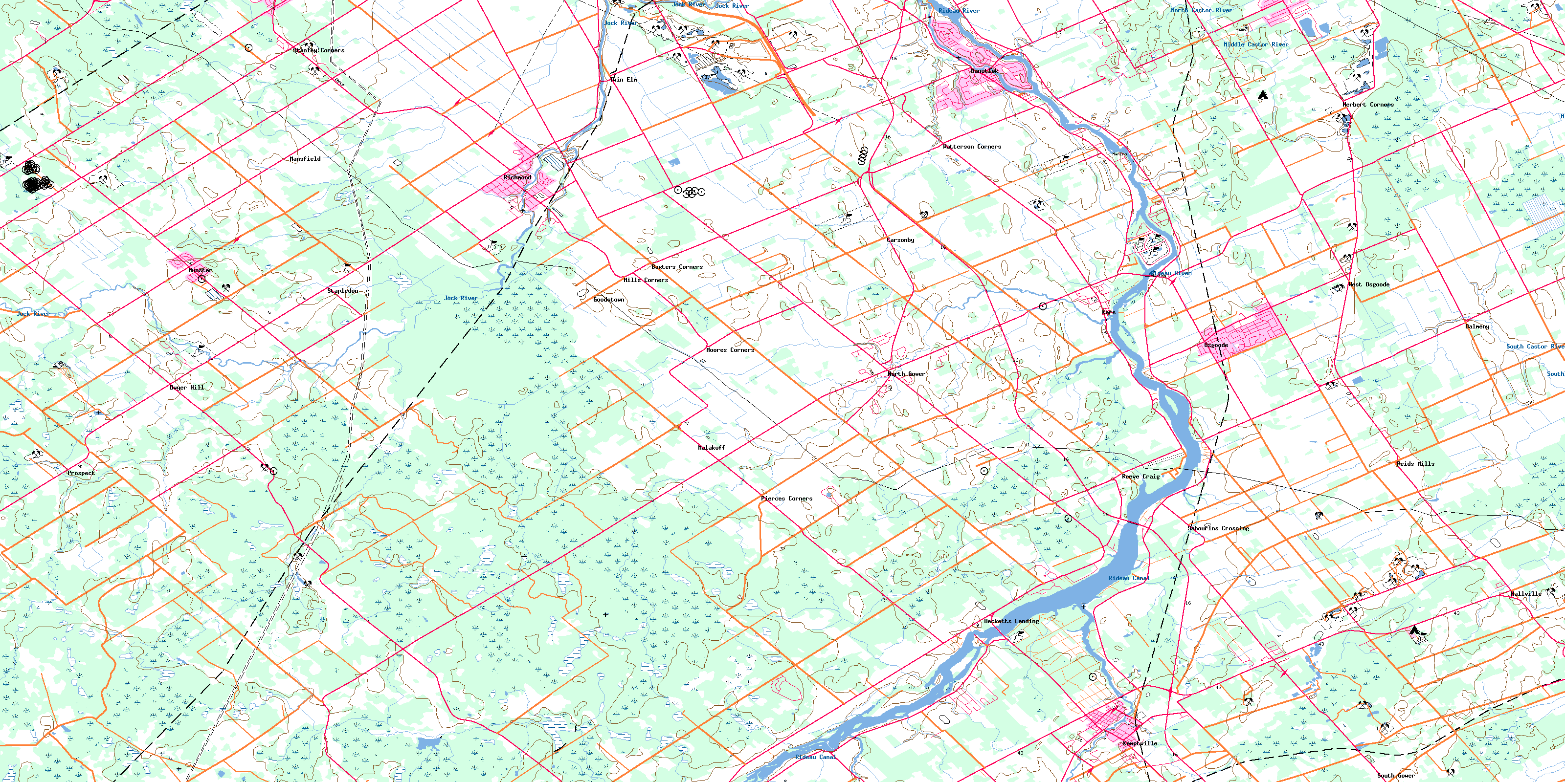
031G04 Kemptville Topo Map
To view this map, mouse over the map preview on the right.
You can also download this topo map for free:
031G04 Kemptville high-resolution topo map image.
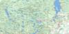
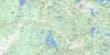
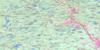
Maps for the Kemptville topo map sheet 031G04 at 1:50,000 scale are also available in these versions:
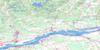
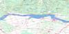
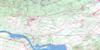
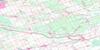
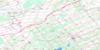
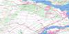
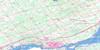
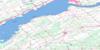
Kemptville Surrounding Area Topo Maps
 |
 |
 |
 |
 |
 |
 |
 |
 |
 |
 |
 |
 |
 |
 |
 |
© Department of Natural Resources Canada. All rights reserved.
Kemptville Gazetteer
The following places can be found on topographic map sheet 031G04 Kemptville:
Kemptville Topo Map: Bays
Mahogany HarbourKemptville Topo Map: Capes
Collins PointKemptville Topo Map: Channels
The CatchallKemptville Topo Map: City
OttawaKemptville Topo Map: Geographical areas
BeckwithCarleton
Dundas
Gloucester
Goulbourn
Grenville
Huntley
Lanark
Marlborough
Montague
Mountain
National Capital Region
Nepean
North Gower
Osgoode
Oxford
Région de la Capitale nationale
South Gower
Kemptville Topo Map: Hydraulic construction
McDermott DrainMilton-Hoy Drain
Murphy Drain
Kemptville Topo Map: Islands
Barnes IslandJames Island
Libby Island
Little Island
Long Island
Nicholl Island
Nicolls Island
Sanders Island
Kemptville Topo Map: Military areas
Champ de manoeuvre RichmondRichmond Training Area
Kemptville Topo Map: Mountains
Hyndmans RidgeKerrs Ridge
Loughlin Ridge
Kemptville Topo Map: Major municipal/district area - major agglomerations
CarletonLanark
Ottawa-Carleton
United Counties of Leeds and Grenville
United Counties of Stormont, Dundas and Glengarry
Kemptville Topo Map: Other municipal/district area - miscellaneous
BeckwithFitzroy
Goulbourn
Huntley
Marlborough
Montague
Mountain
North Dundas
North Gower
North Grenville
Osgoode
Oxford-on-Rideau
Rideau
South Gower
Torbolton
West Carleton
Winchester
Kemptville Topo Map: Conservation areas
Canal RideauLieu historique national du Canada du Canal-Rideau
Rideau Canal National Historic Site of Canada
Rideau Canal World Heritage Site
Rideau River Provincial Park
Kemptville Topo Map: Rivers
Allen CreekBrassils Creek
Cranberry Creek
Jock River
Kemptville Creek
Kings Creek
Mahoney Creek
Middle Castor River
Mud Creek
Nichols Creek
North Branch South Nation River
North Castor River
Rideau River
Rideau River & Canal
Rivière Rideau
Silver Creek
South Castor River
South Kemptville Creek
Steven Creek
Stevens Creek
West Branch Rideau River
Wylie Creek
Kemptville Topo Map: River features
Long ReachMcGahey's Bend
Kemptville Topo Map: Unincorporated areas
Baxters CornersBecketts Landing
Bray
Carsonby
Dalmeny
Dwyer Hill
Dwyerhill
Enniskerry
Goodstown
Hallville
Healey's Heath
Herbert Corners
Kars
Kemptville
Malakoff
Manotick
Mansfield
Maple Hill
Marlmont
Mills Corners
Moores Corners
Mountain
Munster
North Gower
North Montague
North Mountain
North Rideau
Osgoode
Osgoode Station
Pierces Corners
Pooles Corners
Prospect
Reeve Craig
Reevecraig
Reid Mills
Reids Mills
Richmond
Sabourin
Sabourins Crossing
South Gower
Stanley Corners
Stapledon
Stittsville
Twin Elm
Waller
Watterson Corners
West Osgoode
© Department of Natural Resources Canada. All rights reserved.
