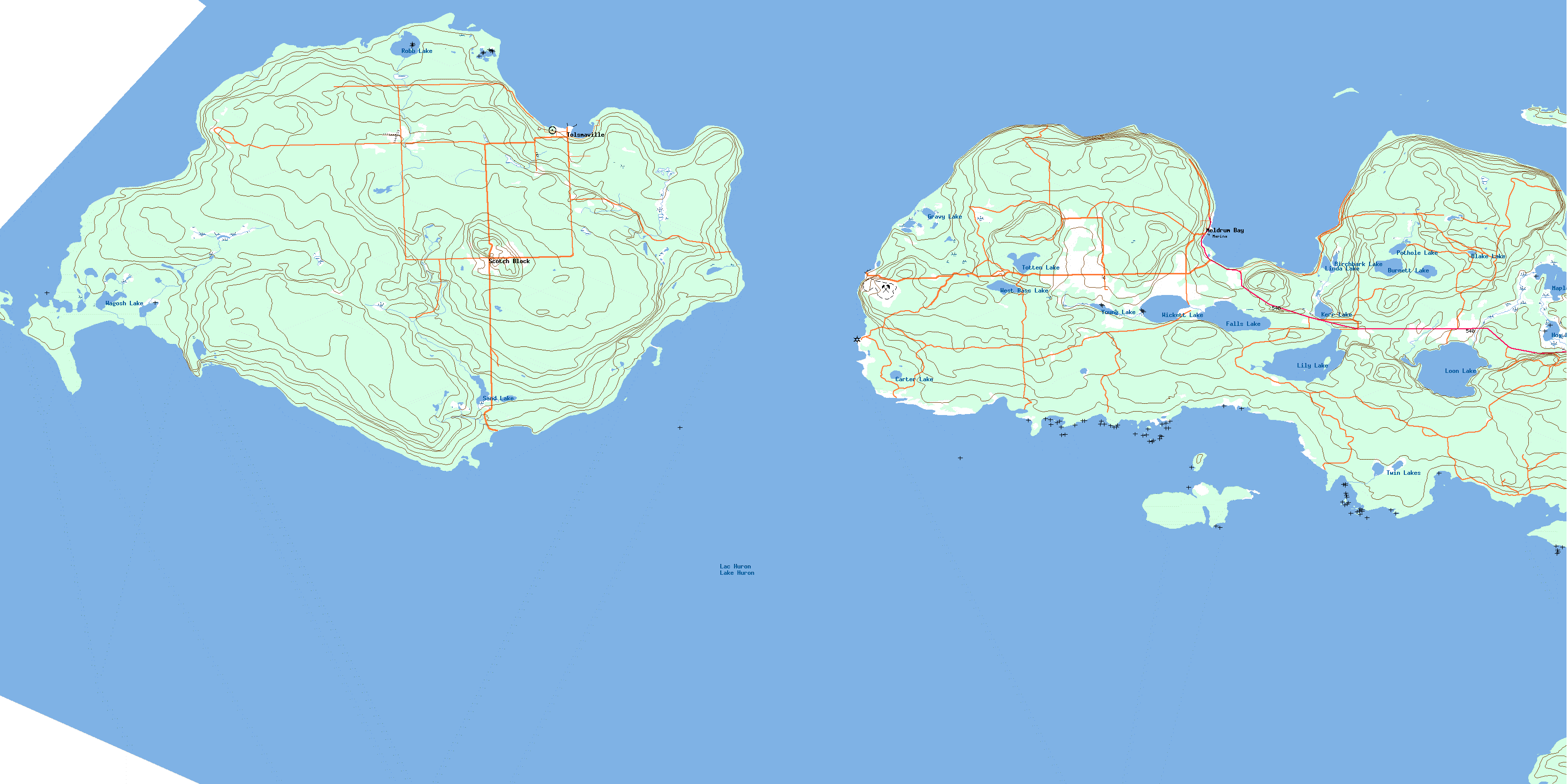
Meldrum Bay Topo Map Online
Download Free Topo Map Sheet 041G14 at 1:50,000 scale
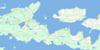
041G14 Meldrum Bay Topo Map
To view this map, mouse over the map preview on the right.
You can also download this topo map for free:
041G14 Meldrum Bay high-resolution topo map image.
Maps for the Meldrum Bay topo map sheet 041G14 at 1:50,000 scale are also available in these versions:
Meldrum Bay Surrounding Area Topo Maps
 |
 |
 |
|
 |
 |
||
© Department of Natural Resources Canada. All rights reserved.
Meldrum Bay Gazetteer
The following places can be found on topographic map sheet 041G14 Meldrum Bay:
Meldrum Bay Topo Map: Bays
Belanger BayBig Bay
Boat Harbour
Boathouse Bay
Bonnie Doon
Burn's Bay
Burnt Cove
Doc Hewson Bay
Double Cove
East Belanger Bay
Greene Island Harbour
Hyndman Bay
Macrae Cove
Meldrum Bay
Mud Bay
Mundy's Bay
Newbery Cove
Quarry Bay
Rickett Harbour
Ricketts Harbour
Robinson Bay
Sand Bay
Tolsma Bay
Vidal Bay
Wagosh Bay
West Belanger Bay
Meldrum Bay Topo Map: Capes
Belanger PointBoom Point
Brittomart Point
Chamberlain Point
Channel Point
Cinder Point
Devils Horn
Girouard Point
Lynn Point
Meldrum Point
Monk Point
Muriel Point
Pitman Point
Pulpwood Point
Quarry Point
Ross Point
Smith Point
Smith Point
Station Point
Thompson Point
Twenty Minute Point
West Point
Whitly Point
Meldrum Bay Topo Map: Channels
False Detour ChannelMississagi Strait
North Channel
Meldrum Bay Topo Map: Geographical areas
AlgomaCockburn Island
Dawson
Manitoulin
Meldrum Bay Topo Map: Indian Reserves
Cockburn Island Indian Reserve 19Réserve indienne Cockburn Island 19
Réserve indienne Zhiibaahaasing 19
Zhiibaahaasing 19
Zhiibaahaasing Indian Reserve 19
Meldrum Bay Topo Map: Islands
Avis IslandBatture Island
Cockburn Island
Duck Islands
Dunn Island
Eagle Island
Grant Islands
Greene Island
Herschell Island
Kitchener Island
Little Kitchener Island
Magnetic Island
Manitoulin Island
McRae's Island
Pearson Island
Steevens Island
Vidal Island
Welsh Island
Western Duck Island
Meldrum Bay Topo Map: Lakes
Bass LakeBirchbark Lake
Blake Lake
Burnett Lake
Carter Lake
Falls Lake
Gravy Lake
Hog Lake
Kerr Lake
Lac Huron
Lake Huron
Lily Lake
Linda Lake
Loon Lake
Maple Lake
Pothole Lake
Robb Lake
Sand Lake
Totten Lake
Twin Lakes
Wagosh Lake
West Bass Lake
Wicket Lake
Wickett Lake
Young Lake
Meldrum Bay Topo Map: Mountains
McCaigs HillMcQuaigs Hill
Meldrum Bay Topo Map: Other municipal/district area - miscellaneous
Cockburn IslandDay and Bright Additional
Howland
Huron Shores
Thessalon
Thompson
Meldrum Bay Topo Map: Rivers
Sand CreekMeldrum Bay Topo Map: Shoals
Ainslie ShoalCarter Rock
Castilian Shoal
Danville Ground
East Reef
Jones Shoal
Labrador Reef
Magnetic Reef
Magnetic Reefs
McKay Rock
Middle Reef
Mink Reef
North Reef
Pitman Bank
Purvis Bank
South Reef
West Duck Reef
West Reef
Western Duck Reef
Wiggins Bank
Meldrum Bay Topo Map: Towns
Northeastern Manitoulin and the IslandsMeldrum Bay Topo Map: Unincorporated areas
Cockburn IslandMeldrum Bay
Nesterville
Scotch Block
Scots Block
Tolsmaville
© Department of Natural Resources Canada. All rights reserved.
