Kagawong Topo Map Online
Download Free Topo Map Sheet 041G16 at 1:50,000 scale
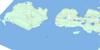
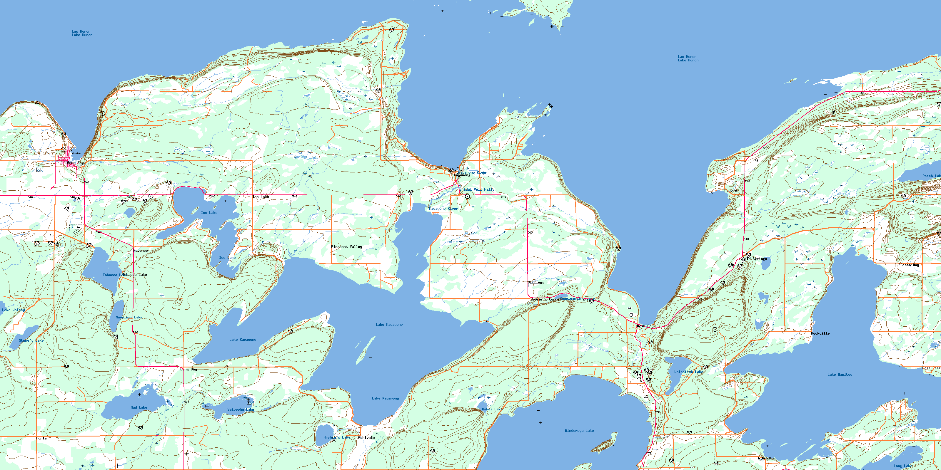
041G16 Kagawong Topo Map
To view this map, mouse over the map preview on the right.
You can also download this topo map for free:
041G16 Kagawong high-resolution topo map image.
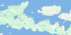
Maps for the Kagawong topo map sheet 041G16 at 1:50,000 scale are also available in these versions:
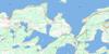
Kagawong Surrounding Area Topo Maps
 |
 |
 |
|
 |
 |
||
© Department of Natural Resources Canada. All rights reserved.
Kagawong Gazetteer
The following places can be found on topographic map sheet 041G16 Kagawong:
Kagawong Topo Map: Bays
Bass BayBass Creek Bay
Ben's Bay
Cannard's Bay
Corbier Cove
Donaldson's Bay
Ednie's Bay
Gibraltar Bay
Gore Bay
Green Bay
Honeymoon Harbour
Honora Bay
Horseshoe Bay
Jump's Bay
Kotcamp's Bay
Long Bay
Maggy's Bay
Martin's Bay
Moody Bay
Mud Bay
Mudge Bay
Newby's Bay
North East Harbour
Oakes Cove
Patterson's Bay
Priors Bay
Rushy Cove
Sandy Bay
Sandy Cove
Schut's Bay
Settler's Bay
Sidney Cox Bay
Silver Bay
Sounding Cove
Spring Bay
Timberlane Bay
Turner Cove
Twin Harbours
West Bay
West Bay
Kagawong Topo Map: Capes
Birch PointBrandow Point
Brandow's Point
Chisholm's Point
Collin's Point
Deer Point
Doc Smith's Point
Duff's Point
Dutchman Head
Ednie's Point
Francis Point
Freer Point
Gorrel Point
Grable's Point
Gramble's Point
Gray Point
Hartley's Point
Honora Point
Janet Head
Jeanna's Point
Jessie Point
Johnny's Point
Johnson Point
Kerr's Point
King's Point
Knoll's Point
Maple Point
Maple Point
Mary Ann Point
Mowat Point
Oakes Point
Panet Point
Pierce's Point
Sextant Point
South Spit
Tamarack Point
Tennents Point
Tennent's Point
The Ridge
Thompson's Point
Town Point
Trudeau Point
Kagawong Topo Map: Channels
North ChannelThe Narrows
Whitefish Channel
Kagawong Topo Map: Cliffs
West BluffWhite Rock
Kagawong Topo Map: Falls
Bridal Veil FallsKagawong Topo Map: Geographical areas
AllanAssiginack
Bidwell
Billings
Campbell
Carnarvon
Gordon
Howland
Manitoulin
Mills
Sandfield
Kagawong Topo Map: Indian Reserves
M'Chigeeng 22Réserve Indienne 22 M'Chigeeng
Réserve indienne Sucker Creek 23
Réserve indienne West Bay 22
Sucker Creek Indian Reserve 23
West Bay Indian Reserve 22
Kagawong Topo Map: Islands
Bass IslandBass Island
Battleship Island
Bear Island
Beverly Island
Burbidge Island
Clapperton Island
Gooseberry Island
Grass Island
Gull Island
Kakawaie Island
Little Grass Island
Little Island
Little Island
Lone Tree Island
Manitoulin Island
McCracken's Island
Meredith Island
Mowat Island
Roper Island
Seagull Island
Taché Island
The Tooth
Treasure Island
Trudeau Island
Wabos Island
Wabosons Island
Kagawong Topo Map: Lakes
Archie's LakeBig Lake
Ice Lake
Kagawong Lake
Kiln Lake
Lake Kagawong
Lake Manitou
Lake Wolsey
Long Lake
Manitou Lake
Mindemoya Lake
Mud Lake
Nameless Lake
Oakes Lake
Otter Lake
Perch Lake
Saigeohn Lake
Saugigansing Lake
Stone's Lake
Tobacco Lake
Whitefish Lake
Kagawong Topo Map: Mountains
Badgerow HillCathedral Rock
Cup and Saucer
East Bluff
High Hill
Jerusalem Hill
Maple Bluff
Kagawong Topo Map: Other municipal/district area - miscellaneous
AssiginackBillings
Burpee
Burpee and Mills
Carnarvon
Central Manitoulin
Gordon
Howland
Sandfield
Kagawong Topo Map: Rivers
Badgerow CreekBarr's Creek
Bass Creek
Clapperton Channel
Kagawong River
Moody Creek
Mud Creek
Perch Creek
Robertson Creek
Scott's Creek
Kagawong Topo Map: Shoals
Boulder BankBurgess Reef
Doc Owen Shoal
Eleven Foot Rock
Foster Bank
James Foote Patch
Kittiwake Rock
Little IslandBank
Martin Reef
McInnes Bank
McRae Patch
Meredith Rock
Middle Bank
North Shoal
Red Rock
Roper's Shoal
Spring Shoal
Straubenzee Reef
Sunken Island
Sutherland Shoal
Taché Island Reef
Kagawong Topo Map: Towns
Gore BayNortheastern Manitoulin and the Islands
Northeastern Manitoulin and the Islands
Kagawong Topo Map: Unincorporated areas
AdvanceAdvance
Bass Creek
Billings
Bowser's Corner
Cold Springs
Excelsior
Gibraltar
Green Bay
Honora
Ice Lake
Kagawong
Long Bay
Magawong Village
Perivale
Pleasant Valley
Poplar
Rockville
Tobacco Lake
West Bay
Kagawong Topo Map: Low vegetation
Blueberry MarshCranberry Marsh
© Department of Natural Resources Canada. All rights reserved.
