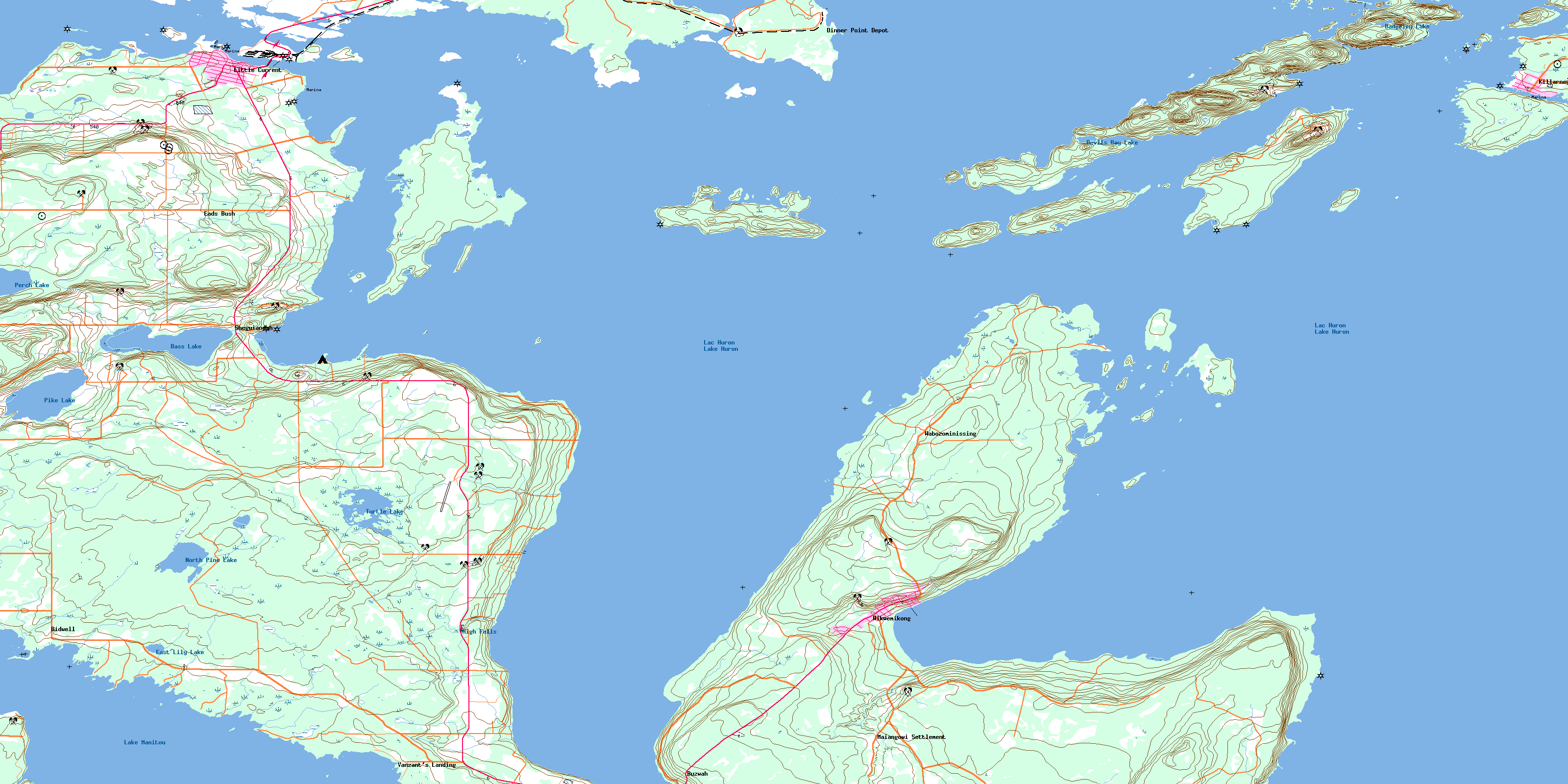
Little Current Topo Map Online
Download Free Topo Map Sheet 041H13 at 1:50,000 scale
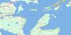
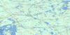
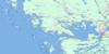
041H13 Little Current Topo Map
To view this map, mouse over the map preview on the right.
You can also download this topo map for free:
041H13 Little Current high-resolution topo map image.
Maps for the Little Current topo map sheet 041H13 at 1:50,000 scale are also available in these versions:
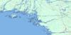
Little Current Surrounding Area Topo Maps
 |
 |
 |
 |
 |
 |
 |
|
 |
 |
||
 |
 |
 |
© Department of Natural Resources Canada. All rights reserved.
Little Current Gazetteer
The following places can be found on topographic map sheet 041H13 Little Current:
Little Current Topo Map: Bays
Baie GeorgienneBathouse Bay
Beaver Island Harbour
Bowell Cove
Boyle Cove
Bragmore Bay
Browning Cove
Buzwales Cove
Cameron Cove
Camp Cove
Cape Horn Bay
Chapleau Cove
Covered Portage Cove
Dawes Bay
Dick's Bay
Fishing Island Cove
Frazer Bay
Georgian Bay
Giwshkwebi Bay
High Beach Cove
Killarney Bay
Killarney Harbour
Little River
Mackay's Bay
Mallard Cove
Manitowaning Bay
Melvin Bight
Mosquito Bay
Plummer Cove
Portage Cove
Powderhouse Bay
Powell Cove
Sandy Cove
Shallow Bay
Shearpin Bay
Sheguiandah Bay
Shirley's Bay
Shoal Bight
Silver Bay
Smith Bay
Snug Harbour
Surecatch Bay
Tilson's Bay
Turner Cove
Turtle Creek Bay
Watson Bay
Wee Point Bay
White Cove
White's Cove
Little Current Topo Map: Beaches
High BeachLittle Current Topo Map: Capes
Ashiganshing PointBadgeley Point
Bird Point
Bold Point
Bragmore Point
Cape Horn Point
Cape Smith
Caron Point
Castigan Point
Chapleau Point
Dinner Point
East Point
English Point
Evans Point
Fish Point
Flat Point
Frost Point
Gibbons Point
Gibson Point
Gow Point
Griffiths Point
Indian Dock Point
Kanigandibe Point
Le Haye Point
Leech Point
Limestone Point
Lobster Point
Lone Star Point
Long Point
Long Point
Mackay Point
Mackay's Point
Magazine Point
Maple Rock Point
Mary Point
Maxwell Point
Mayes Point
Meshkodeyang Point
Miller Point
Monk Point
Nadeau Point
O'Meara Point
Oxley Point
Paul's Point
Phipps Point
Prairie Point
Sagamaw Point
Sandy Point
Shoal Island Spit
Shutin Point
Sims Point
Skull Point
South Point
Southeast Point
Stanley Point
Stony Point
Sturgeon Point
Ten Mile Point
The Gut Dock
Thompson Point
Underhill Point
Watson Point
Wee Point
Wharton Point
Little Current Topo Map: Channels
Hole in the WallKillarney Channel
Lansdowne Channel
Little Current
North Channel
North Channel
Pine Island Channel
Strawberry Channel
The Narrows
Little Current Topo Map: Cliffs
Baudin BluffBayfield Bluff
Clay Cliff
East Red Cliff
West Red Cliff
Little Current Topo Map: Falls
High FallsLittle Current Topo Map: Geographical areas
AssiginackBidwell
Howland
Manitoulin
Rutherford
Sandfield
Sheguiandah
Little Current Topo Map: Indian Reserves
Réserve indienne Sheguiandah 24Réserve indienne Sucker Creek 23
Réserve indienne Wikwemikong Unceded 26
Sheguiandah 24
Sheguiandah Indian Reserve 24
Sucker Creek 23
Sucker Creek Indian Reserve 23
Wikwemikong Unceded Indian Reserve 26
Little Current Topo Map: Islands
Anthony IslandBadgeley Island
Beauty Island
Beaver Island
Big Burnt Island
Big Gooseberry Island
Browning Island
Centre Island
Creak Island
Deepwater Island
Double Island
Double Islands
Dufferin Island
East Mary Island
East Mound
Elm Island
Fishing Island
Garden Island
George Island
Giwshkwebi Island
Goat Island
Gooseberry Island
Great Cloche Island
Great La Cloche Island
Gull Island
Harris Island
Heywood Island
Hog Island
King William Island
Kokanongwi Island
Lisgar Island
Little Cloche Island
Little Gooseberry Island
Little Island
Little Island
Little La Cloche Island
Lobster Island
Loon Island
Low Island
Maltas Island
Manitoulin Island
McKenzie Island
Narrow Island
Northwest Burnt Island
One Mile Island
Partridge Island
Partridge Island
Patten Island
Pender Islets
Picnic Island
Pine Island
Rabbit Island
Seagull Island
Sheep Island
Shibabiyag
Shoal Island
Snake Island
Spider Island
Strawberry Island
The Nest
Tin Can Island
Tree's Island
Twin Islands
West Mary Island
West Mound
William Island
Little Current Topo Map: Lakes
Badgeley LakeBass Lake
Devils Bay Lake
East Lily Lake
Lac Huron
Lake Huron
Lake Manitou
Manitou Lake
North Pine Lake
Perch Lake
Pike Lake
Pine Lake
Turtle Lake
Little Current Topo Map: Marine navigation features
Fisher HarbourMocassets Landing
Little Current Topo Map: Mountains
Ayekwadinak HillColumbus Mountain
Lions Head
Lions Rump
McLeans Mountain
Murray Hill
Sheguiandah Hill
The Spur
Wikwemikong Hill
Little Current Topo Map: Other municipal/district area - miscellaneous
AssiginackCarnarvon
Central Manitoulin
Howland
Rutherford and George Island
Sandfield
Little Current Topo Map: Rivers
Francis BrookGoat Island Channel
Kaboni Creek
Norton's Creek
Sanswe Creek
Springer Brook
Sucker Creek
Little Current Topo Map: Road features
Rat PortageLittle Current Topo Map: Shoals
Ann Long BankAzov Ledges
Badgeley Rocks
Bayfield Reef
Bayfield Rock
Beaver Island Bank
Bernard Rock
Boat Rock
Boulton Reef
Burnt Island Bank
Campbell Rock
Caron Reef
Centre Island Bank
Double Island Ledges
Doyle Rock
Five Fathom Patch
Frank Ledge
Garden Island Bank
George Rock
Gibbons Bank
Goldhunter Rock
Gow Shoal
Gull Roost
Heywood Rock
Ironsides Rock
John Ledge
Kokanongwi Shingle
Langevin Rock
Leech Reef
Linter Rock
Loon Island Reef
McGregor Bank
Middle Bank
Nobles Bank
Partridge Island Rocks
Pelkie Rock
Petley Rock
Phipps Point Shoal
Powell Cove Bank
Quartz Rock
Rabbit Island Rock
Red Cliff Flat
Richards Reef
Sandy Cove Ledge
Six Fathom Patch
Skull Point Reef
Split Rock
Steamer Reef
Ten Mile Shoal
Watts Rock
Little Current Topo Map: Towns
KillarneyNortheastern Manitoulin and the Islands
Northeastern Manitoulin and the Islands
Little Current Topo Map: Unincorporated areas
BidwellBuzwah
Dinner Point Depot
Eads Bush
Killarney
Little Current
Maiangowi Settlement
Sheguiandah
Turner
Vanzant's Landing
Wabozominissing
Wikwemikong
© Department of Natural Resources Canada. All rights reserved.
