Copper Cliff Topo Map Online
Download Free Topo Map Sheet 041I06 at 1:50,000 scale
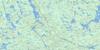
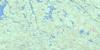
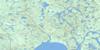
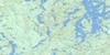
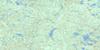
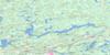
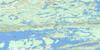
041I06 Copper Cliff Topo Map
To view this map, mouse over the map preview on the right.
You can also download this topo map for free:
041I06 Copper Cliff high-resolution topo map image.
Maps for the Copper Cliff topo map sheet 041I06 at 1:50,000 scale are also available in these versions:
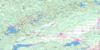
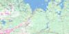
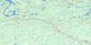
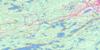
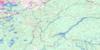
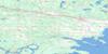
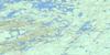
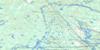
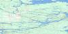
Copper Cliff Surrounding Area Topo Maps
 |
 |
 |
 |
 |
 |
 |
 |
 |
 |
 |
 |
 |
 |
 |
 |
© Department of Natural Resources Canada. All rights reserved.
Copper Cliff Gazetteer
The following places can be found on topographic map sheet 041I06 Copper Cliff:
Copper Cliff Topo Map: Bays
Hixon's BayStony Bay
Vermilion Bay
Copper Cliff Topo Map: Capes
Jackson's PointVirginia Point
Copper Cliff Topo Map: Channels
Primo NarrowsSaginaw Channel
Sand Channel
Steamboat Channel
Copper Cliff Topo Map: City
Grand SudburyGreater Sudbury
Copper Cliff Topo Map: Falls
Cascade FallsDuncan Chute
McFadden Falls
Copper Cliff Topo Map: Geographical areas
BevinBroder
Caen
Creighton
Creighton-Davies
Denison
Dieppe
Drury
Eden
Fairbank
Graham
Halifax
Lorne
Louise
McKim
Snider
Sudbury
Tilton
Trill
Truman
Waters
Copper Cliff Topo Map: Indian Reserves
Réserve indienne Whitefish Lake 6Whitefish Lake 6
Whitefish Lake Indian Reserve 6
Copper Cliff Topo Map: Islands
Ben IsleBenard Island
Big Chief Island
Big Pine Island
Chapman Island
Chicken Island
Cook's Island
Fairbank Island
Flat Island
Hiram Hixon Island
Hutchinson Island
Maplegrove Island
McCalley's Island
Morin Island
Navy Islands
Pine Island
Rabbit Island
Rauhala Island
Robinson Island
St. John Island
Swanson Island
Traverse Island
Wittie Island
Yankee Island
Yankee Island
Copper Cliff Topo Map: Lakes
Ann LakeArnold Lake
Ashigan Lake
Bass Lake
Bass Lake
Bass Lake
Beaver Lakes
Bevin Lake
Big Trout Lake
Blackwater Lake
Brady Lake
Cameron Lake
Camp Lake
Chief Lake
Clara Belle Lake
Clarabelle Lake
Clearwater Lake
Cranberry Lake
Crooked Lake
Echo Lake
Eden Lake
Ella Lake
Emma Lake
Ethel Lake
Fairbank Lake
Fly Lake
Forest Lake
Gordon Lake
Grassy Lake
Hannah Lake
Happy's Lake
Kelley Lake
Kelly Lake
Kusk Lake
Lady Macdonald Lake
Lake la Vase
Lake Panache
Leach Lake
Line Lake
Little Bass Lake
Little Blackwater Lakes
Little Chief Lake
Little Fairbank Lake
Little Fairbank Lake
Little Fly Lake
Little Panache Lake
Little Rat Lake
Little Round Lake
Little Trout Lake
Little Trout Lake
Lohi Lake
Long Lake
Louie Lake
Lower White Oak Lake
Luke Lake
Makada Lake
Margaret Lake
May Lake
McCharles Lake
Meatbird Lake
Middle Lake
Mond Lake
Monk Lake
Moose Lake
Mud Lake
Mud Lake
Mud Lake
Nemag Lake
Nepahwin Lake
North Star Lake
Northeast Lake
Norwest Lake
Number Ten Lake
Otter Lake
Page Lake
Perch Lake
Perch Lake
Pine Lake
Pistin Lake
Pump Lake
Rat Lake
Reef Lake
Rickale Lake
Robinson Lake
Ross Lake
Round Lake
Sand Pit Lake
Silver Lake
Simon Lake
Skill Lake
Slim Lake
St. Charles Lake
St. Pothier Lake
Still Lake
Sucker Lake
Threecorner Lake
Tilton Lake
Turner Lake
Twin Lakes
Twin Lakes
Upper Gordon Lake
Vermilion Lake
Wakemi Lake
Wavy Lake
West Lake
White Oak Lake
Whitefish Lake
Wolfe Lake
Y Lake
Copper Cliff Topo Map: Mountains
Blueberry HillLouise Tower Mountain
Copper Cliff Topo Map: Major municipal/district area - major agglomerations
SudburyCopper Cliff Topo Map: Other municipal/district area - miscellaneous
BalfourDowling
Drury, Denison and Graham
Copper Cliff Topo Map: Conservation areas
Eden Township Forest Conservation ReserveFairbank Provincial Park
Tilton Forest Conservation Reserve
Copper Cliff Topo Map: Rivers
Bevin CreekBlackwater Creek
Blake Creek
Brady Creek
Cameron Creek
Fairbank Creek
Gordon Creek
Junction Creek
Levey Creek
Lily Creek
Luke Creek
Makada Creek
Maki Creek
Meatbird Creek
Muskawin Creek
Nolins Creek
Ramsey Creek
Rivière Vermillion
Vermilion River
Wavy Creek
Whitefish River
Copper Cliff Topo Map: Towns
DowlingWaters
Copper Cliff Topo Map: Unincorporated areas
Beaver LakeCinottiville
Clara Belle
Copper Cliff
Crean Hill
Creighton
Creighton Mine
Creosote
Cresote
Donovan
East Creighton
Gatchell
Gertrude
Little Britain
Lively
Lockerby
Mikkola
Milate
Mond
Moxam's Landing
Naughton
O'Donnell
Onaping Falls
Rayside-Balfour
Robinson Subdivision
Sudbury
The Donovan
Traverse Landing
Victoria Mine
Walden
Whitefish
Worthington
Copper Cliff Topo Map: Low vegetation
West Swamp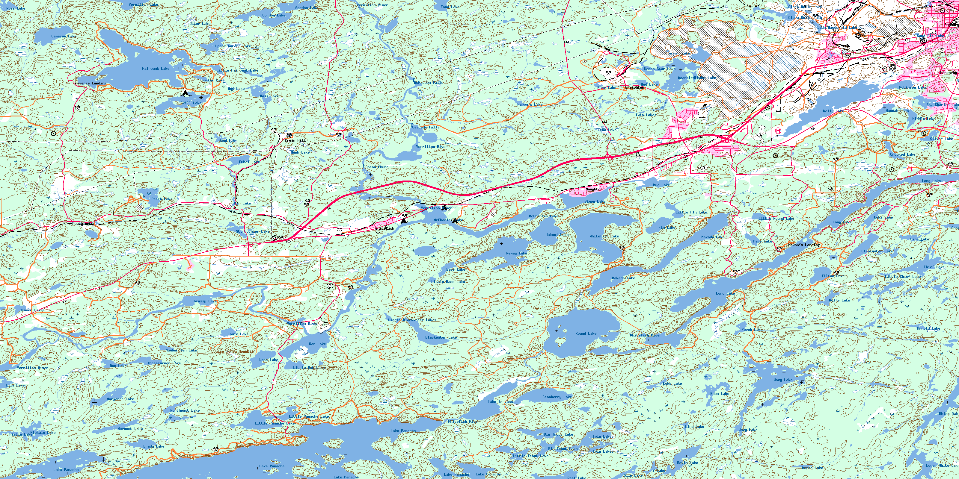
© Department of Natural Resources Canada. All rights reserved.
