Longbow Lake Topo Map Online
Download Free Topo Map Sheet 052E09 at 1:50,000 scale
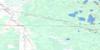
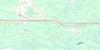
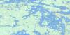
052E09 Longbow Lake Topo Map
To view this map, mouse over the map preview on the right.
You can also download this topo map for free:
052E09 Longbow Lake high-resolution topo map image.
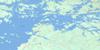
Maps for the Longbow Lake topo map sheet 052E09 at 1:50,000 scale are also available in these versions:
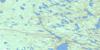
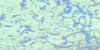
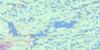
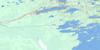
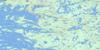
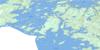
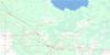
Longbow Lake Surrounding Area Topo Maps
 |
 |
 |
 |
 |
 |
 |
 |
 |
 |
 |
 |
 |
 |
 |
 |
© Department of Natural Resources Canada. All rights reserved.
Longbow Lake Gazetteer
The following places can be found on topographic map sheet 052E09 Longbow Lake:
Longbow Lake Topo Map: Bays
Adams River BayAndrew Bay
Bald Indian Bay
Bear Bay
Beatton Bay
Bigstone Bay
Bottle Bay
East Bay
Echo Bay
Golf Course Bay
Greens Bay
Jackfish Bay
Lowry Bay
Matheson Bay
Moore Bay
P.O.W. Bay
Pine Portage Bay
Red Cliff Bay
Redwing Bay
Riches Bay
Route Bay
Smugglers Cove
St. Mary's Bay
Storm Bay
The Bowling Alley
Thunder Bay
Tomahawk Bay
Weedy Bay
Witch Bay
Yellow Girl Bay
Longbow Lake Topo Map: Beaches
Scotty's BeachLongbow Lake Topo Map: Capes
Bare PointEastern Peninsula
Finches Point
Hall's Point
Heaps Point
Heenan Point
Logans Point
Needle Point
Pine Point
Pipestone Peninsula
Pipestone Point
Treaty Point
Yellow Girl Point
Longbow Lake Topo Map: Channels
Allans NarrowsDeadbroke Channel
Devils Gap
Eagle Pass
French Narrows
Moskahossi Passage
Rocky Narrows
Skull Rock Narrows
The Devil's Elbow
The Elbow
The Funnel
The Shore Island Stretch
Longbow Lake Topo Map: City
KenoraLongbow Lake Topo Map: Cliffs
Devil's RockLongbow Lake Topo Map: Geographical areas
CodeCoyle
Desmond
Devonshire
Haycock
Jaffray
Kirkup
le May
MacQuarrie
Manross
McMeekin
Work
Longbow Lake Topo Map: Indian Reserves
Kenora 38BKenora Indian Reserve 38B
Réserve indienne Kenora 38B
Réserve indienne Yellow Girl Bay 32B
Yellow Girl Bay 32B
Yellow Girl Bay Indian Reserve 32B
Longbow Lake Topo Map: Islands
Allans IslandAllie Island
Anchor Island
Baker's Island
Bald Island
Barrier Islands
Bath Island
Bells Island
Big Island
Billygoat Island
Boulder Islands
Britannia Island
Bunn Island
Burley Island
Caldwell Island
Canniff Island
Cat Island
Chien D'Or Island
Chisholm Island
Clam Island
Cliff Island
Connor Island
Copper Island
Craig Island
Deacon's Island
Dog Island
East Allie Island
Fantasy Island
Ferrier Island
Fish Island
Fog Island
Fort Sam Island
Fraser Island
Gaherty Island
Galt Island
Goat Island
Gordon Island
Gull Island
Hades Islands
Hay Island
Houghs Island
Johnson Island
Kipling Island
Leach Island
Leisure Island
Lunny's Island
Mac Island
Manitou Island
Mather Island
Mazies Island
McEwen's Islands
Middle Island
Minnesabik Island
Nantons Island
Nepetugain Island
Nickerson Island
Oliver Island
Pewabic Island
Pickerel Island
Quarry Island
Queen Bee Island
Queer Island
Railroad Island
Ramona Island
Red Deer Island
Rideout Island
Robertson Island
Rogers Island
Sanna Island
Scotty Island
Scovil Island
Shore Island
Shragges Island
Slate Island
South Strawberry Island
Square Island
St. Helena Island
Strawberry Island
Sultana Island
Survey Island
Thompson Island
Town Island
Treaty Island
Whiteout Island
Wildcat Island
Longbow Lake Topo Map: Lakes
Alexandre LakeAndy Lake
Barnes Lake
Bill Lake
Bipemaejoe Lake
Black Lake
Blindfold Lake
Bug Lake
Bull Lake
Bunion Lake
Camp Lake
Carmichael Lake
Cassadaga Lake
Chipmunk Lake
Clear Lake
Cole Lake
Corn Lake
Crusoe Lake
Desbiens Lake
Divide Lake
Dogtooth Lake
Doubtful Lake
Dryberry Lake
End Lake
Fawn Lake
Finn Lake
Flounder Lake
Forbes Lake
Gagne Lake
Gale Lake
Gelley Lake
Gibi Lake
Gold Lake
Graphic Lake
Hatchet Lake
Hilly Lake
Holger Lake
Hollow Lake
Hook Lake
Hump Lake
Ian Lake
Isabel Lake
Isabella Lake
Islet Lake
Jadakin Lake
Jimmy Lake
Kennard Lake
Kilvert Lake
Lac des Bois
Lac la Belle
Lake of the Woods
Lavender Lake
Leach Lake
Lily Lake
Little Desbiens Lake
Little Dogtooth Lake
Lodestone Lake
Lonely Lake
Longbow Lake
Loon Lake
Lunch Lake
Mac Lake
Magnet Lake
Melady Lake
Mike Lake
Monster Lake
Muskie Lake
Nabob Lake
Nelly Lake
Newman Lake
Oblong Lake
Pipe Lake
Puma Lake
Raft Lake
Rat Lake
Rattrap Lake
Riley Lake
Robinson Lake
Robinson Lake
Russ Lake
Snow Lake
Squirrel Lake
Stella Lake
Stokes Lake
Sup Lake
Tea Lake
Top Lake
Tower Lake
Ulster Lake
Viola Lake
Welsh Lakes
White Lake
Yellow Lake
Longbow Lake Topo Map: Other municipal/district area - miscellaneous
McGeorge & WillingdonSioux Narrows
Sioux Narrows Nestor Falls
Sioux Narrows-Nestor Falls
Longbow Lake Topo Map: Conservation areas
Lake of the Woods Conservation ReserveRushing River Provincial Park
Longbow Lake Topo Map: Rivers
Adams RiverBerry Creek
Berry River
Black River
Desbiens Creek
Gale Creek
Graphic Creek
Johnny Creek
Longbow Creek
Rivière Winnipeg
Rushing River
Winnipeg River
Yellow Creek
Longbow Lake Topo Map: Road features
Pipestone PortageLongbow Lake Topo Map: Shoals
Balancing RockGardners Monument
Grace Anne Reef
Steamboat Reef
Wydemans Rock
Longbow Lake Topo Map: Towns
Jaffray and MelickJaffray Melick
Longbow Lake Topo Map: Unincorporated areas
Longbow Lake
© Department of Natural Resources Canada. All rights reserved.
052E Related Maps:
052E Kenora052E01 Morson
052E02 Big Island
052E03 Buffalo Bay
052E04 Sprague
052E05 Whitemouth River
052E06 Berry Point
052E07 Falcon Island
052E08 Sioux Narrows
052E09 Longbow Lake
052E10 Clearwater Bay
052E11 Falcon Lake
052E12 Mcmunn
052E13 Whitemouth
052E14 Caddy Lake
052E15 Keewatin
052E16 Kenora
