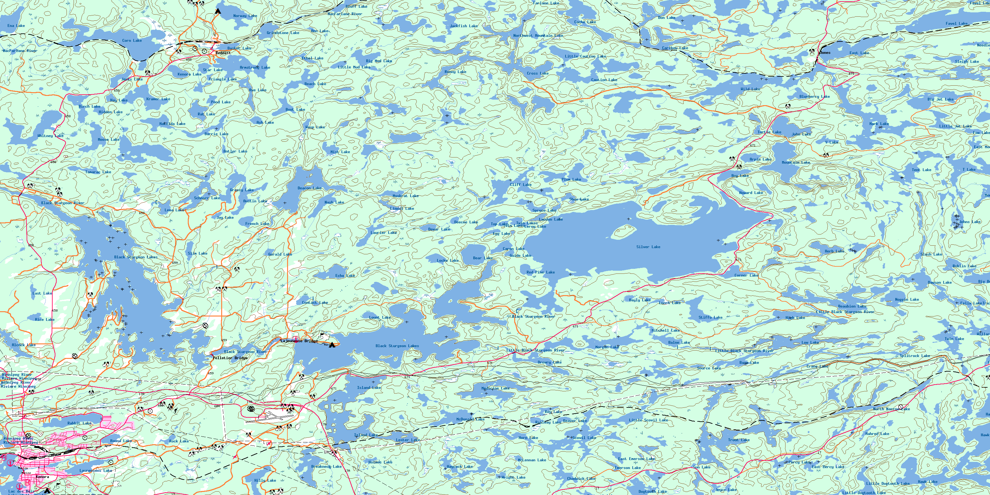
Kenora Topo Map Online
Download Free Topo Map Sheet 052E16 at 1:50,000 scale
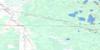
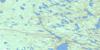
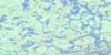
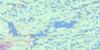
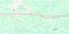
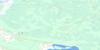
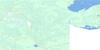
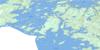
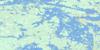
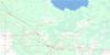
052E16 Kenora Topo Map
To view this map, mouse over the map preview on the right.
You can also download this topo map for free:
052E16 Kenora high-resolution topo map image.
Maps for the Kenora topo map sheet 052E16 at 1:50,000 scale are also available in these versions:
Kenora Surrounding Area Topo Maps
 |
 |
 |
 |
 |
 |
 |
 |
 |
 |
 |
 |
 |
 |
 |
 |
© Department of Natural Resources Canada. All rights reserved.
Kenora Gazetteer
The following places can be found on topographic map sheet 052E16 Kenora:
Kenora Topo Map: Bays
Crystal BayGolf Course Bay
Greens Bay
Kenora Bay
Long Tent Bay
North East Bay
Rat Portage Bay
Rice Bay
Rideout Bay
Kenora Topo Map: Capes
Bennetto PointCamerons Point
Logans Point
Pophams Point
Kenora Topo Map: Channels
Camerons NarrowsFirst Rapids Narrows
Grassy Narrows
Kenora Topo Map: City
KenoraKenora Topo Map: Geographical areas
CoyleDesmond
Haycock
Jackman
Jaffray
MacNicol
Melick
Pettypiece
Redditt
Kenora Topo Map: Hydraulic construction
Norman DamKenora Topo Map: Islands
Bush IslandConey Island
Ile Petite
Langs Island
McLeod Island
Old Fort Island
Tooles Island
Tunnel Island
Kenora Topo Map: Lakes
Alcock LakeAnn Lake
Antler Lake
Armstrong Lake
Arpin Lake
Ash Lake
Austin Lake
Axe Lake
Balne Lake
Barrie Lake
Base Lake
Basket Lake
Bayly Lake
Beach Lake
Bear Lake
Beaubien Lake
Beaver Lake
Big Beaver Lake
Big Jet Lake
Big Mud Lake
Birch Lake
Black Sturgeon Lakes
Blueberry Lake
Bluff Lake
Bog Lake
Boot Lake
Breakneck Lake
Cache Lake
Caribou Lake
Caron Lake
Caution Lake
Chadwick Lake
Cliff Lake
Contact Lake
Corn Lake
Corner Lake
Crane Lake
Cross Lake
Dawson Lake
Deacon Lake
Deecee Lake
Dewar Lake
Dogtooth Lake
Don Lake
Drewry Lake
East Emerson Lake
East Lake
East Moose Lake
East Percy Lake
Echo Lake
Egg Lake
Emerson Lake
Ena Lake
Ethel Lake
Farlane Lake
Favel Lake
Felix Lake
Foot Lake
Fox Lake
French Lake
Gerald Lake
Grassy Lake
Grindstone Lake
Guide Lake
Hawk Lake
Hay Lake
Haycock Lake
Herb Lake
Hidden Lake
High Lake
Hilly Lake
Holmes Lake
Horn Lake
Howard Lake
Island Lake
Jackfish Lake
Jacks Lake
Jay Lake
Jay Lake
John Lake
Johns Lake
Joyce Lake
Kenora Lake
Kramer Lake
Lac des Bois
Lake of the Woods
Landon Lake
Last Lake
Laurence Lake
Laurensons Lake
Laurier Lake
Lena Lake
Leroy Lake
Lester Lake
Lindal Lake
Lindel Lake
Link Lake
Little Caution Lake
Little Dogtooth Lake
Little Jet Lake
Little Mud Lake
Little Scovil Lake
Locke Lake
Lount Lake
Low Lake
Lunch Lake
Mahree Lake
Mark Lake
Matilda Lake
McDonald Lake
McLennan Lake
Medicine Lake
Mist Lake
Mitchell Lake
Monkeywrench Lake
Moose Lake
Moose Lake
Morgan Lake
Mountain Lake
Mountain Lake
Muskrat Lake
Nash Lake
Needle Lake
Noggin Lake
North Narrow Lake
Northwest Mountain Lake
Norway Lake
Percy Lake
Plum Lake
Pond Lake
Rabbit Lake
Railway Lake
Rat Lake
Red Pine Lake
Rice Lake
Roblin Lake
Rock Lake
Ronny Lake
Round Lake
Roy Lake
Schnarr Lake
Scovil Lake
Show Lake
Silver Lake
Sleigh Lake
Slim Lake
Slush Lake
Source Lake
Splitrock Lake
Spruce Lake
Star Lake
Stiffo Lake
Sun Lake
T Lake
Talbot Lake
Tamarac Lake
Tent Lake
Top Lake
Trailer Lake
Triangle Lake
Trout Lake
Turtle Lake
Twin Lake
Twin Lakes
V Lake
Wasp Lake
Whitney Lake
Wild Lake
Willard Lake
Wright Lake
Kenora Topo Map: Conservation areas
The Jones Road Wilderness AreaKenora Topo Map: Rivers
Black Sturgeon RiverBog Creek
Boot Creek
Cache Creek
Crooked Creek
Deacon Creek
Echo Creek
Fisher Creek
Haycock Creek
Hilly Creek
Island Creek
Laurenoon Creek
Laurensons Creek
Laurier Creek
Little Black Sturgeon River
MacFarlane River
Medicine Creek
Muskeg River
Octopus Creek
Plum Creek
Rivière Winnipeg
Scovil Creek
Talbot Creek
Whitney Creek
Winnipeg River
Kenora Topo Map: Road features
Fisher PortageKenora Topo Map: Towns
Jaffray and MelickJaffray Melick
Rat Portage
Kenora Topo Map: Unincorporated areas
JonesKenora
Lajeunesse Bridge
Margach
Pelletier Bridge
Redditt
Rimstad
Scovil
© Department of Natural Resources Canada. All rights reserved.
052E Related Maps:
052E Kenora052E01 Morson
052E02 Big Island
052E03 Buffalo Bay
052E04 Sprague
052E05 Whitemouth River
052E06 Berry Point
052E07 Falcon Island
052E08 Sioux Narrows
052E09 Longbow Lake
052E10 Clearwater Bay
052E11 Falcon Lake
052E12 Mcmunn
052E13 Whitemouth
052E14 Caddy Lake
052E15 Keewatin
052E16 Kenora
