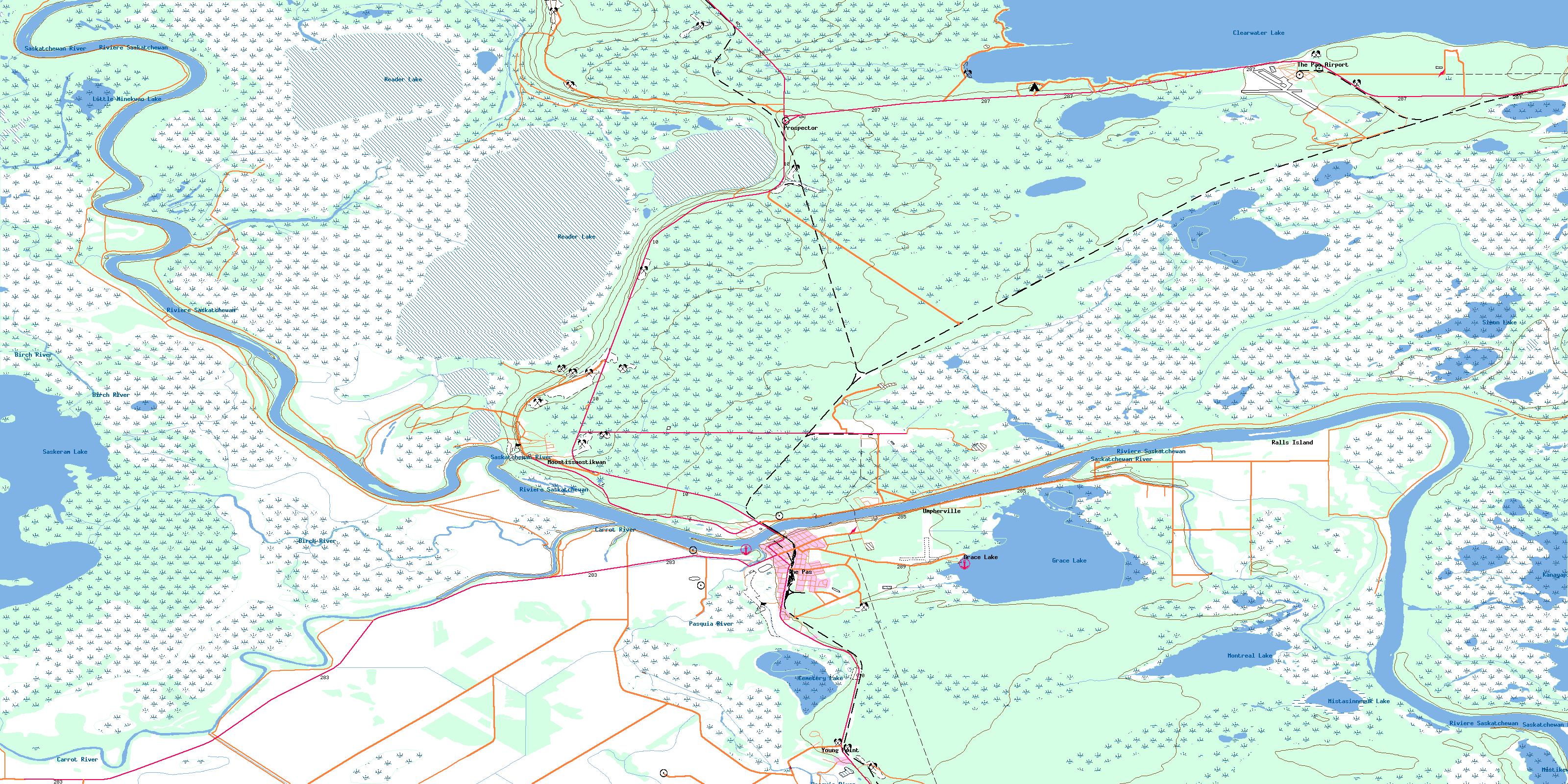
The Pas Topo Map Online
Download Free Topo Map Sheet 063F14 at 1:50,000 scale
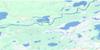
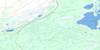
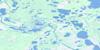
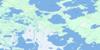
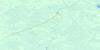
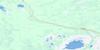
063F14 The Pas Topo Map
To view this map, mouse over the map preview on the right.
You can also download this topo map for free:
063F14 The Pas high-resolution topo map image.
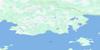
Maps for the The Pas topo map sheet 063F14 at 1:50,000 scale are also available in these versions:
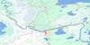
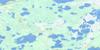
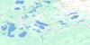
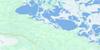
The Pas Surrounding Area Topo Maps
 |
 |
 |
 |
 |
 |
 |
 |
 |
 |
 |
 |
 |
 |
 |
 |
© Department of Natural Resources Canada. All rights reserved.
The Pas Gazetteer
The following places can be found on topographic map sheet 063F14 The Pas:
The Pas Topo Map: Bays
Campers CoveWatchi Bay
The Pas Topo Map: Beaches
Sunset BeachThe Pas Topo Map: Capes
Pumphouse PointRocky Point
The Pas Topo Map: Geographical areas
Big Eddy SettlementPasquia Settlement
The Pas Topo Map: Indian Reserves
Opaskwayak Cree Nation 21AOpaskwayak Cree Nation 21B
Opaskwayak Cree Nation 21C
Opaskwayak Cree Nation 21D
Opaskwayak Cree Nation 21E
Opaskwayak Cree Nation 21F
Opaskwayak Cree Nation 21G
Opaskwayak Cree Nation 21I
Opaskwayak Cree Nation 21J
Opaskwayak Cree Nation 21K
Opaskwayak Cree Nation 21N
Opaskwayak Cree Nation 21P
Opaskwayak Cree Nation Root Lake 231
Réserve indienne Root Lake 231
Réserve indienne The Pas 21A
Réserve indienne The Pas 21B
Réserve indienne The Pas 21C
Réserve indienne The Pas 21D
Réserve indienne The Pas 21E
Réserve indienne The Pas 21F
Réserve indienne The Pas 21G
Réserve indienne The Pas 21I
Réserve indienne The Pas 21J
Réserve indienne The Pas 21K
Réserve indienne The Pas 21N
Réserve indienne The Pas 21P
Root Lake Indian Reserve 231
The Pas Indian Reserve 21A
The Pas Indian Reserve 21B
The Pas Indian Reserve 21C
The Pas Indian Reserve 21D
The Pas Indian Reserve 21E
The Pas Indian Reserve 21F
The Pas Indian Reserve 21G
The Pas Indian Reserve 21I
The Pas Indian Reserve 21J
The Pas Indian Reserve 21K
The Pas Indian Reserve 21N
The Pas Indian Reserve 21P
The Pas Topo Map: Islands
Bucks IslandDunlop Island
Fisher Island
Kaministikwatinak Island
Kaministikwatinask Island
Kanayapiskak Island
Middle Island
Ochayk Island
Poplar Island
Potato Island
Rahls Island
Ralls Island
Round Island
The Pas Topo Map: Lakes
Atikameg LakeCampbell Lake
Cedar Pond
Cemetery Lake
Clearwater (Atikameg) Lake
Clearwater Lake
Grace Lake
Halcrow Lake
Kakeyskachak Lake
Kamasikomak Lake
Kanaabiskack Lake
Kanayapiskak Lake
Kapiskeetaw Lake
Little Minekwao Lake
Mistasinnewuk Lake
Mistikewapi Lake
Montreal Lake
Muskitapan Lake
Pike Lake
Pine Pond
Reader Lake
Saskeram Lake
Shallow Lake
Simon Lake
Spruce Pond
The Pas Lake
Wanastikwayak Lake
The Pas Topo Map: Other municipal/district area - miscellaneous
KelseyThe Pas Topo Map: Conservation areas
Clearwater Lake Provincial ParkSaskeram Wildlife Management Area
Tom Lamb Wildlife Management Area
The Pas Topo Map: Rivers
Birch RiverCarrot River
Dinner Place Creek
Jackfish Creek
Kapakoneecheewak Creek
Middle Cut-off
Muskitapan Creek
Pasquia River
Rahls Creek
Ralls Creek
Reader Creek
Red Rock Creek
Rivière Saskatchewan
Saskatchewan River
Saskeram River
Summerberry River
Whitefish River
Wuskay Creek
The Pas Topo Map: Road features
Omaneesis PortagePapimpataw Portage
The Pas Topo Map: Towns
The PasThe Pas Topo Map: Unincorporated areas
Clearwater SanatoriumFlin Flon Junction
Grace Lake
Guy Hill
Moostissoostikwan
Orok
Prospector
Rahls Island
Ralls Island
The Pas Airport
Tremaudan
Umpherville
Young Point
© Department of Natural Resources Canada. All rights reserved.
063F Related Maps:
063F The Pas063F01 Mossy Portage
063F02 Spruce Island
063F03 Overflowing River
063F04 Chemong Creek
063F05 Turnberry
063F06 No Title
063F07 Connolly Bay
063F08 Kokookuhoo Island
063F09 Lamb Lake
063F10 Red Earth Lake
063F11 Pasquia Lake
063F12 Culdesac Lake
063F13 Barrier Lake
063F14 The Pas
063F15 Landry Lake
063F16 Crossing Bay
