Chilanko Forks Topo Map Online
Download Free Topo Map Sheet 093C01 at 1:50,000 scale
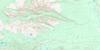
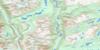
093C01 Chilanko Forks Topo Map
To view this map, mouse over the map preview on the right.
You can also download this topo map for free:
093C01 Chilanko Forks high-resolution topo map image.
Maps for the Chilanko Forks topo map sheet 093C01 at 1:50,000 scale are also available in these versions:
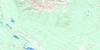
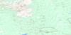
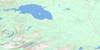
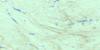
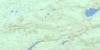
Chilanko Forks Surrounding Area Topo Maps
 |
 |
 |
 |
 |
 |
 |
 |
 |
 |
 |
 |
 |
 |
 |
 |
© Department of Natural Resources Canada. All rights reserved.
Chilanko Forks Gazetteer
The following places can be found on topographic map sheet 093C01 Chilanko Forks:
Chilanko Forks Topo Map: Indian Reserves
Alexis Creek Indian Reserve 12Alexis Creek Indian Reserve 13
Alexis Creek Indian Reserve 14
Alexis Creek Indian Reserve 15
Alexis Creek Indian Reserve 16
Alexis Creek Indian Reserve 17
Alexis Creek Indian Reserve 18
Puntzi Lake Indian Reserve 2
Réserve indienne Alexis Creek 12
Réserve indienne Alexis Creek 13
Réserve indienne Alexis Creek 14
Réserve indienne Alexis Creek 15
Réserve indienne Alexis Creek 16
Réserve indienne Alexis Creek 17
Réserve indienne Alexis Creek 18
Réserve indienne Puntzi Lake 2
Réserve indienne Seymour Meadows 19
Réserve indienne Toby Helenes Meadow 10
Réserve indienne Toby Helenes Meadow 11
Seymour Meadows Indian Reserve 19
Toby Helenes Meadow Indian Reserve 10
Toby Helenes Meadow Indian Reserve 11
Chilanko Forks Topo Map: Lakes
Hourglass LakeLe Blanc Lake
Loon Lake
Puntzi Lake
Pyper Lake
Tatla Lake
Chilanko Forks Topo Map: Mountains
Fit MountainMount Charlieboy
Mount Palmer
Puntzi Mountain
Chilanko Forks Topo Map: Major municipal/district area - major agglomerations
Cariboo Regional DistrictChilanko Forks Topo Map: Plains
Fraser PlateauInterior Plateau
Chilanko Forks Topo Map: Rivers
Chilanko RiverPuntzi Creek
Pyper Creek
Tatla Lake Creek
Chilanko Forks Topo Map: Unincorporated areas
Chilanko Forks
© Department of Natural Resources Canada. All rights reserved.
093C Related Maps:
093C Anahim Lake093C01 Chilanko Forks
093C02 Chantslar Lake
093C03 Charlotte Lake
093C04 Junker Lake
093C05 Atnarko
093C06 Anahim Lake
093C07 Satah Mountain
093C08 Chezacut
093C09 Clusko River
093C10 Downton Creek
093C11 Christensen Creek
093C12 Tusulko River
093C13 Ulkatcho
093C14 Carnlick Creek
093C15 Kushya River
093C16 Toil Mountain
