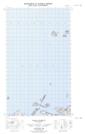
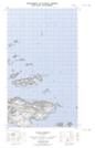
Maps showing Gannet Islands, Newfoundland and Labrador
Gannet Islands is a Island located in Newfoundland and Labrador.
- Latitude: 53° 56' 27'' North (decimal: 53.9408748)
- Longitude: 56° 30' 51'' West (decimal: -56.5140977)
- Topography Feature Category: Island
- Geographical Feature: Islands
- Canadian Province/Territory: Newfoundland and Labrador
- Atlas of Canada Locator Map: Gannet Islands
- GPS Coordinate Locator Map: Gannet Islands Lat/Long
Gannet Islands NTS Map Sheets