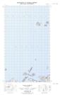
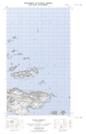
Maps showing Independent Island, Newfoundland and Labrador
Independent Island is a Island located in Newfoundland and Labrador and has an elevation of 39 meters.
- Latitude: 53° 51' 24'' North (decimal: 53.8566056)
- Longitude: 56° 53' 20'' West (decimal: -56.8888603)
- Topography Feature Category: Island
- Geographical Feature: Island
- Canadian Province/Territory: Newfoundland and Labrador
- Elevation: 39 meters
- Atlas of Canada Locator Map: Independent Island
- GPS Coordinate Locator Map: Independent Island Lat/Long
Independent Island NTS Map Sheets