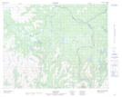
Maps showing Jim Vincents Pond, Newfoundland and Labrador
Jim Vincents Pond is a Lake located in Newfoundland and Labrador.
- Latitude: 51° 50' 0'' North (decimal: 51.8333859)
- Longitude: 56° 34' 56'' West (decimal: -56.5823553)
- Topography Feature Category: Lake
- Geographical Feature: Pond
- Canadian Province/Territory: Newfoundland and Labrador
- Atlas of Canada Locator Map: Jim Vincents Pond
- GPS Coordinate Locator Map: Jim Vincents Pond Lat/Long
Jim Vincents Pond NTS Map Sheets