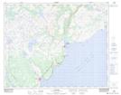
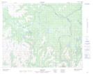
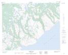
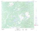
Maps showing Pinware River, Eagle River, Newfoundland and Labrador
Pinware River is a River located in Eagle River, Newfoundland and Labrador and has an elevation of 137 meters.
- Latitude: 51° 38' 8'' North (decimal: 51.6355555)
- Longitude: 56° 41' 15'' West (decimal: -56.6874999)
- Topography Feature Category: River
- Geographical Feature: River
- Canadian Province/Territory: Newfoundland and Labrador
- Elevation: 137 meters
- Location: Eagle River
- Atlas of Canada Locator Map: Pinware River
- GPS Coordinate Locator Map: Pinware River Lat/Long
Pinware River NTS Map Sheets
012P10 Pinware Topographic Map at 1:50,000 scale
012P15 No Title Topographic Map at 1:50,000 scale
012P16 Barge Bay Topographic Map at 1:50,000 scale
013A01 Chateau Pond Topographic Map at 1:50,000 scale
013A02 No Title Topographic Map at 1:50,000 scale
013A07 No Title Topographic Map at 1:50,000 scale
012P Blanc-Sablon Topographic Map at 1:250,000 scale
013A Battle Harbour Topographic Map at 1:250,000 scale