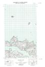
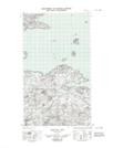
Maps showing Table Bay Point, Newfoundland and Labrador
Table Bay Point is a Cape located in Newfoundland and Labrador.
- Latitude: 53° 43' 2'' North (decimal: 53.7173077)
- Longitude: 56° 27' 31'' West (decimal: -56.4584827)
- Topography Feature Category: Cape
- Geographical Feature: Point
- Canadian Province/Territory: Newfoundland and Labrador
- Atlas of Canada Locator Map: Table Bay Point
- GPS Coordinate Locator Map: Table Bay Point Lat/Long
Table Bay Point NTS Map Sheets