Canada Topographic Maps

Sand Hill River Topo Maps

Topography maps and Latitude/Longitude Location

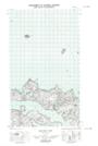
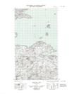
Maps showing Sand Hill River, Newfoundland and Labrador

Sand Hill River is a River located in Newfoundland and Labrador and has an elevation of 74 meters.

  • Latitude: 53° 35' 24'' North   (decimal: 53.5898855)
  • Longitude: 56° 20' 45'' West   (decimal: -56.3459327)
  • Topography Feature Category: River
  • Geographical Feature: River
  • Canadian Province/Territory: Newfoundland and Labrador
  • Elevation: 74 meters
  • Atlas of Canada Locator Map: Sand Hill River
  • GPS Coordinate Locator Map: Sand Hill River Lat/Long

Sand Hill River NTS Map Sheets

013H03 No Title Topographic Map at 1:50,000 scale

013H06 Paradise River Topographic Map at 1:50,000 scale

013H07 No Title Topographic Map at 1:50,000 scale

013H08 Porcupine Bay Topographic Map at 1:50,000 scale

013H09E Sand Hill Cove Topographic Map at 1:50,000 scale

013H09W Sand Hill Cove Topographic Map at 1:50,000 scale

013H Cartwright Topographic Map at 1:250,000 scale

 
Buy Topographic Maps DVD
Newsletter Sign-up

Yes, I want to receive map store discounts.


Bookmark and Share