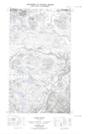
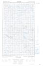
Maps showing Steele Creek Ponds, Eagle River, Newfoundland and Labrador
Steele Creek Ponds is a Lake located in Eagle River, Newfoundland and Labrador.
- Latitude: 53° 57' 32'' North (decimal: 53.9588874)
- Longitude: 57° 41' 41'' West (decimal: -57.6947741)
- Topography Feature Category: Lake
- Geographical Feature: Ponds
- Canadian Province/Territory: Newfoundland and Labrador
- Location: Eagle River
- Atlas of Canada Locator Map: Steele Creek Ponds
- GPS Coordinate Locator Map: Steele Creek Ponds Lat/Long
Steele Creek Ponds NTS Map Sheets