Canada Topographic Maps

Annis River Topo Maps

Topography maps and Latitude/Longitude Location

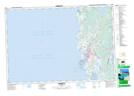
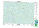
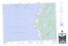
Maps showing Annis River, Yarmouth, Nova Scotia

Annis River is a River located in Yarmouth, Nova Scotia and has an elevation of 30 meters.

  • Latitude: 43° 51' North   (decimal: 43.8500000)
  • Longitude: 66° 00' West   (decimal: -65.9991666)
  • Topography Feature Category: River
  • Geographical Feature: River
  • Canadian Province/Territory: Nova Scotia
  • Elevation: 30 meters
  • Location: Yarmouth
  • Atlas of Canada Locator Map: Annis River
  • GPS Coordinate Locator Map: Annis River Lat/Long

Annis River NTS Map Sheets

020O16 Yarmouth Topographic Map at 1:50,000 scale

020P13 Tusket Topographic Map at 1:50,000 scale

021A04 Wentworth Lake Topographic Map at 1:50,000 scale

021B01 Meteghan Topographic Map at 1:50,000 scale

020P Shelburne Topographic Map at 1:250,000 scale

021A Annapolis Royal Topographic Map at 1:250,000 scale

021B Eastport Topographic Map at 1:250,000 scale

020O Map Not Available Topographic Map at 1:250,000 scale

 
Buy Topographic Maps DVD
Newsletter Sign-up

Yes, I want to receive map store discounts.


Bookmark and Share