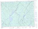
Maps showing Rivière Batiscan, Batiscan; Les Chenaux, Quebec
Rivière Batiscan is a River located in Batiscan; Les Chenaux, Quebec and has an elevation of 116 meters.
- Latitude: 46° 31' 12'' North (decimal: 46.5200262)
- Longitude: 72° 14' 7'' West (decimal: -72.2353847)
- Topography Feature Category: River
- Geographical Feature: Rivière
- Canadian Province/Territory: Quebec
- Elevation: 116 meters
- Location: Batiscan; Les Chenaux
- Atlas of Canada Locator Map: Rivière Batiscan
- GPS Coordinate Locator Map: Rivière Batiscan Lat/Long
Rivière Batiscan NTS Map Sheets
031I09 Grondines Topographic Map at 1:50,000 scale
031I16 Notre-Dame-De-Montauban Topographic Map at 1:50,000 scale
031P01 Talbot Topographic Map at 1:50,000 scale
031P08 Beaudet Topographic Map at 1:50,000 scale
031P09 Lac-Edouard Topographic Map at 1:50,000 scale
031I Trois-Rivieres Topographic Map at 1:250,000 scale
031P La Tuque Topographic Map at 1:250,000 scale