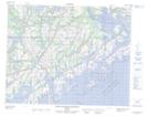
Maps showing Chenal Catherine, Saint-Augustin; Basse-Côte-Nord, Quebec
Chenal Catherine is a Channel located in Saint-Augustin; Basse-Côte-Nord, Quebec.
- Latitude: 51° 7' 15'' North (decimal: 51.1208922)
- Longitude: 58° 40' 43'' West (decimal: -58.6785520)
- Topography Feature Category: Channel
- Geographical Feature: Chenal
- Canadian Province/Territory: Quebec
- Location: Saint-Augustin; Basse-Côte-Nord
- GPS Coordinate Locator Map: Chenal Catherine Lat/Long
Chenal Catherine NTS Map Sheets