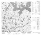
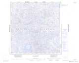
Maps showing Pointe de l'Esker, Rivière-Koksoak; Kativik, Quebec
Pointe de l'Esker is a Cape located in Rivière-Koksoak; Kativik, Quebec.
- Latitude: 60° 56' 55'' North (decimal: 60.9486104)
- Longitude: 74° 12' 17'' West (decimal: -74.2047752)
- Topography Feature Category: Cape
- Geographical Feature: Pointe
- Canadian Province/Territory: Quebec
- Location: Rivière-Koksoak; Kativik
- Atlas of Canada Locator Map: Pointe de l'Esker
- GPS Coordinate Locator Map: Pointe de l'Esker Lat/Long
Pointe de l'Esker NTS Map Sheets