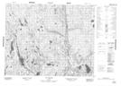
Maps showing Lac Gallet, Petit-Mécatina; Minganie, Quebec
Lac Gallet is a Lake located in Petit-Mécatina; Minganie, Quebec and has an elevation of 167 meters.
- Latitude: 51° 48' 1'' North (decimal: 51.8003369)
- Longitude: 58° 24' 11'' West (decimal: -58.4029718)
- Topography Feature Category: Lake
- Geographical Feature: Lac
- Canadian Province/Territory: Quebec
- Elevation: 167 meters
- Location: Petit-Mécatina; Minganie
- Atlas of Canada Locator Map: Lac Gallet
- GPS Coordinate Locator Map: Lac Gallet Lat/Long
Lac Gallet NTS Map Sheets