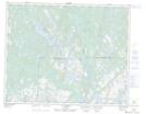
Maps showing Pointe Galoman, Petit-Mécatina; Minganie, Quebec
Pointe Galoman is a Cape located in Petit-Mécatina; Minganie, Quebec and has an elevation of 50 meters.
- Latitude: 51° 26' 6'' North (decimal: 51.4350605)
- Longitude: 58° 41' 41'' West (decimal: -58.6946541)
- Topography Feature Category: Cape
- Geographical Feature: Pointe
- Canadian Province/Territory: Quebec
- Elevation: 50 meters
- Location: Petit-Mécatina; Minganie
- Atlas of Canada Locator Map: Pointe Galoman
- GPS Coordinate Locator Map: Pointe Galoman Lat/Long
Pointe Galoman NTS Map Sheets