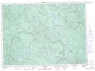
Maps showing Ruisseau Houle, Shawinigan; Shawinigan, Quebec
Ruisseau Houle is a River located in Shawinigan; Shawinigan, Quebec and has an elevation of 360 meters.
- Latitude: 46° 45' 35'' North (decimal: 46.7597528)
- Longitude: 73° 4' 20'' West (decimal: -73.0723486)
- Topography Feature Category: River
- Geographical Feature: Ruisseau
- Canadian Province/Territory: Quebec
- Elevation: 360 meters
- Location: Shawinigan; Shawinigan
- Atlas of Canada Locator Map: Ruisseau Houle
- GPS Coordinate Locator Map: Ruisseau Houle Lat/Long
Ruisseau Houle NTS Map Sheets