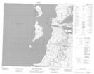
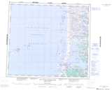
Maps showing Ruisseau Kuugaa'uk, Baie-d'Hudson; Kativik, Quebec
Ruisseau Kuugaa'uk is a River located in Baie-d'Hudson; Kativik, Quebec and has an elevation of 26 meters.
- Latitude: 56° 5' 33'' North (decimal: 56.0925)
- Longitude: 76° 40' 27'' West (decimal: -76.6741667)
- Topography Feature Category: River
- Geographical Feature: Ruisseau
- Canadian Province/Territory: Quebec
- Elevation: 26 meters
- Location: Baie-d'Hudson; Kativik
- Atlas of Canada Locator Map: Ruisseau Kuugaa'uk
- GPS Coordinate Locator Map: Ruisseau Kuugaa'uk Lat/Long
Ruisseau Kuugaa'uk NTS Map Sheets