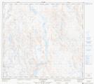
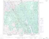
Maps showing Chute Limestone, Rivière-Koksoak; Kativik, Quebec
Chute Limestone is a Falls located in Rivière-Koksoak; Kativik, Quebec.
- Latitude: 57° 28' 53'' North (decimal: 57.4812658)
- Longitude: 69° 18' 28'' West (decimal: -69.3076627)
- Topography Feature Category: Falls
- Geographical Feature: Chute
- Canadian Province/Territory: Quebec
- Location: Rivière-Koksoak; Kativik
- GPS Coordinate Locator Map: Chute Limestone Lat/Long
Chute Limestone NTS Map Sheets