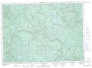
Maps showing Lac Tessier, Shawinigan; Shawinigan, Quebec
Lac Tessier is a Lake located in Shawinigan; Shawinigan, Quebec and has an elevation of 382 meters.
- Latitude: 46° 45' 10'' North (decimal: 46.7528090)
- Longitude: 73° 8' 49'' West (decimal: -73.1470727)
- Topography Feature Category: Lake
- Geographical Feature: Lac
- Canadian Province/Territory: Quebec
- Elevation: 382 meters
- Location: Shawinigan; Shawinigan
- Atlas of Canada Locator Map: Lac Tessier
- GPS Coordinate Locator Map: Lac Tessier Lat/Long
Lac Tessier NTS Map Sheets