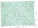
Maps showing Lac Wigwasson, Lac-Minaki; Matawinie, Quebec
Lac Wigwasson is a Lake located in Lac-Minaki; Matawinie, Quebec and has an elevation of 480 meters.
- Latitude: 46° 52' 27'' North (decimal: 46.8742024)
- Longitude: 73° 27' 57'' West (decimal: -73.4659681)
- Topography Feature Category: Lake
- Geographical Feature: Lac
- Canadian Province/Territory: Quebec
- Elevation: 480 meters
- Location: Lac-Minaki; Matawinie
- Atlas of Canada Locator Map: Lac Wigwasson
- GPS Coordinate Locator Map: Lac Wigwasson Lat/Long
Lac Wigwasson NTS Map Sheets