Maps showing Récif Lacroix, Baie-de-la-Bouteille; Matawinie, Quebec
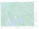
Récif Lacroix is a Shoal located in Baie-de-la-Bouteille; Matawinie, Quebec.
- Latitude: 46° 48' 17'' North (decimal: 46.8047599)
- Longitude: 73° 43' 9'' West (decimal: -73.7190301)
- Topography Feature Category: Shoal
- Geographical Feature: Récif
- Canadian Province/Territory: Quebec
- Location: Baie-de-la-Bouteille; Matawinie
- Atlas of Canada Locator Map: Récif Lacroix
- GPS Coordinate Locator Map: Récif Lacroix Lat/Long
Récif Lacroix NTS Map Sheets