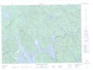
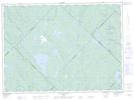
Maps showing Île aux Lapins, Lac-Bazinet; Antoine-Labelle, Quebec
Île aux Lapins is a Island located in Lac-Bazinet; Antoine-Labelle, Quebec.
- Latitude: 47° 0' 3'' North (decimal: 47.0008777)
- Longitude: 73° 56' 44'' West (decimal: -73.9454229)
- Topography Feature Category: Island
- Geographical Feature: Île / Ile
- Canadian Province/Territory: Quebec
- Location: Lac-Bazinet; Antoine-Labelle
- Atlas of Canada Locator Map: Île aux Lapins
- GPS Coordinate Locator Map: Île aux Lapins Lat/Long
Île aux Lapins NTS Map Sheets